Inis Oírr – sunken churches and wrecked ships

In 2023 I visited Inis Mór, the largest of the three Aran Islands. You can read about that here. Anyway, in 2024 I decided to visit the other two. First up was Inis Oírr (Inisheer) which is the smallest of the three. Despite its small size, there’s plenty to see, and you’ll still be back in time for the ferry. I’ve added more of the travel details at the end, if you’re still awake by then.

Getting Around 🚤✈️🚲🏇🚶‍♂️

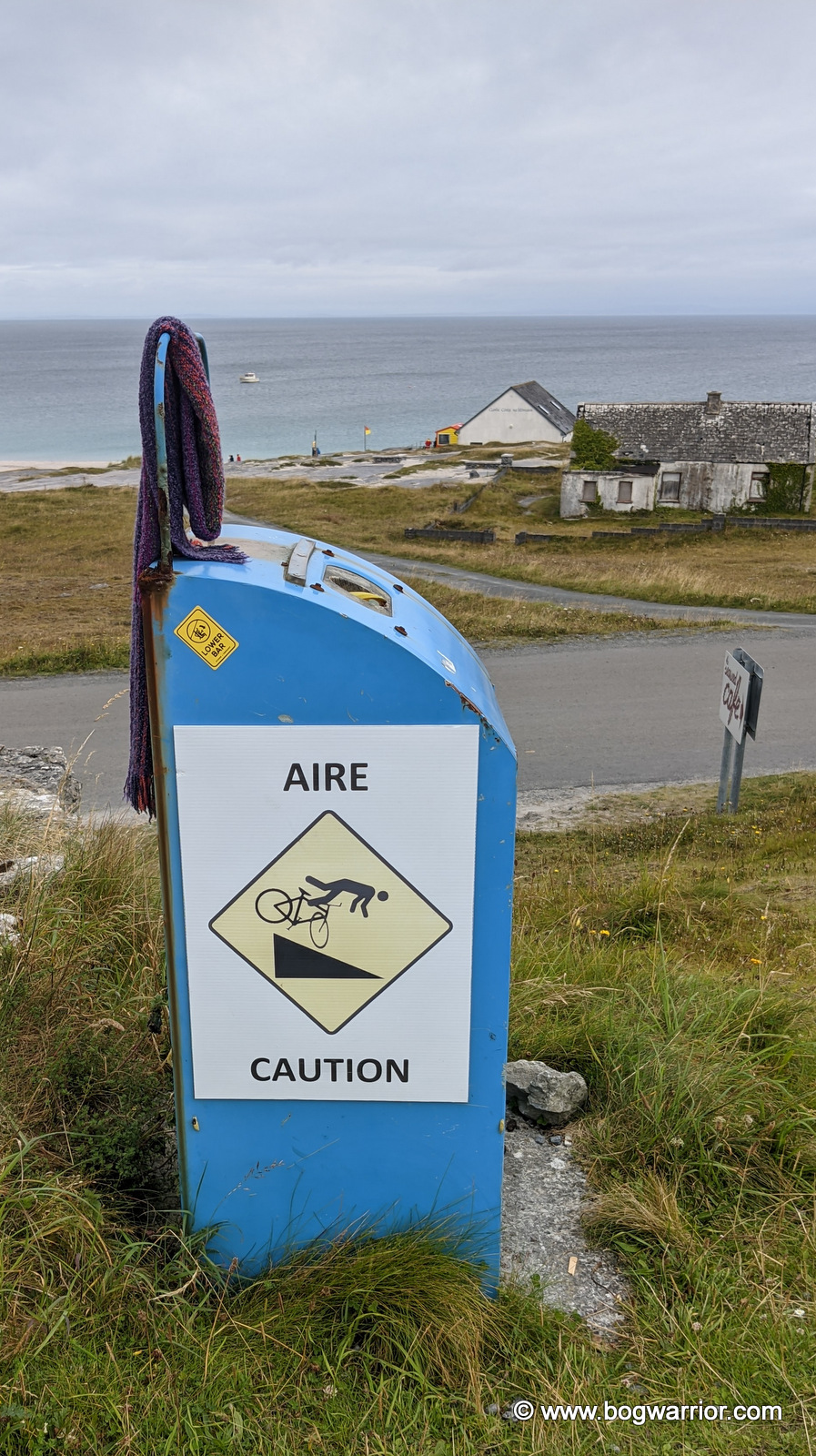
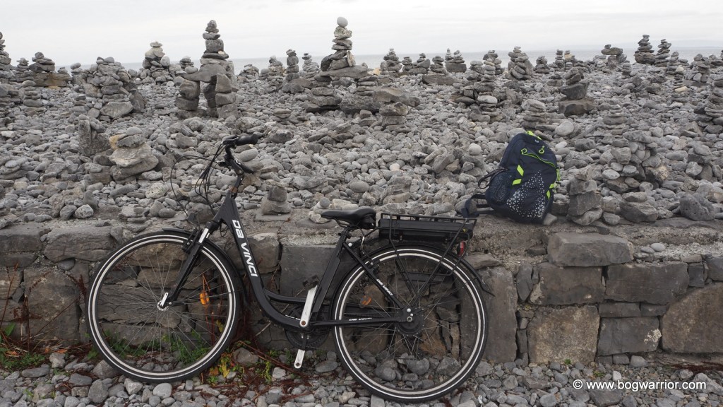
I hired a bike from one of the two hire businesses that operate near the pier. Inis Oírr is relatively flat, so even if you don’t hire a fancy e-bike, you can still whizz around quite comfortably. The road surfaces are generally OK, but there are uneven patches, and you never know who might come around the corner. So be careful when going downhill—the language of eating concrete transcends international borders.
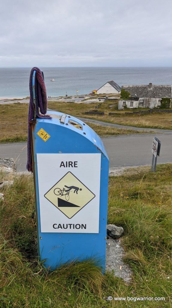
These warning signs also mean you can stop pedalling for a while

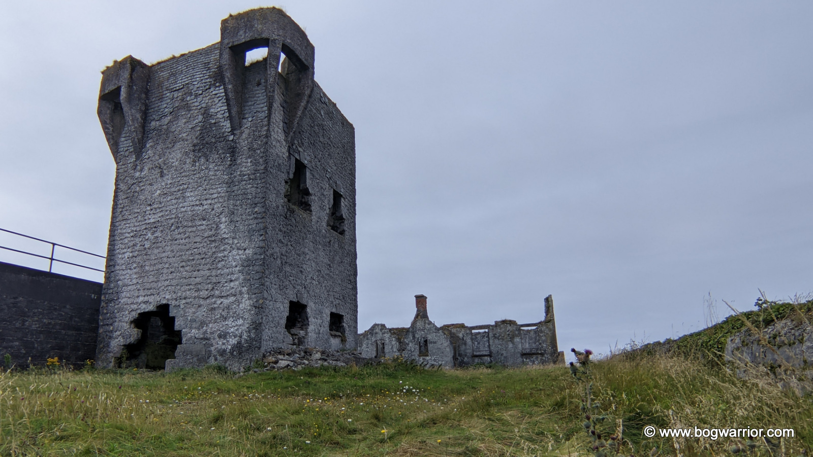
O’Brien’s Castle

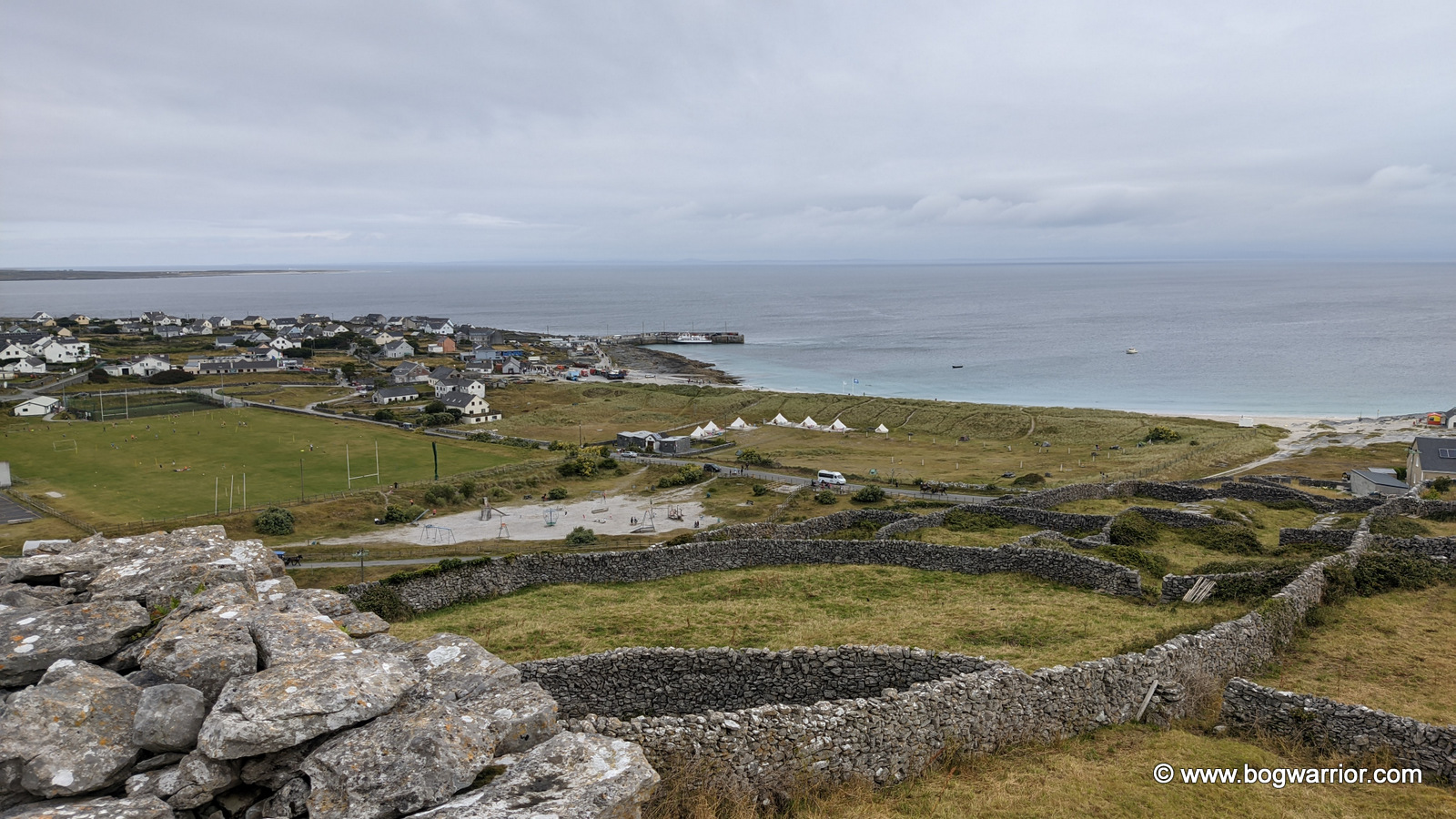
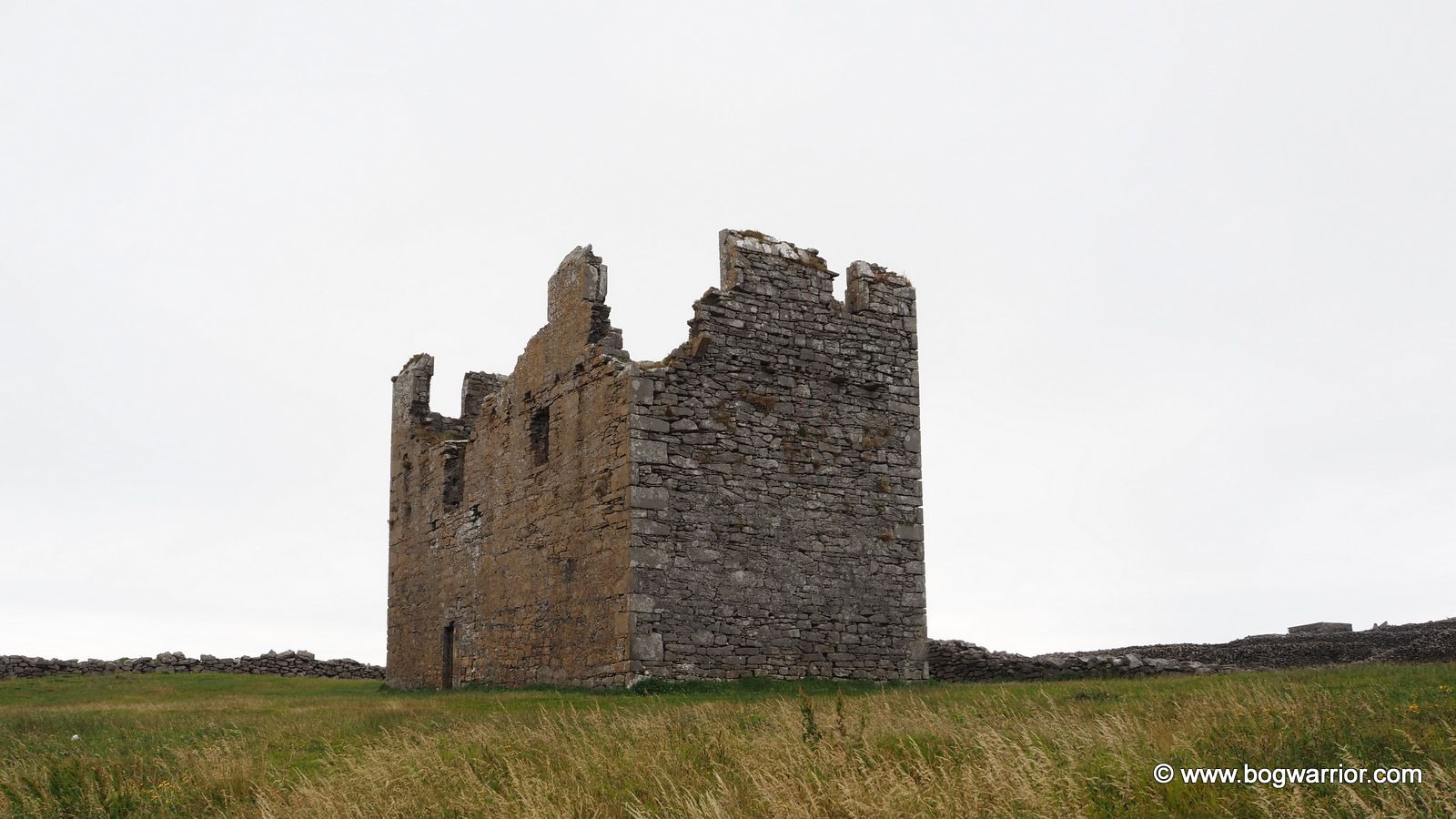
O’Brien’s Castle (aka Furmina Castle) is one of the most noticeable buildings on the island. It’s a ruined 15th-century tower house built on top of a hill. The ruins themselves are a bit ho-hum, but they’re in good condition. Once upon a time, wooden stairs linked the floors, but they have long gone. The view from the grounds is worth the short climb, though.
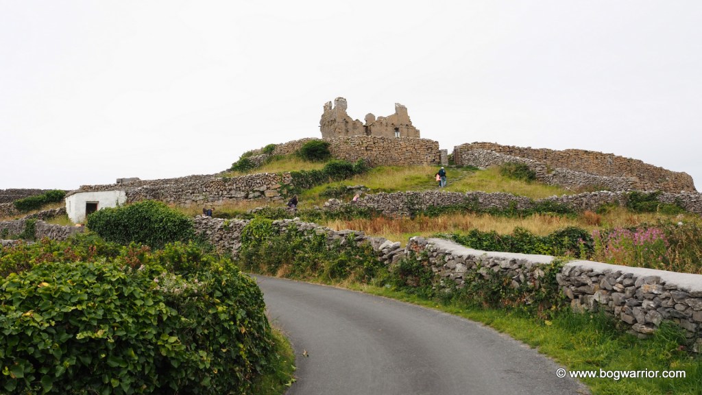
O’Brien’s Castle

Further up the hill is An Túr Faire, a ruined Napoleonic signal tower. It was built in the early 19th century when it was feared that the French might attempt to invade Ireland. The grounds were locked up so this photo was taken through the gate. There are several more of these dotted around the Irish coastline.

An Túr Faire

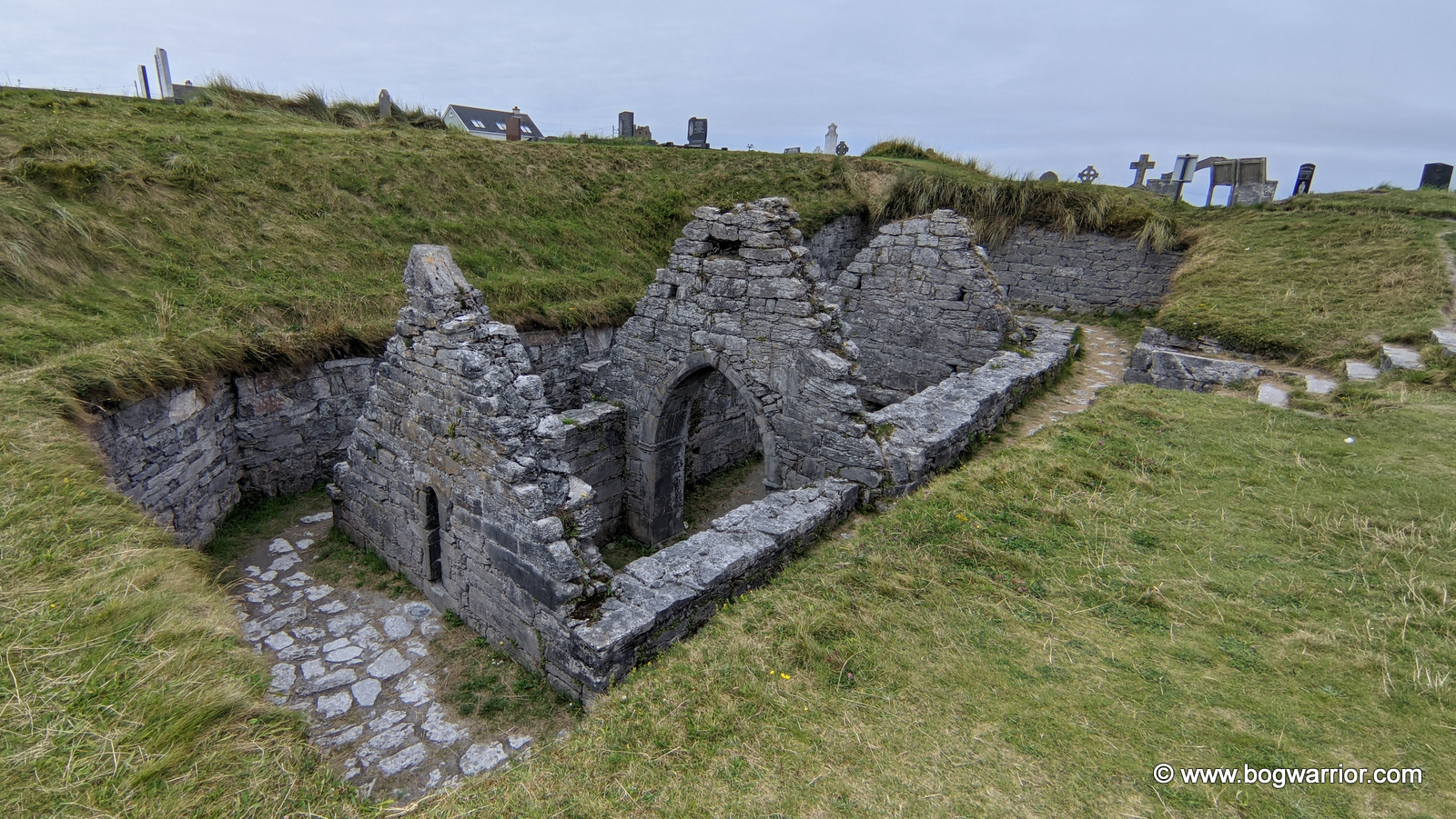
The sunken church/aka Teampall Chaomháin

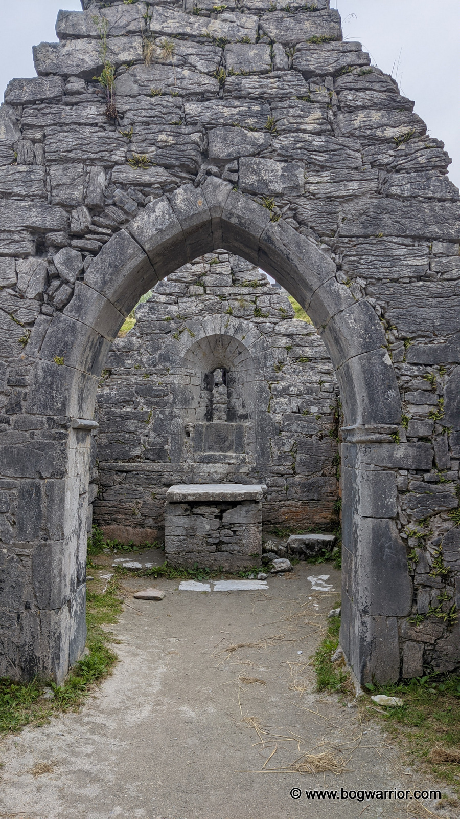
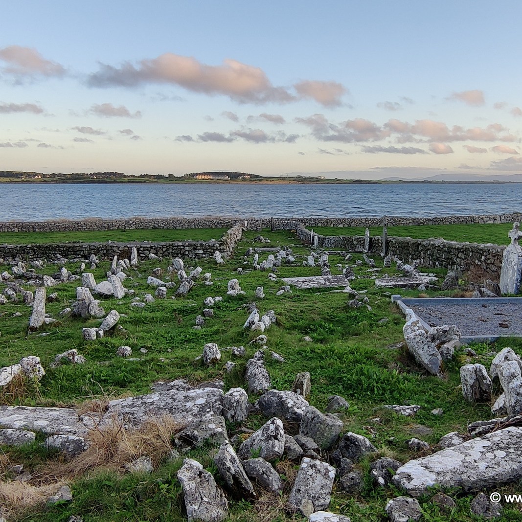
This is a ruined church found in the local cemetery. Its age is up for debate—although the OPW sign nearby indicates that it’s a 10th-century church, other sources claim otherwise. What isn’t up for debate is that this church is largely below ground level and looks like it has sunk into the ground. In times past it was buried by shifting sands from the nearby beach. There is a little roofed tomb nearby, which is believed to house the remains of St. Caomhán who may have founded this church. You can walk into the church, and that is an unusual experience. It is odd to be looking straight down into the ruins rather than up and to find a church window at waist height. This may have been a larger church in times past—the chancel is what remains now.
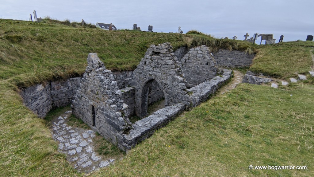
St. Caomhán’s Church

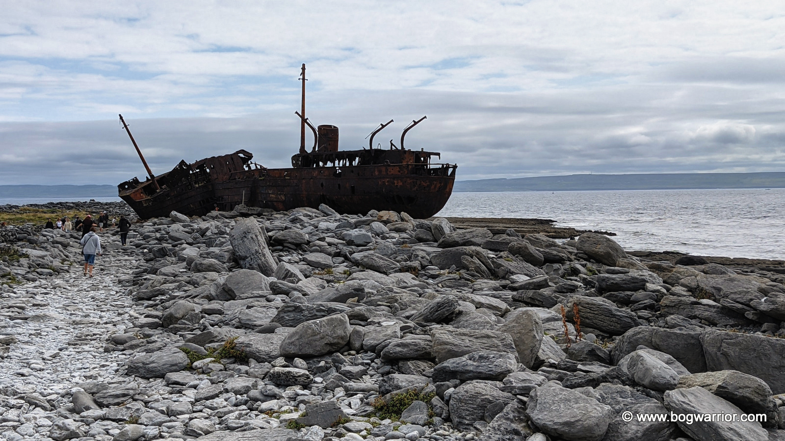
The Plassey Shipwreck

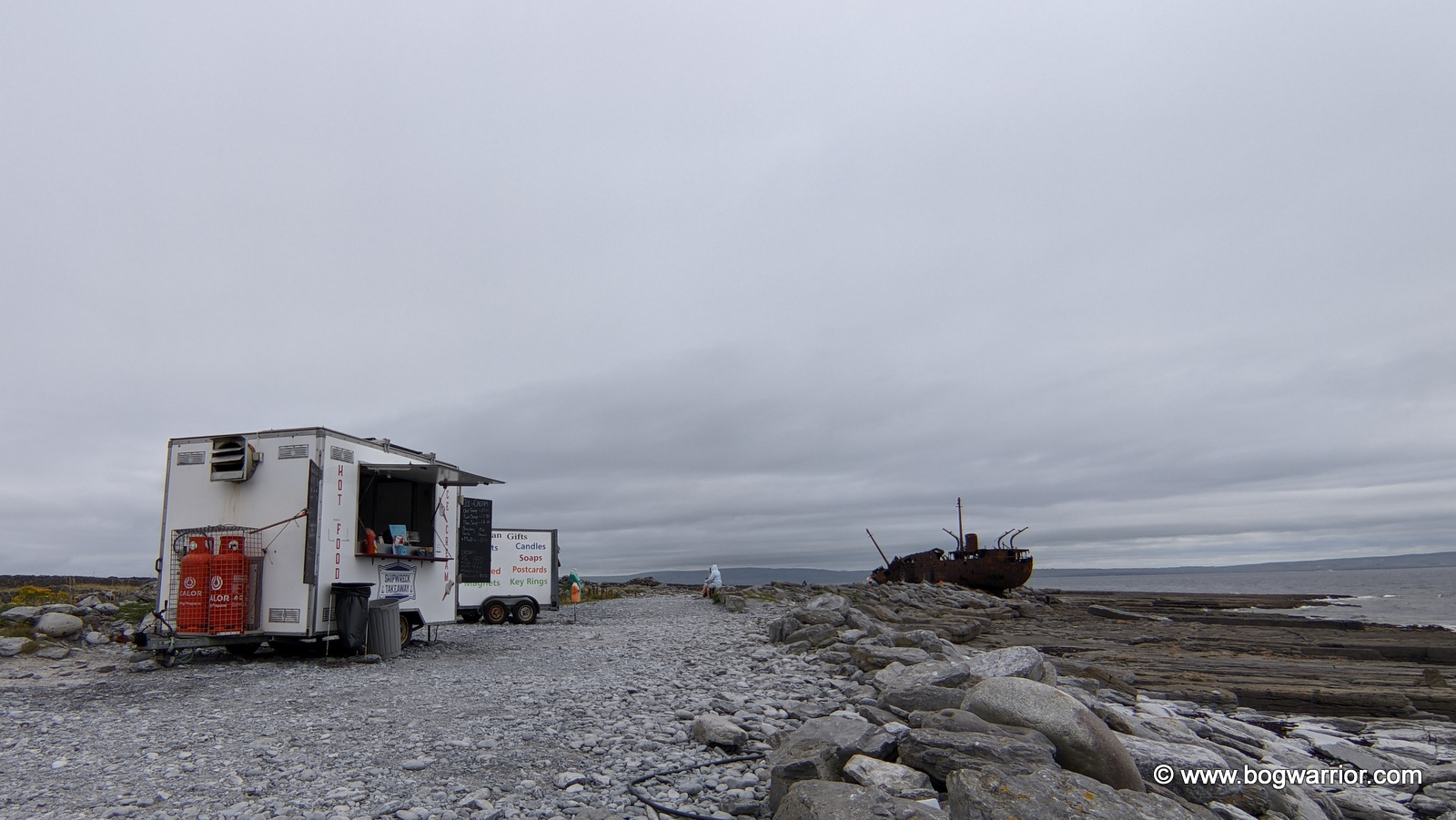
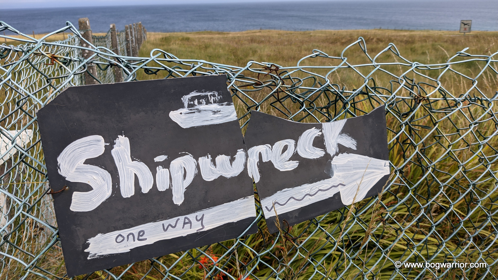
This rusting shipwreck dates all the way back to WWII. It was built in 1940 by the British Royal Navy and was originally called HMS Juliet. It served its time in the war and was later converted into a cargo vessel. It was renamed Peterjohn. In 1951 the Limerick Steamship Company purchased it and renamed it MV Plassy/Plassey (spellings vary). It continued to operate as a cargo vessel until 8th March 1960. On that day, the ship was caught up in a severe storm and was driven up onto Finnis Rock off Inis Oírr’s coast. The crew of 11 was rescued by a group of islanders. Some weeks later, another storm hit, and this one brought the Plassey onshore. It has remained here ever since, slowly deteriorating and occasionally shifting if an Atlantic storm is particularly ferocious. It became better known in the 1990s when it was featured in the opening titles of the sitcom Fr. Ted. Somebody made a sign directing visitors to the shipwreck (see gallery below), but it too is starting to succumb to the elements.
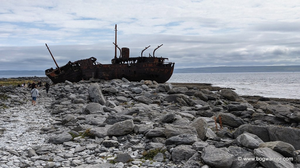
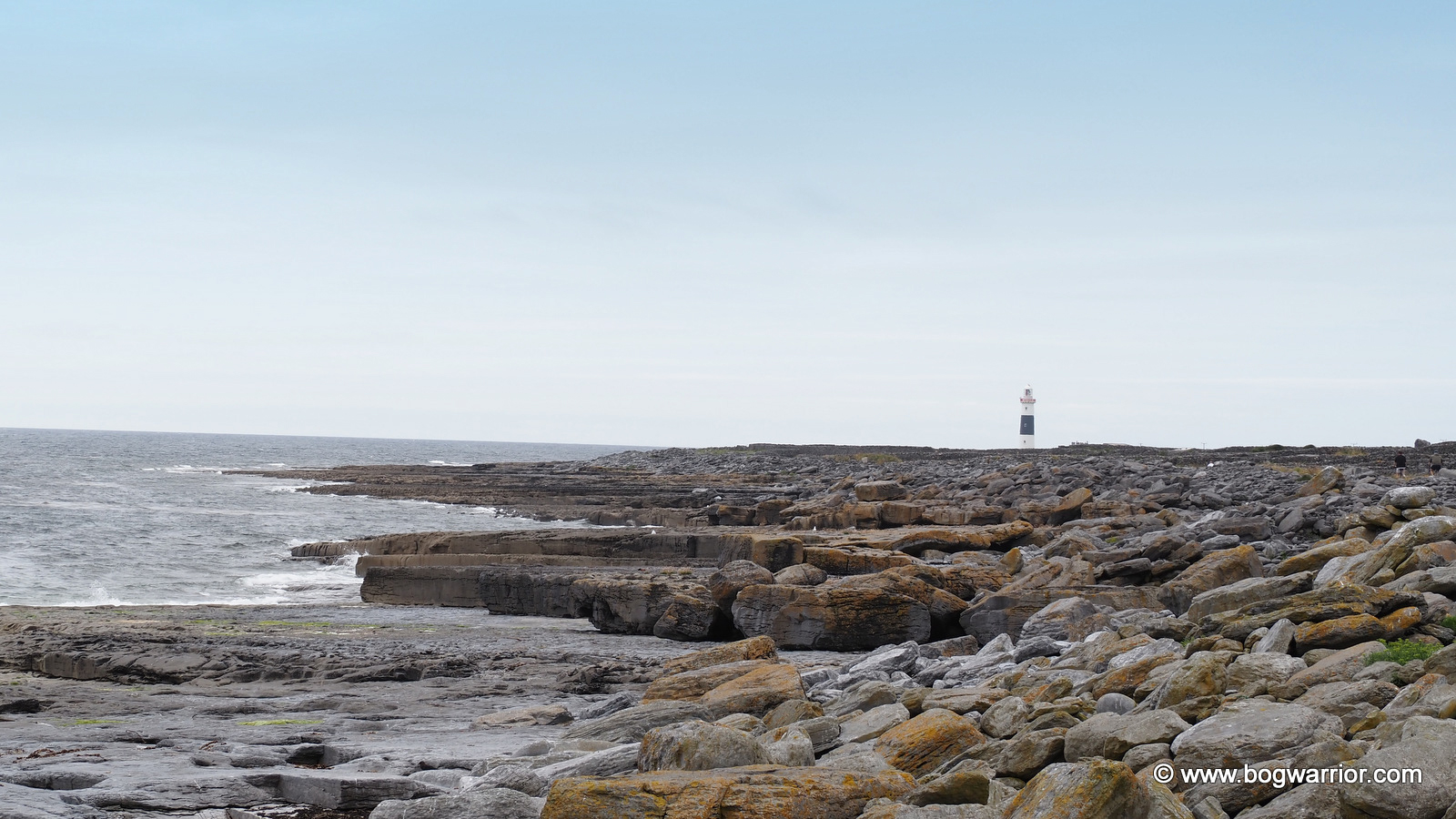
Ironically, the shipwreck isn’t too far from a lighthouse…

Eatenin’ and Drinkenin’

You can, of course, bring your own food to Inis Oírr but if you’d rather grab something on the island, there is plenty of choice. There are some pubs, cafés, and food trucks serving all sorts of food, snacks, and drinks. I kept it simple and had some fish & chips from Tigh Ned. Other eateries are available.
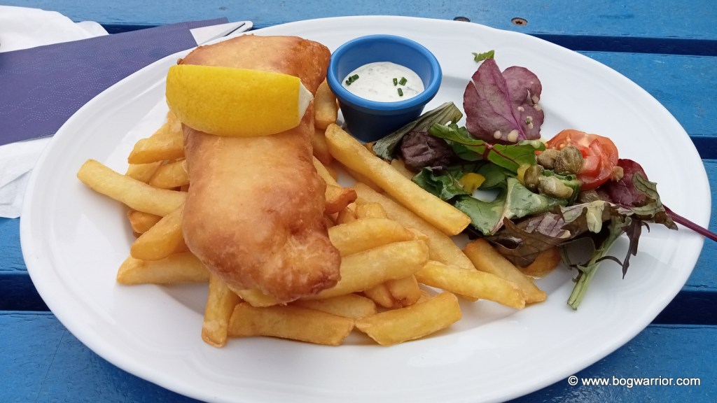
Fish & Chips from Tigh Ned

If you have never been to any of the Aran Islands, I think Inis Oírr is a great place to start. It’s a small island, so you should be able to tick off most, if not all, of the places of note in one day. The locals are friendly too, and the scenery is beautiful. You can buy Aran sweaters here too—according to online reviews, they are cheaper than what you’d pay in Dublin. All the shops and pubs seem to take card payments, so there’s no need to load up on cash.

Getting There

Inis Oírr is served all year round by ferries that leave from Rossaveel in Co. Galway or from Doolin, Co. Clare. Aran Islands Ferries operate out of Galway, and you can either travel to Rossaveel Pier yourself or catch their shuttle bus from Galway city centre. Two ferry companies sail from Doolin, Co. Clare—the Doolin Ferry Company and O’Brien’s Ferry. Aer Arann flies from Inverin in Galway if you fancy something different.

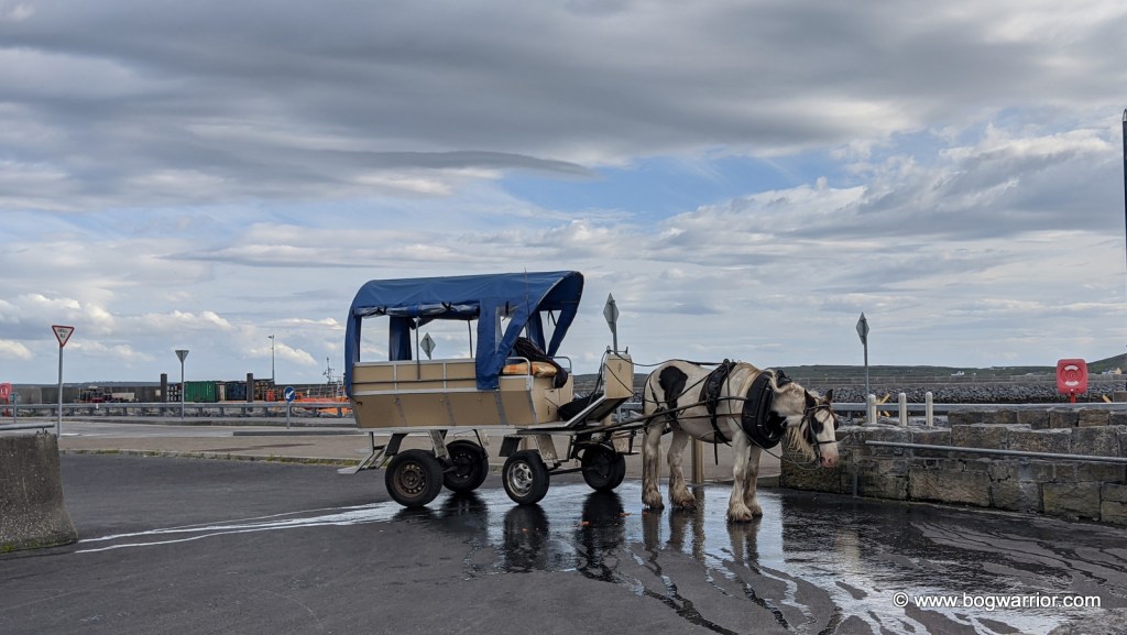
Inis Oírr can be explored on foot, but most people hire a bike from Joyce Bike Hire or Rothaí Inis Oírr. Both hire out all sorts of bikes, from e-bikes to tandems to dog buggies. If you fancy something less energetic, you can hire a local to bring you around the island by horse and cart or by minibus.

Gallery.

Click on a picture to launch

Inis Mór – the one with the big fort and the mad swimming pool

In 2023 I decided to visit Inis Mór (aka Inishmore), which is the largest of the three Aran Islands. In 2024 I went on to visit the other two, which I will write about soon.
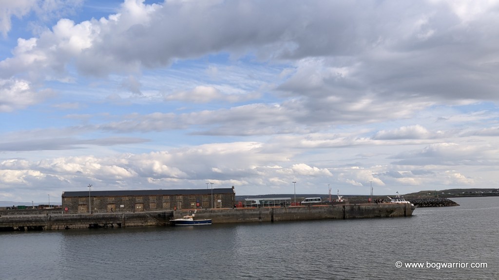
The Aran Islands is a group of three islands off the west coast of Ireland. To many people, they are associated with Aran knitwear. These are distinctive, chunky woollen jumpers and cardigans traditionally made for fishermen and other natives of these islands. Because they’re out in the Atlantic, they’ve developed their own distinctive feel and identity. There is far more to these three islands than woolly jumpers, as you’ll see if you read on 😁 I’ll elaborate on the specifics at the end of this post because I don’t want to become the equivalent of those recipe websites. You know the ones – all you want is the recipe so you can make something different for dinner yet you find yourself forced to scroll past 15 paragraphs of waffle about Great Grandma Alice, some family pets, the weather and a family recipe which has been handed down through 6 generations. Enough!
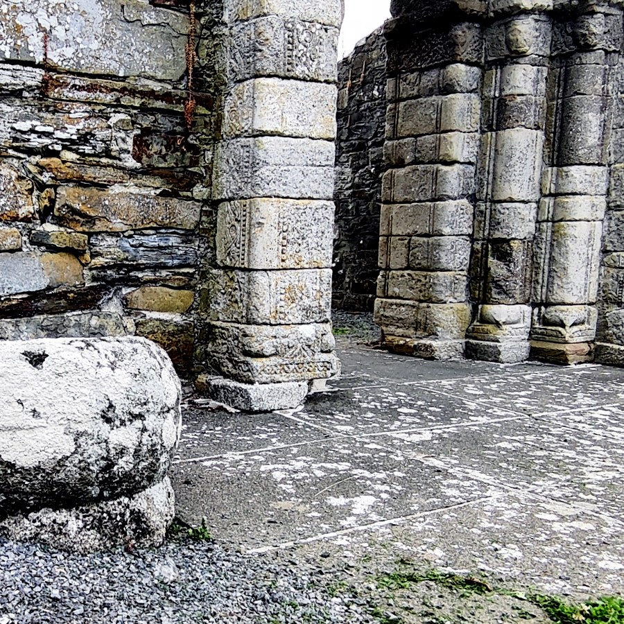
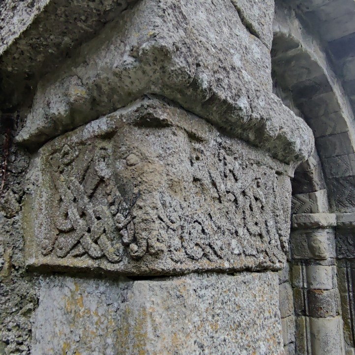
Getting Around 🚤✈️🚲🏇🚶‍♂️

For this visit, I hired an electric bike and loved it! There are two main routes around the island and because I had this extra firepower, I chose the more challenging high road. The nice thing about travelling around all three Aran Islands is that there isn’t that much vehicular traffic, so it’s very safe. The roads can be a bit bumpy in places so watch out for that. The natives speak Irish as their first language but they have fluent English. Enjoy resurrecting your rusty Leaving Cert Irish…

Dún Aonghasa

A postcard from almost the edge

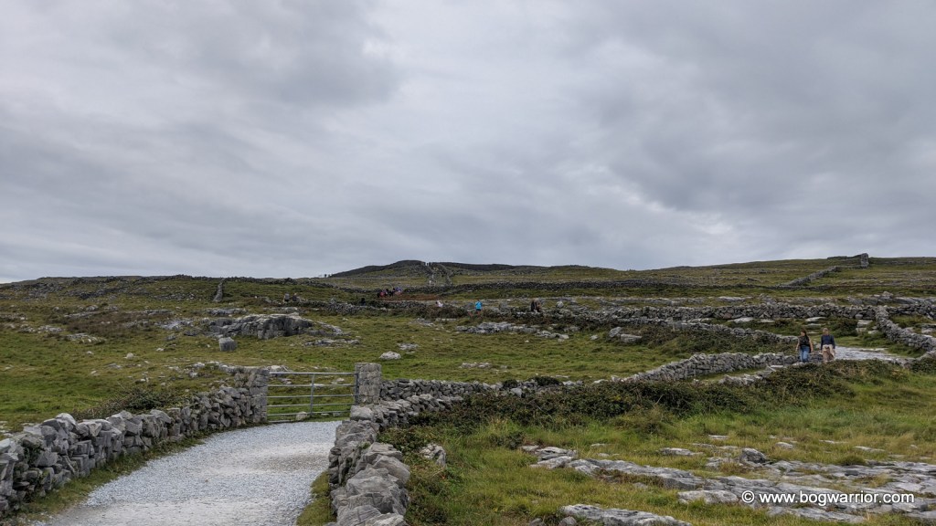
Dún Aonghasa is a prehistoric fort and probably Inis Mór’s best-known tourist attraction. It is amazing for what it is, and it looks pretty impressive from the many aerial photos you’ve undoubtedly seen. This is where I’m going to be controversial and argue that it isn’t a must-see if time is of a premium to you. I honestly think it looks more impressive from the air than when you’re on the ground. Anyway, there is a small visitor centre which has lots of information, then an 800m walk up to the fort. This takes you over some rough ground, which proved to be a challenge to the flip-flop-wearing people I spotted. The fort itself consists of 3 dry-stone ramparts and the remains of a fourth. Perhaps its most distinctive feature is where it stops abruptly at the edge of a sheer cliff. One misstep and into the Atlantic you go. Not that it stopped the many people who wanted to take a selfie. The views are nice though.

The Wormhole/Poll na bPéist

Somebody goes diving

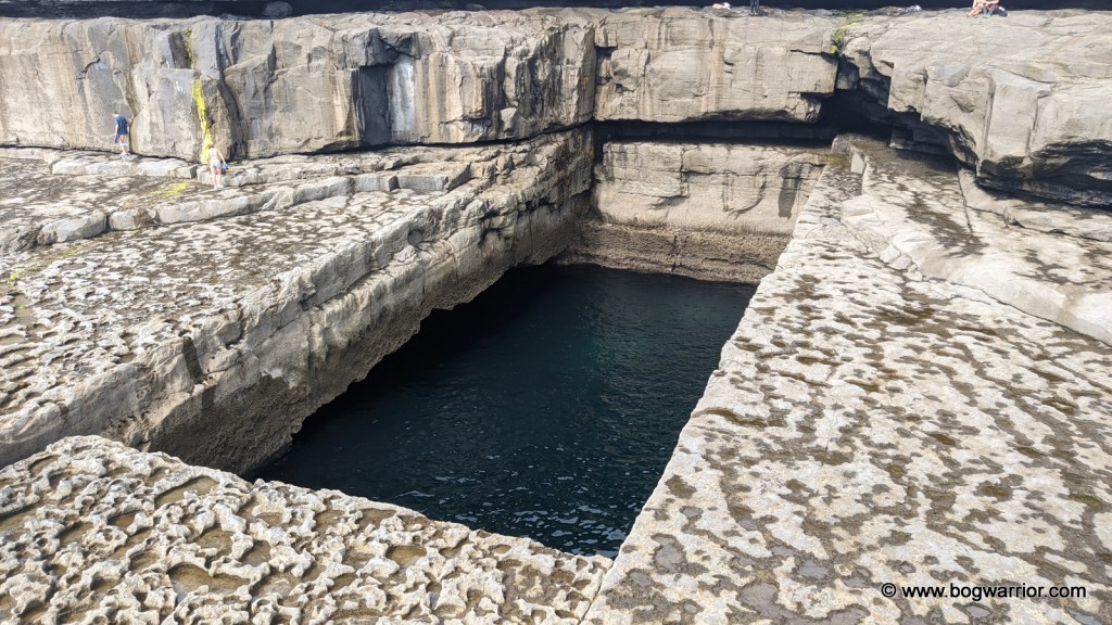
This was my favourite part of the day. The Wormhole is a naturally-occurring blow-hole which is 25m long and 10m wide. It’s almost a perfect rectangle which makes it even more striking. It came to prominence when Red Bull held diving competitions here in 2014-2017. There are videos on YouTube if you want to watch lunatics at work! There were no TV crews or diving rigs to be seen when I visited but it made it no less spectacular. Several people dived into the water while I was there.

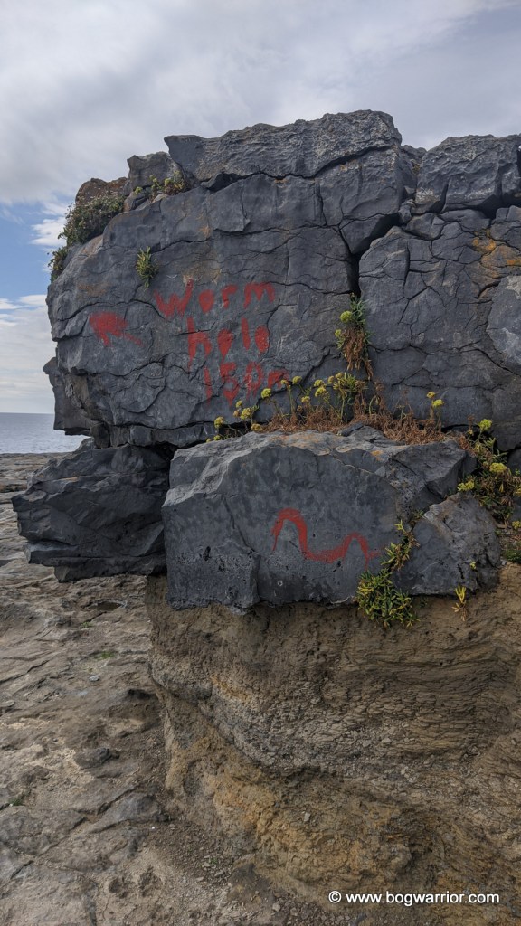
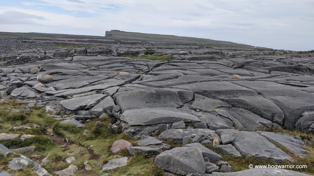
The walk out to the wormhole can be a bit tricky so I strongly advise you to read and read again the directions for how to get there. We took the scenic route which turned out to be a bit of a time-sink, though it did take us across a spectacular karst limestone landscape. A kind soul used a paintbrush and red paint to give directions to the Wormhole. Should you decide to try and find this amazing place, they will quickly become your favourite person.

Kilronan

Kilronan is the main village on the island and where you’ll start and end your journey. It has shops of all sorts, including ones selling the inevitable Aran Sweaters. It also has a Spar supermarket which looks to be reasonably large. Because there was a ferry to be caught, I didn’t get to see as many of the highlights of the island as I’d like to have. This, naturally, is a reason to return.

Modern twists on a traditional design

Getting There

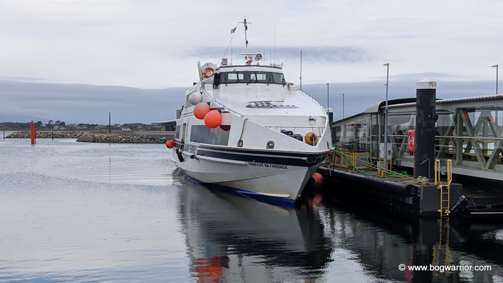
All three islands can be reached by ferry or by air. Aran Islands Ferries in Galway runs regular ferries from Rossaveel in Connemara. They have a shuttle bus which brings people from Galway City centre out to the ferry. Alternatively, you can travel directly to Rossaveel and depart from there. On this occasion, I took the Galway shuttle bus/ferry combo.

Two ferry companies operate out of Doolin, County Clare: Doolin Ferry Company and O’Brien’s Ferry.

There are airstrips and small airports on all three Aran Islands. These are serviced by Aer Arann, which flies out of Inverin Airport in Galway. The flights are quite short so this may suit some people more.

Getting Around

As you might have guessed by now, you won’t be bringing your own car to Inis Mór. You can walk, of course, but there are other options. You can hire a mini-bus or a guided tour by pony and trap. These can be pre-booked, though in my experience there always seemed to be people offering these to people disembarking from the ferry.

Bikes for Hire on Inis Mór

Aran Islands Bike Hire , which is located just off the pier in Kilronan, has a good selection of bikes on hand. As well as regular bikes and the aforementioned e-bikes, they hire out buggies and tandems.

Other advice

Google Maps is your friend. Even though there is very little Google Streetview coverage of the Aran Islands, the directions to the various places still work fine. Signposting on Inis Mór is patchy so definitely don’t rely on that.

Inis Mór is too large to get around in one day so take a look at a map and decide what you want to see this time around. You won’t get to see everything if you’re on a day trip.

The shops and pubs all take plastic, so you don’t have to load up on cash before you leave.

Wear sensible footwear if you want to do any exploring at all.

Derrigimlagh Bog – Be Not Here Now

Derrigimlagh is a large expanse of blanket bog, halfway between Clifden and Ballyconneely in County Galway. Perhaps because of its location so close to the Atlantic coast, it has played host to two significant events in 20th-century history. One by accident, the other by design.


Marconi’s Wireless Station (1907)

On 12th December 1901, the world’s first Transatlantic wireless message was sent from Poldhu, Cornwall to an abandoned hospital in St. John’s, Newfoundland. The man receiving the message was the person who had created the technology behind it – one Guglielmo Marconi. After this early success, Marconi began the search for a site more suitable for a commercial operation. He finally settled on Derrigimlagh Bog which was 7km from Clifden, Co. Galway in Ireland. There were several reasons for choosing Derrigimlagh. It was close to the Atlantic Ocean on Ireland’s west coast, there was no shortage of land to build what was needed and there were ample natural resources onsite. The peat bog and the lake would supply enough fuel and water to keep everything running smoothly. The radio station began operating in 1907, transmitting messages to its sister station 3,000km away in Glace Bay, Nova Scotia.

AI colourised photo of the site 1

The radio station at Derrigimlagh was quite an extensive complex. The antenna system stretched out for more than half a kilometre and consisted of 8 masts, each 6m high. A power station was built onsite with six steam-powered generators in the building – three were always in operation, with the other three as backup. A huge condenser building (106m x 23m) was built to store the energy that had been generated and to supply enough “oomph” to get those messages across the Atlantic. (I hope my old science teacher isn’t reading this thoroughly unscientific explanation). Several other buildings were constructed onsite, including housing for workers and a social club. The station did what it said on the tin, and operated successfully for a number of years.

Digital recreation of the antennae, as seen on the BBC’s Coast 22

As the technology improved, Derrigimlagh was superseded by a more powerful station at Caernarfon in Wales. In July 1922 it was attacked by Republican forces during the War of Independence and some of the buildings were damaged. That proved to be the death knell for the station. It was closed and the contents sold off.

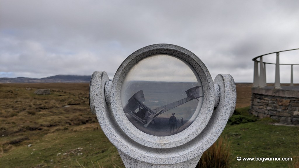
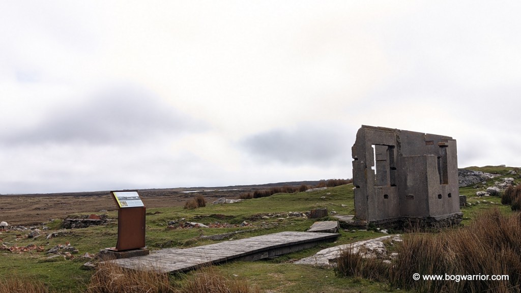
All of this means that despite the significance of this site, and the extent of what used to be here, visitors could easily go for a long walk and return to their cars oblivious. Happily, lots of work has been done to remedy this. Along with pathways and boardwalks, the site is dotted with information stops, photoscopes and helpful signs. All of these definitely help to make you understand how large and unique this site once was. It’s so frustrating that there isn’t even one building standing any more. All we have are tantalising glances of foundations, a few fragments of wall, loose bricks and concrete bases. The photoscopes in particular are a welcome addition because you can look through them and see old photos against the current landscape.

In 2010, a smaller version of the station was recreated for the BBC series Coast. If you’re interested, the episode can be seen here (scroll on to 9:26)

Alcock & Brown’s Soft Landing

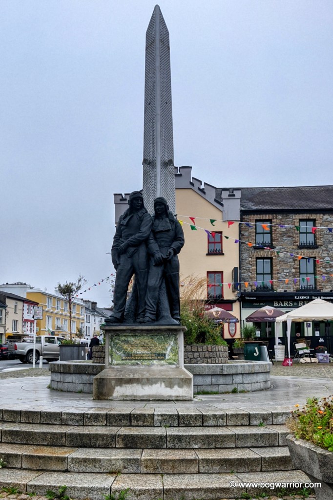
On Saturday 14th June 1919, two British pilots – Captain John Alcock and Lieutenant Arthur Whitten Brown set off from Lester’s Field, St. John’s, Newfoundland, Canada in a modified Vickers Vimy aeroplane. Both had flown aeroplanes in World War 1 but they had a slightly more peaceful mission in mind this time. The Daily Mail newspaper (yes, that one) was offering a prize of £10,000 for the first non-stop Transatlantic flight. That’s over €500,000 in today’s money, just in case you were wondering.

Their aircraft was a twin-engined bomber which had been modified for the crossing. Out went the bomb racks and in came extra fuel tanks and oil. To stay warm, both wore electrically heated clothing, Burberry overalls, fur gloves and fur-lined helmets. Alcock took the controls of the plane while Brown did the navigation.

Inevitably, the flight was incident-packed and not in a good way. 3½ hours into the journey, the plane’s wind-driven electrical generator failed. That deprived them of radio contact, their intercom and the heating. They then encountered thick fog which made navigation impossible – Alcock nearly crashed the plane into the sea after losing control of the aircraft. Now freezing cold because of the lack of heating, they encountered a snowstorm. After nearly 16 long hours in the plane, the duo finally made land again. They spotted the antenna at the Marconi station and that helped them get their bearings. Alcock landed the plane in what he thought was a nice green field. Anybody familiar with that part of Connemara would simply say “lol”. Anyway, both men emerged safe and sound from their plane. The plane itself was in reasonably good condition despite the flight but it soon began to sink into the soft ground.

The plane was soon removed from there and can now be seen in the Science Museum in London. The spot where they landed in Derrigimlagh is now overlooked by a viewing platform. Strangely, there is a second Alcock and Brown monument in the area but it’s on the L5132 road to Errislannan.

To sum up, if you want to spend a pleasant few hours walking in the fresh air and taking in the bleak but beautiful Connemara scenery you could do worse than come here.

How to get here: Navigating to here should be marginally less arduous than Alcock & Brown’s flight across the Atlantic. Derrigimlagh Bog is on the R341 between Clifden and Ballyconneely. There is a small car park at the entrance. Needless to say, wear comfortable footwear and at the very least, bring some water with you. You’ll be out there for a while.

Footnotes

  1. Original version of this photo is from the Laurence Collection and was digitised by the National Library of Ireland ↩︎
  2. Screenshot taken from Coast, Series 5, Episode 5 “Galway to Arranmore Island” (2010) ↩︎

Build it and they will come…or not

Yet again, my talent for visiting heritage sites under scaffolding does not disappoint

Ormond Castle in Carrick-on-Suir is a little bit different to your usual castle visit. For starters, the site isn’t obviously a castle. What catches the eye aren’t the ruins of the castle which are there, but the Elizabethan Tudor manor house built onto it. As we know, Tudor manor houses aren’t all that common in Ireland. This one could’ve been soo much more Elizabethan if only Queen Elizabeth I (i.e. Ms Elizabethan herself) had bothered to come and visit.

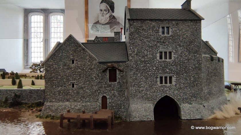
Anyway, let’s go back a bit in time. A castle was first built on the site in the fourteenth century. At the time it was very close to the River Suir (as depicted in a rather nice model that’s on display in the visitor centre) and was strategically important. It was originally owned by the Wall family but was given to the powerful Butler Family. James Butler would later become the first Earl of Ormond. The Butler family, incidentally, also owned Kilkenny Castle for many centuries.

Model depicting the castle and the river

Over 200 years later, Thomas Butler, the Tenth Earl of Ormond built the Tudor manor house onto the castle. Black Tom, as he was also known, was a cousin of Queen Elizabeth I through her mother Anne Boleyn. He became close friends with Elizabeth. So close, in fact, that there were rumours they were more than good friends. Elizabeth was known to refer to him as her “Black husband”.

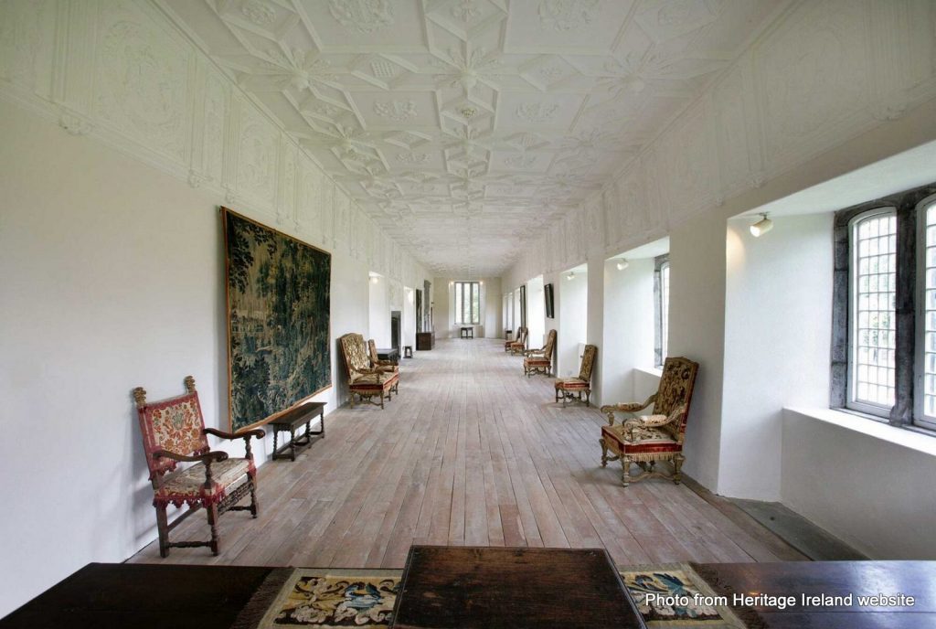
Photo from Heritage Ireland website
The Long Gallery (photo not mine)

Thomas invited Elizabeth to come visit him in Ireland and she accepted the invitation. In 1565 he built the manor house here, in preparation for her visit. As an Elizabethan-style house, it had larger windows, brick chimneys and a layout different to traditional Irish buildings. It has a beautiful long hall that has some pretty amazing stucco plasterwork on the walls and ceiling.

Sideways view of the model, showing how the manor house was built onto the castle

Disappointingly for Tom, Elizabeth was long on promises but short on action. She never did get around to visiting the manor house he had built for her.

“She had promised to visit when her Irish wars were won”

In 1588 Thomas became a Knight of the Garter and in 1597 he became Lieutenant General of Ireland in 1597. He also found the time to get married 3 times and fathered at least 16 children (4 inside the marriages, 12 elsewhere). When he died in 1614, his illegitimate son Piers FitzThomas Butler of Duiske benefited most from his will. This led to rumours that Piers might’ve been a child he’d had with Elizabeth.

Over time the financial clout and power of the Butler family diminished. The house was abandoned in the late 17th century and fell into ruin. The Butlers handed the site over to the Irish state in 1947

Some of the castle ruins

The castle and manor house have undergone significant restoration since then. In recent years the manor house was plastered over again. If you do a google image search, you can see plenty of photos of the manor house with its stonework exposed.

Even if Elizabeth couldn’t be bothered coming to visit, it is worth a trip if you fancy looking at something that isn’t yet another castle. There are some remnants of the castle on the site, including the tower house. The guided tour didn’t bring us in there but perhaps that may change in the future. There’s also a short film on the history of the castle and a museum with some interesting bits and bobs

Getting There

The castle closes over the winter time, so check Heritage Ireland’s website before planning your visit. As of 2024 its season is running from March-November. More details here

The castle is accessed through the park you can see on Google Streetview. Carrick on Suir is a busy town so you may not find parking right beside the castle. Astonishingly, the payment machine in the nearby council-run New Street Car Park didn’t offer a contactless card payment option. If you don’t have enough coins to hand (luckily we did) then you’re required to download an app and pre-load it with credit. That’s fine if you park in Co. Tipperary on a regular basis. If you’re on a one-time visitor then it’s daylight robbery.

Roscam – Never finished?

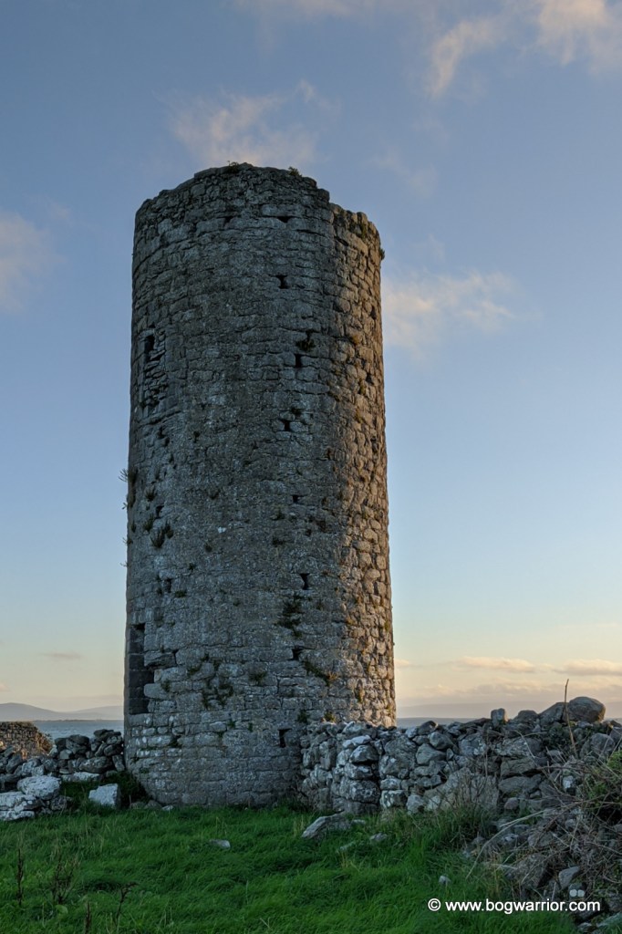
A recent trip to Galway afforded me the opportunity to “bag” another round tower. And so, I went in search of the tower at Roscam, which is on the outskirts of the city, overlooking Oranmore Bay. It’s a beautiful location, though the view is hampered somewhat by the inevitable development on the other side of the bay.

Very little is known about the monastery which once stood here. It is thought it may have been established here in the 5th century, which would make it one of the oldest monastic settlements in Ireland. It has been associated with St. Patrick (yep, that one) and with Odran, brother to St. Ciarán of Clonmacnoise. In 807, the site was attacked by those serial monastery pillagers, the Vikings. The monastery might also be where the bones of King Brión mac Echach Muigmedóin were brought to by Saint Aedus. There are question marks as to whether King Brión ever actually existed so you can make up your own mind.

The putlock holes are still visible on the tower

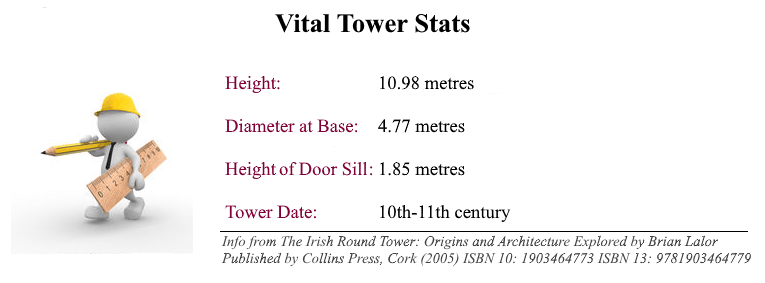
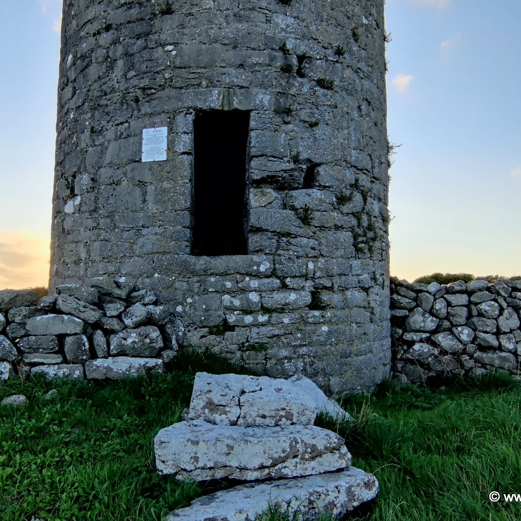
The tower stands 10.98m tall and is unusual for two reasons. One is that the lintelled doorway is quite low to the ground. The other is that the tower still has numerous putlock (or putlog) holes on its external walls. These were used to support scaffolding while the towers were being built, but were covered up afterwards. The presence of these holes in the tower raises doubts as to whether this particular one was ever finished. There is just one window in the tower, directly over the door. At some point afterwards, somebody attempted to add some height to the tower but the new stonework is not of the quality of what went before.

The church, and some company…

Close to the tower are the ruins of a medieval church. I wasn’t able to get near them because of the extensive stone walls and unclimbable gates in the area. Some of these are the remnants of ancient fortifications and they’re still doing their work effectively in 2021!

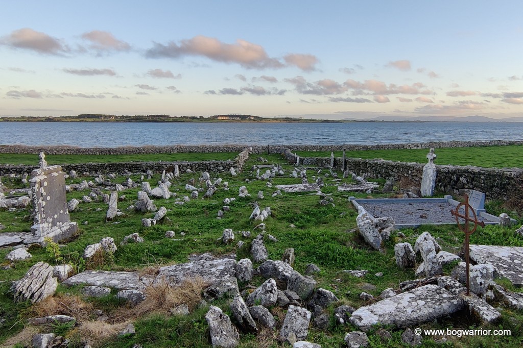
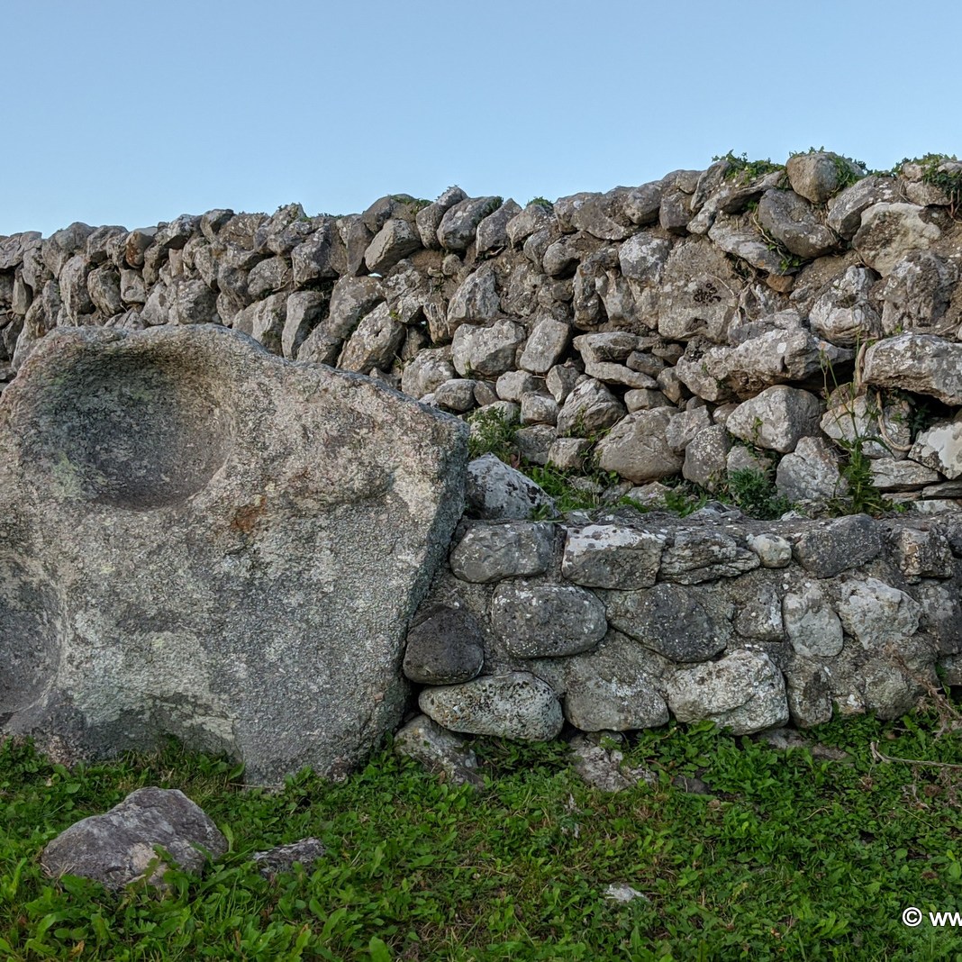
Far more interesting is the ancient graveyard which overlooks the bay. It doesn’t appear to be still in use but it looks like it was used extensively over the centuries. It’s populated with lots of broken, illegible headstones and rocks and it’s wonderful. There are two large bullaun stones in there as well, one of which is associated with St. Patrick. It seems the great snake banisher was also a dab hand at making round dents in big rocks.

One of the bullaun stones in the grave yard

By a long shot, this was the trickiest round tower to get to. For better or worse, I accessed it by driving along the Rosshill Road, then walked (carefully!) along the rocky beach that runs south of the site. Then some clambering over stone walls and navigating electric fences came into the equation. The tower is in the middle of a working farm, so naturally the animals come first.

Liathmore – New(ish) to the party

Every now and then, a new round tower gets added to the list of known towers. In 2018, some mortar from a ruined tower in the grounds of a grammar school in Derry were radiocarbon dated. It had been thought that the tower was a ruined windmill but the analysis of the mortar revealed it to be an older building. Evidence suggests it could quite likely be a round tower that had been known to have stood in the area.

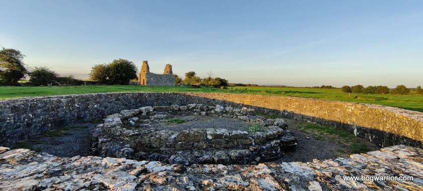
The rediscovery of the tower at Liathmore, Co. Tipperary took place nearly 50 years before this. In 1969-70 Dr. Robin E. Glasscock from Queens University, Belfast led excavations at this site. The foundations of the tower were found, along with some worked ashlars which were later used to reconstruct the base. The foundations went to a depth of 2.6 metres which is unusually deep for a round tower. As to why the tower vanished and was forgotten about, that’s anybody’s guess. Subsequent to the excavations, the Office of Public Works (OPW) reconstructed the base of the tower using the material found during the dig. The base is surrounded by a larger circular stone wall, constructed by the OPW to protect it from cattle.

The reconstructed base of Liathmore Round Tower. To its north is the smaller and older of the two churches here.

The monastery here was founded by St. Mochoemóg in the early 7th century. Tradition has it that he is buried in the larger church. And in a blurring of fact and fiction, he features in some versions of the Children of Lir story as the monk who baptised the four swans and turned them back into humans. Local folklore has it that every four years, four swans return to the area and spend a week here.

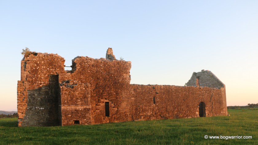
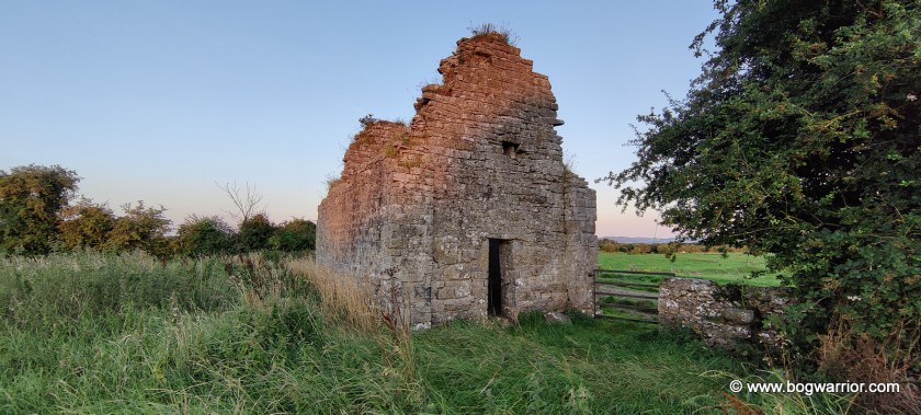
The tower base is situated almost half way between two ruined churches. Apart from these, there is evidence of a settlement which once existed here, perhaps until the 16th or 17th century. These lumps and bumps in the ground are easily visible in the area around the larger church

Aerial photo of the tower base and the two churches.

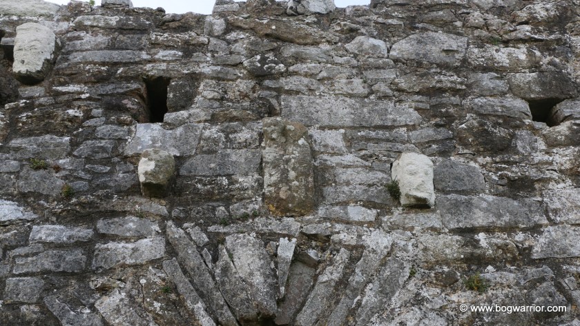
The smaller of the two is an 11th-century oratory. The larger church dates from the 12th century, though it was modified after that. Alterations made in the 15th century are quite noticeable here. There is a loft and steps that access the roof. This church has some interesting features, including some carved heads over the doorway and a Sheela-na-Gig that’s a little hard to find unless you know where to look (fnar). I visited this site on a sunny summer’s evening and wasn’t able to get a decent picture of said exhibitionist. So if you’re curious, there are pics on the “Ireland’s Síle na Gigs” website.

This site wouldn’t make it onto my “must see” list but it was a pleasant way to spend a sunny summer’s evening. The larger church in particular is interesting to look at. Because it’s a much altered building, there are random carvings set into doorways and masonry to look at inside.

Heads!

Getting There

This site is trickier to find than most of the others because it is on private farmland and isn’t signposted from the main road. The entrance to the farm, and the farm track out to the site, look a bit different to the 2009 Google Streetview imagery. Other online accounts of visiting this site mention the mud and advise wearing wellies, so I left my visit to this one until we’d had a dry spell of weather.

Killeshin. No round tower but…but…that doorway!

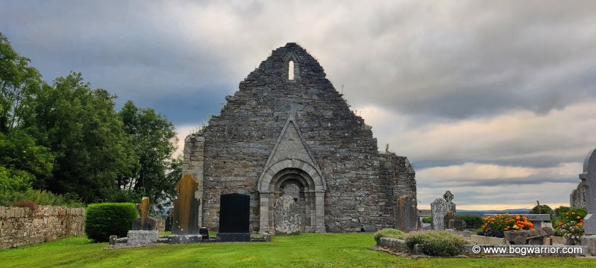
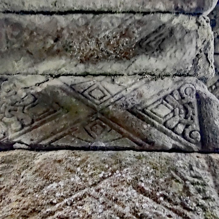
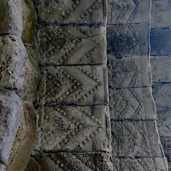
Killeshin is a small village in County Laois, just a few kilometres from Carlow town. It is also the site of former monastery, founded by either St. Comgan or St. Diarmait in the 5th century. It seems to have been a monastic site of note in its early days and was mentioned in historical literature. Little remains of this monastery now – according to the information board on the site it was mostly destroyed in 1077 AD. The only historic artefacts which are to be found there now are now are the ruins of a later church, a pretty amazing Hiberno-Romanesque doorway, and a baptismal font. But first, can I lament the demolition of its round tower in 1703? Hell, it’s my blog so I can do what I want to 🙂

The graveyard in Killeshin isn’t that large these days but until 1703, there was a round tower in the south-western corner of the graveyard. It seems to have been in pretty poor condition by that time but the worst was yet to come. The tower is recorded as having been 105 feet high (32m) and lay to the north-west of the church. It was “this was taken down in 1703 because the owner feared that it might fall on his cattle!“ . So in short, let me smite Colonel Wolseley who decided to demolish the tower, and add my voice of support to the Protestant Bishop of Leighlin who was “very displeased with him.”.

The Hiberno-Romanesque doorway in the gable end of Killeshin church

Despite this, the cemetery in Killeshin is still worth a visit if Romanesque doorways are your thing. The church ruins here are mostly from the 12th century and comprise mainly of two gable ends and plenty of fresh air in between. One of the gable ends has a window that looks out into the nice Laois countryside but it’s for the doorway that these ruins are most notable.

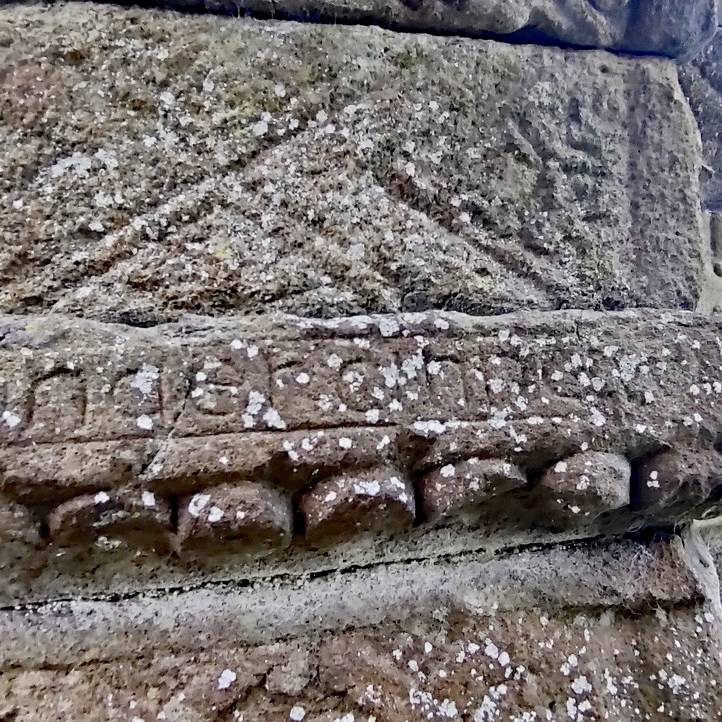
Part of the inscription dedicated to Diarmit MacMurrough

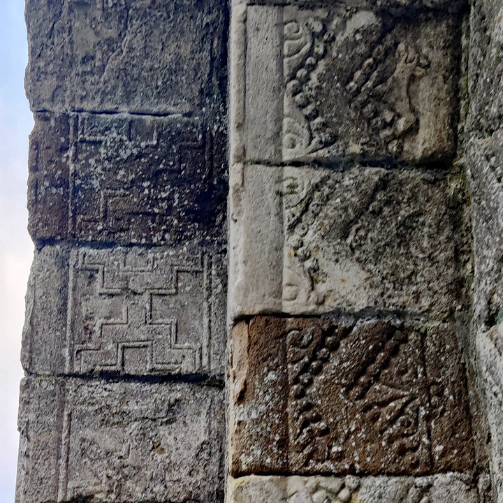
The doorway is in the unique “Hiberno-Romanesque” style and is one of the best examples to be found on the island of Ireland. To add an element of intrigue, the doorway may have been commissioned by the notorious Diarmit MacMurrough, the Irish king whose actions led to the English first coming to Ireland. There is an inscription in the doorway which reads ‘Orait do Diarmait Ri Lagen‘ or ‘a prayer for Diarmait, King of Leinster’ if your Irish is a bit rusty.

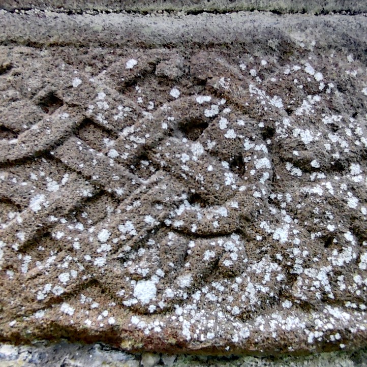
Regardless of who commissioned the doorway, it’s wonderful. It’s covered with all sorts of carvings, from written text to animal heads to all sorts of decorations. I’d go as far as to say it’s mesmerising if you have any liking for crumbly old ruins at all.

Getting There

It is an easy site to find – it is signposted and is on the side of a country road. It is a 2 minute walk from the current Killeshin Catholic church. The church’s car park is the handiest place to leave your four-wheeled means of transport. The cemetery is beautifully maintained – indeed on the evening I called in there was somebody mowing the grass.

Oughterard – Pint Sized

The original monastery at Oughterard is said to have been founded by St. Briga (aka. St Brigid). Confusingly, this isn’t the same St. Brigid who is connected with the settlement in nearby Kildare or one of the many other Brigids out there. Honestly, your head would start to spin if you try to figure all of it out. Less confusingly (and more of that in a moment), it is also the final resting place of Arthur Guinness, who founded that brewery.

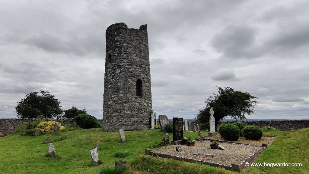
Little remains of the original monastery now, apart from the round tower. It stands at the back of a cemetery which is found at the top of a hill. Indeed, the Irish name for Oughterard is Uachtar Ard or high upper place. Like many other monasteries, it was raided by the Vikings. In the case of Oughterard, it was raided by the wonderfully named Sigtrygg Silkbeard who was a well-known Dublin-based Viking. At one point, the area was owned by Dermot MacMurrough, who’s possibly buried near another round tower…

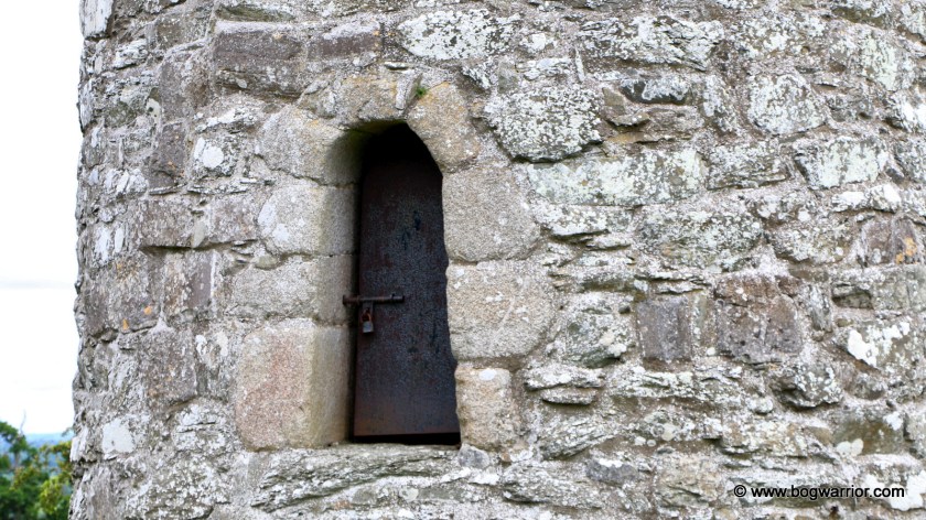
Now partially ruined, the tower here is built from shale rubble. Its doorcase is round-headed and made from granite. There is a padlocked metal door now in the doorway, ensuring that nobody’s getting in.

Close to the tower is a ruined church which dates from the 14th century. Its most striking feature, apart from the window which faces the cemetery gate, is the stairs turret which looks like it’s ready to topple over o_O Looking at other photos online, it is still possible to climb it but it wasn’t for me!
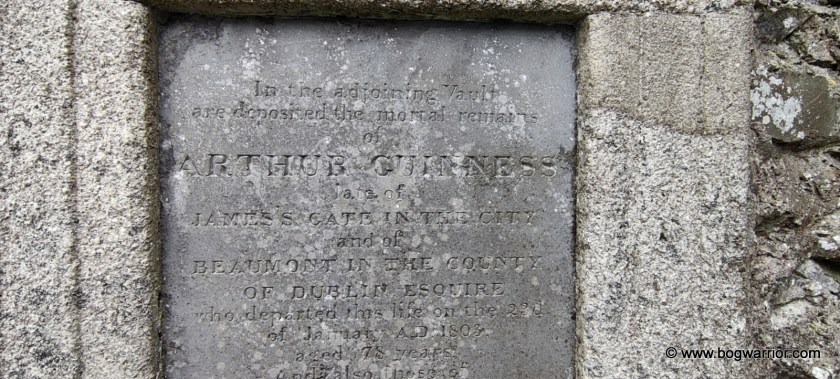
Inside the wall of the church is a plaque which begins “In the adjoining vault are deposited the mortal remains of Arthur Guinness…..” Guinness was born locally in either 1724 or 1725 – the date and place of his birth are disputed. Tradition has it that his grandfather and his father brewed ale, so it was inevitable that he’d end up continuing that line of business. After initially leasing a brewery in Leixlip, he signed a 9,000 year lease at a site in St. James’s Gate, Dublin. This is where the Guinness brewery and adjoining tourist trap continue to operate to this day.

Getting There

These days, the cemetery is marketed as part of “Arthur’s Way”, a Guinness related tourist trail run by Kildare County Council. The entrance is near a bend in a country road but there is room to park along there. It is a well-maintained site and even though there isn’t a lot here, it’s quite a pleasant place to spend a while. There are some nice views too.

Taghadoe

I went to university in Maynooth in the early 1990s and spent my time there blissfully unaware that a 2o minute bike ride out of town would’ve taken me to a round tower. Anyway, I took the opportunity to finally take a look at the round tower in Taghadoe after all these years. What’s 30 years in the lifespan of a round tower anyway?

Sorry about the overcooked looking photo – this is exactly what came out of my phone. Visiting at 8:30pm on a summer’s evening isn’t the best time for tower snaps

Very little is known about the monastic site which once stood here. Taghadoe is attributed to St. Tua (also known as St. Ultan the Silent). The only other thing known about the monastery is that one of its abbots (Folachtach of Tech-Tua, died 770AD) had previously been abbot of Clonmacnoise.

All that remains of the monastery is the tower. It stands in a small, well-kept graveyard beside a ruined 19th century church. It is built from limestone and stands 19.9 metres high. Above the round-headed doorway is what appears to be a heavily worn head. There is a similar feature in Monasterboice, some 80km away. At one point, the tower was used as a coal store of all things and doorway was cut into the wall. It was closed up in the 19th century and my untrained eye couldn’t say for sure where the doorway once was.

Taghadoe Round tower
How dairy come along and take photos of our tower

And there you have it…. There isn’t a lot to see here other than the tower. The church beside it was built in 1821 and abandoned 40 or so years later. The site surrounded by a dairy farm and fields of cattle – as a result, my visit was soundtracked to the sound of vigorous mooing and the scent of cow dung 🙂

Getting There

The tower is easy to find – it is on the side of a country road, 5km south of Maynooth. There isn’t a lot of parking around here, so be mindful of where you leave your car and don’t block any gateways.

Clondalkin

There are four round towers in County Dublin but the one in Clondalkin is the only one I have photos of. (I took a look at the one in Swords when I was a teenager) Anyway, the one in Clondalkin is notable for being the only round tower in Ireland which is thought to still have its original roof intact – there are no records of it having been reconstructed. It is made of stern stuff too. In the late 18th century, there was an explosion in a nearby powder-mill. The explosion of its 250 barrels of gunpowder demolished the parish church but the tower remained standing.

A monastic settlement was founded in Clondalkin by St. Mo-Chúa or St. Crónan in the late 6th or early 7th century. The road now splits the site in two, with a churchyard standing on the opposite side of the street to the tower. Still, the general layout make sense, with the doorway still facing a church. It’s not the original – perhaps the one that fell foul of the gunpowder explosion was on the site of that. There are two early crosses and a baptismal font in the churchyard, along with the remnants of the demolished church. You can see photos of those on the Ireland in Ruins blog. The evening of my flying visit, the churchyard was locked up.

Like many other old buildings in Dublin (i.e. Kilmainham Gaol, part of the old library in Trinity College, numerous Georgian houses), the tower is built from calp Limestone. The masonry is somewhat uneven and unlike most other towers, this one doesn’t narrow as it moves upwards. Indeed, the top of the tower flares out a bit.

At the bottom of the tower is a base which was added at a much later time. There is no date for this addition but it is thought it may have helped stabilise the tower. The base has some steps cut into it, which provide access to the door. The lintelled doorway and windows are much less elaborate than ones that are found elsewhere. The doorway is surrounded by granite.

According to Brian Lalor’s book, there are floors and ladders in the tower and that a key for access is available from the caretaker. It is unclear if that is still the case.

3D Google view of the site. The tower doorway is still facing in the direction of the now-vanished church

Getting There

The tower is hard to miss, seeing as it is standing on the side of the road in Clondalkin. There is parking in the nearby shopping centre. Since my brief visit back in 2014, a visitor centre has been developed close to the tower (more info here). An excuse to revisit? 😉