Kilnaboy

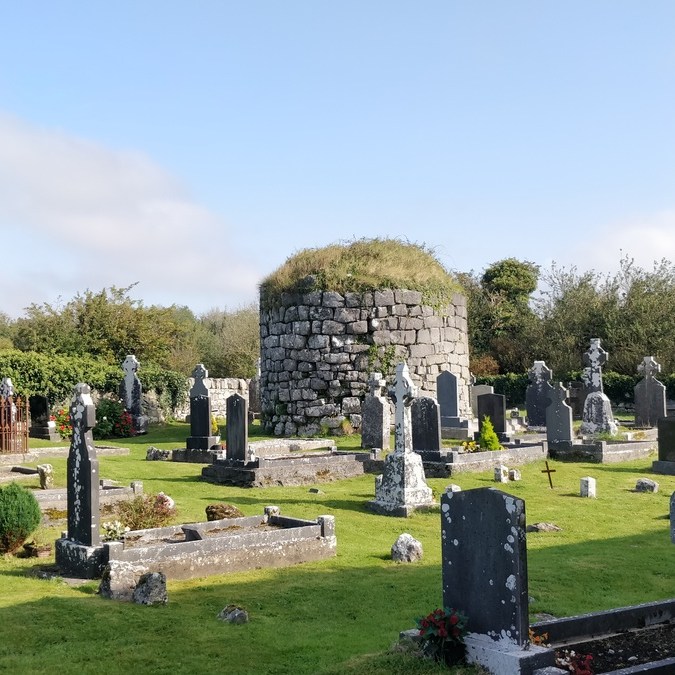
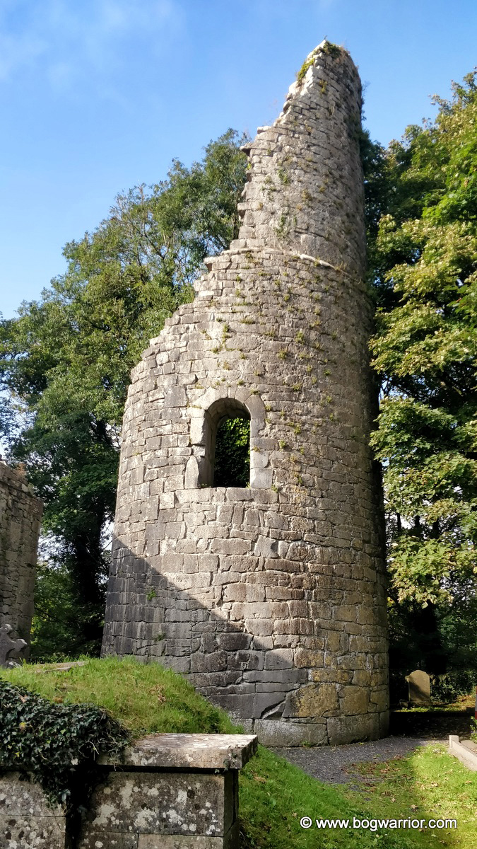
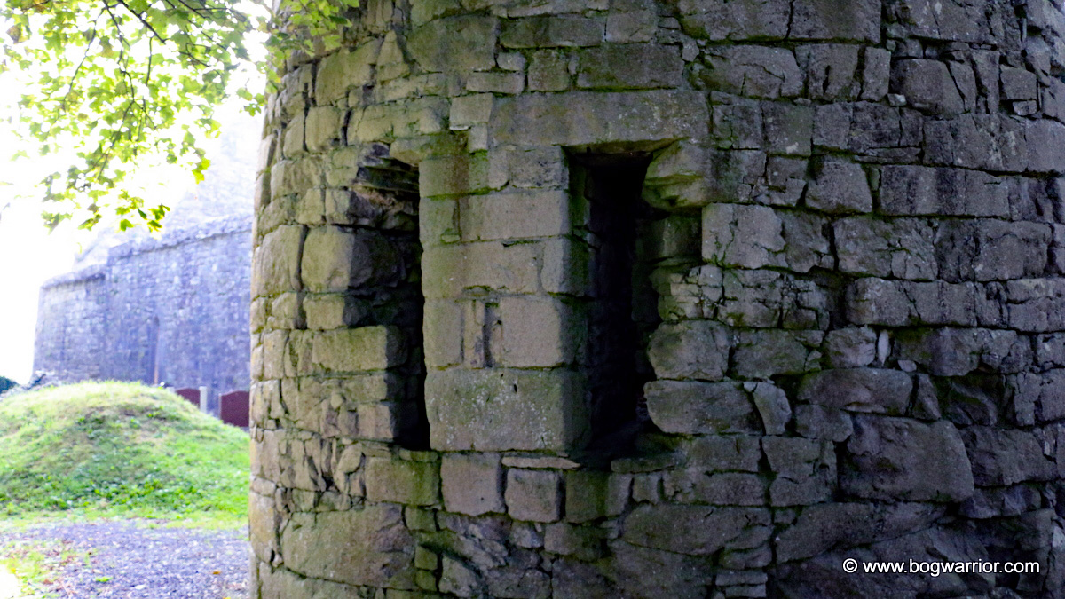
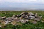
Of the three non-island round towers in Co. Clare, the one in Kilnaboy has suffered the most over the centuries. The other two at Dysert O’Dea and Drumcliff, whilst ruined, still look like they were once towers. Kilnaboy is little more than a stub these days.

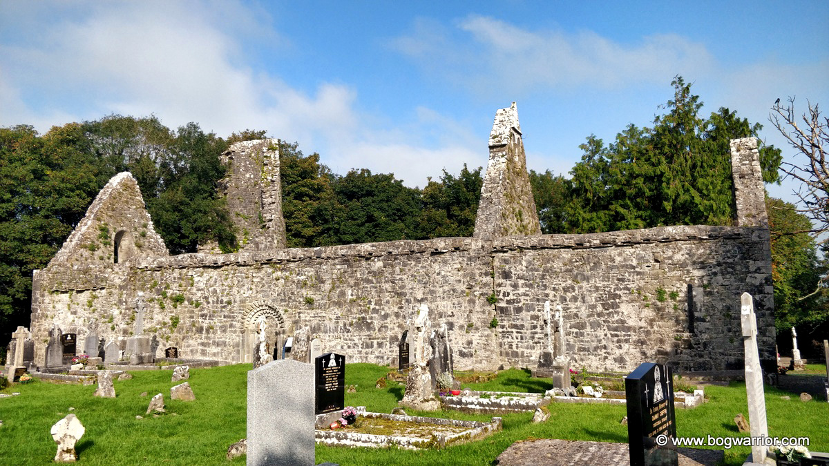
The tower stands in the grounds of a ruined church in the village of Kilnaboy. The church has a couple of noteworthy features but more about those in a moment. Unusually, the foundation of the monastery here is attributed to a woman. Killinaboy – is an angliciation of the Irish Cill Iníne Baoithe or “Church of the Daughter of Baoithe”. There’s a question mark over who this daughter might have been, with one suggestion being that she dates back much further than the monastery. Another is that she was a member of a wealthy family and that a clan chief allowed her to build her monastery here in the 6th century.

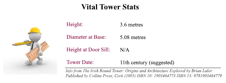
The tower has been this short for quite a long time. It has been said that the tower served as a lookout post until it was destroyed by Oliver Cromwell’s forces around 1650. Whether the story is true or not, all that remains now is a stub 3.6m high. Brian Lalor’s book describes the tower as being severely neglected in the 1990s, covered with ivy and filled with debris. The tower looks like it is being better maintained these days, which gives you a better look at what remains. The tower is made from limestone blocks but in comparison to others, it has a rough and ready feel to it.

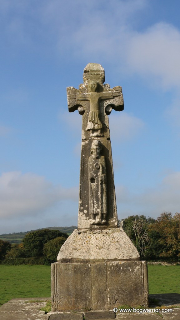
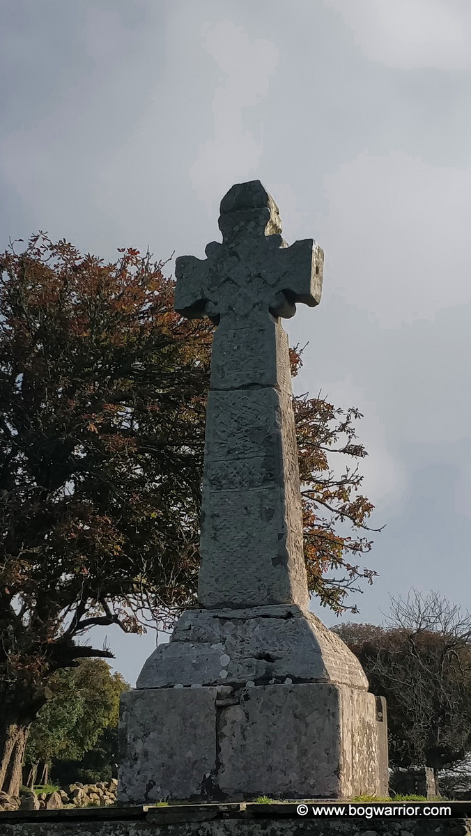
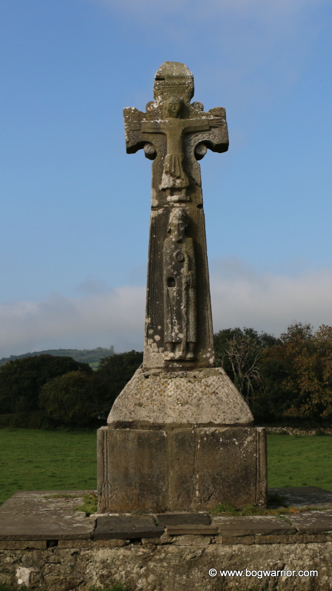
The ruined church, which was built afterwards, has a couple of interesting features worth noting. The gable end facing the road has a double-barred cross integrated into it. This is generally known as a “Cross of Lorraine”.

Over the doorway into the church is a somewhat worn Sheela-Na-Gig. Googling this particular one led me to a site which documents numerous Sheelas around Ireland. It made me chuckle so I recommend it heartily 🙂

While there isn’t much to keep a visitor here, it’s worth a visit. The information board in the nearby car park details other places of interest in the area and they might be worth investigating

Getting here

This is a site which is easy to find and doesn’t involve hair-raising rural roads. Close to Kilnaboy, it’s on top of a hill and there are some car parking spaces near the steps up to it.

Tower Visit: 18th September 2020

Dysert O’Dea – wet socks!

Dysert O’Dea church and round tower

For some reason, my abiding memory of my visit to Dysert O’Dea is getting my feet wet in the cemetery. I mean, why would you wear trainers into a graveyard in the middle of a spell of glorious weather in September? 😀 The things I do when struggling to come up with a heading for a blog post. Anyway, enough about my sodden feet. Let’s talk crumbly old ruins.

Dysert O’Dea was founded by St. Tola in the late 7th century or early 8th century. He is believed to be the bishop who appears below Jesus Christ on the nearby 12th century high cross. It isn’t clear when the monastery was abandoned but it is claimed that Oliver Cromwell’s troops torched the round tower and damaged it. Perhaps this is why there is a breach in the north-west wall of the tower.

These days, the round tower and church stand in a cemetery which is still in use. The tower stands just 14.6m high now, though it looks like there may have been battlements added to the top at some point. There are also the remnants of a window which was added later. Its base has the largest diameter of any of the round towers, though it’s unclear how tall the tower ever was.

Breach in the wall

On the north-west side of the tower is evidence of fire damage to the tower. There is also a breach in the wall, now supported by a column. It’s not known if this is as a result of the fire or the remnants of a doorway added later on. Either way, it’s not what one would expect to see just around the corner from the doorway. If around the corner is “a thing” on round towers…

The tower stands very close to the ruins of St. Tola’s church. The church itself dates mostly from the 12th and 13th century and is quite substantial in size. Its most striking feature is the Romanesque doorway in its south wall. I didn’t know this was here at all so what a nice surprise it was to see this.

The doorway was originally in the west wall but was moved here. It is believed to have been carved in the 12th century and has 19 heads on the top row – 12 human, 7 animal. The rest of the doorway mostly consists of geometric patterns and it’s stunning. I came here for the round tower but the doorway was my favourite feature

In the field behind the church and round tower is an unusual looking high cross. St Tola’s High Cross, known locally as the White Cross, stands in the middle of a very ordinary looking farmer’s field. According to another website I read, there can be a bull in the field. Thankfully, there were no ill-tempered bovines to be seen so I was able to admire the cross at my leisure.

It is believed that this high cross stands close to where it would’ve originally been erected. The base it now stands on looks like it originated elsewhere so we’re now looking at some historical upcycling. Still, it and the plinth underneath give the cross quite a bit of height and keep it safe from livestock. The top figure on the cross is Jesus Christ and it is thought that the bishop underneath is St. Tola, the monastery’s founder. There is a hole where his right hand should be. It is believed that a now missing piece would have been inserted into it. According to separate inscriptions on the base the cross has been repaired and re-erected twice – 1683 and 1871.

The less decorated side of the cross

Way back in 1908, a Plaster of Paris copy of this cross was made as part of an exhibition of high crosses. I was lucky enough to see this copy back in 2011 and was surprised at the time by its unusual appearance. It was really nice to finally see it in person, even if it was to be found in slightly surprising surroundings.

The church, round tower and high cross are very close to Dysert O’Dea Castle. It’s open during the summer but was closed up on the day of my visit. Weekdays in mid-September during a global pandemic probably keeps the crowds away! What was there was worth visiting, sodden socks and all.

Dysert O’Dea Castle.

Still, following the signposts for the castle was the better way to visit the site. There are two routes which will bring you to the monastic site. This route is probably more direct but if you like your car, you might not fancy parking it on the narrow country road for long. The last leg of the road to the castle is pretty rural (to say the least) but there is more room to safely park your car. The field with St. Tola’s Cross is close by and then it’s just a matter of climbing a stile into the churchyard.

Date of Visit: 18th September 2020

Loop Head Lighthouse

Loop Head lighthouse, now open to the public

Loop Head peninsula is situated on Ireland’s south-western coast, on the north side of the Shannon Estuary. The peninsula itself is a beautiful place to visit but as anyone who knows me will confirm, it was the lighthouse that drew me here. In recent years, the Commissioner for Irish lights (the body who run the lighthouses in Ireland) has been marketing a small number of lighthouses around the country as tourist destinations. Some as places for the public to visit, some as self-catering accommodation for tourists. Loop Head lighthouse straddles both camps, though I visited as a mere day-tripper looking for an opportunity to climb a tower 😀 The lighthouse keeper’s house on the site isn’t open to the public but photographs of the interior can be seen here 

Like many lighthouses around Ireland, the building on site now isn’t the only one which has stood there over time. Originally it was a 17th century stone cottage, replaced in 1802 by a regular lighthouse. Because of ongoing problems with the light signals coming from this lighthouse, it was decided to replace it with the present tower. Work began on it in 1844 and finished a decade later. The original lighthouse was eventually dismantled and the stone recycled. Or upcycled as they call it these days.

IMG_20170504_150301
The visitor’s centre is straight ahead

What’s on site?

The lighthouse itself is worth a visit if only to admire the handiwork of the men who built the tower. The interlocking stairs which run along the walls between the floors are stunning in themselves. It is still a working lighthouse to this day so I got a fleeting glimpse of the lantern in operation as we moved between floors. We were “whooshed” up and down the lighthouse rather quickly so I didn’t have a chance to take many photos. It was a shame it was a dull, overcast day because it reduced visibility a bit. Still, it wasn’t a wasted journey by any means.

IMG_4385
The only pic I got of the interior of the lighthouse. The stairs is wonderful though

The visitor’s centre is basic enough, with the usual multimedia displays, interactive screens, memorabilia etc. I was surprised to see there wasn’t some sort of coffee shop on site. The two vending machines which sell drinks and snacks were broken. Hmm…this is starting to turn into a TripAdvisor review 😀 I hope that over time they will develop the visitor’s centre further and add more facilities. Unlike the similar (better) visitor’s centre at Hook Head, they’re not over-burdened with existing buildings. Indeed, the toilets are in a portacabin outside. Not that I’m going to fault them for that – I’ve been in far far worse water closets 😀

While we were at the top of the lighthouse, the tour guide pointed out an area a little further down the headland with a connection to World War II. Ireland remained neutral during the war but over 80 navigation signs with the word EIRE were set into the ground along the coast. These were for American pilots to identify where they were flying. There was one of these signs at Loop Head, along with a hut which now lies in ruins. It is a shame that this hut has been left there like a pile of rubble. It is part of our history and would be an interesting addition to the area.

IMG_4408
The ruined remnants of the lookout hut

The headland is a lovely place to walk around, even on an overcast day. Someone said to me that they’d spotted dolphins further back up along the headland. By the time I got there though, there wasn’t a flipper to be seen. Oh well….