Killeshin. No round tower but…but…that doorway!

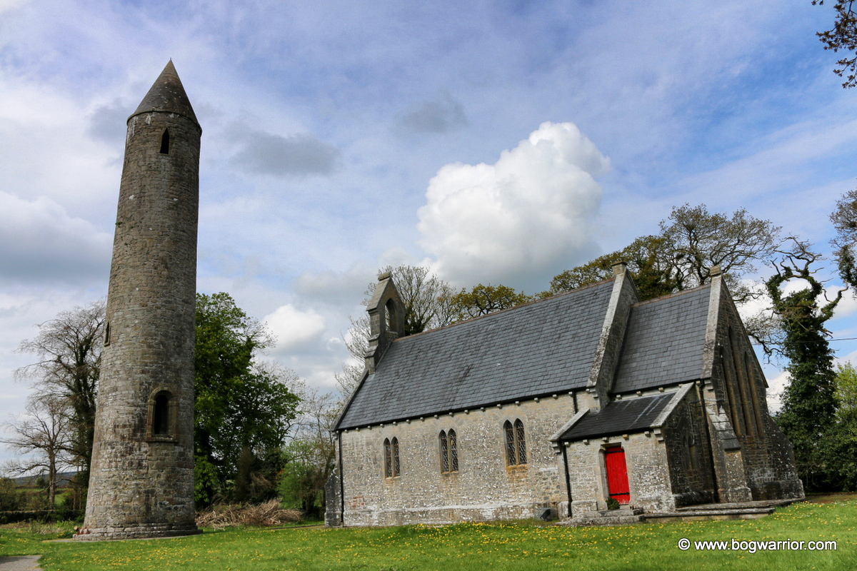
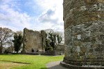
Killeshin is a small village in County Laois, just a few kilometres from Carlow town. It is also the site of former monastery, founded by either St. Comgan or St. Diarmait in the 5th century. It seems to have been a monastic site of note in its early days and was mentioned in historical literature. Little remains of this monastery now – according to the information board on the site it was mostly destroyed in 1077 AD. The only historic artefacts which are to be found there now are now are the ruins of a later church, a pretty amazing Hiberno-Romanesque doorway, and a baptismal font. But first, can I lament the demolition of its round tower in 1703? Hell, it’s my blog so I can do what I want to 🙂

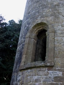
The graveyard in Killeshin isn’t that large these days but until 1703, there was a round tower in the south-western corner of the graveyard. It seems to have been in pretty poor condition by that time but the worst was yet to come. The tower is recorded as having been 105 feet high (32m) and lay to the north-west of the church. It was “this was taken down in 1703 because the owner feared that it might fall on his cattle! . So in short, let me smite Colonel Wolseley who decided to demolish the tower, and add my voice of support to the Protestant Bishop of Leighlin who was “very displeased with him.”.

The Hiberno-Romanesque doorway in the gable end of Killeshin church

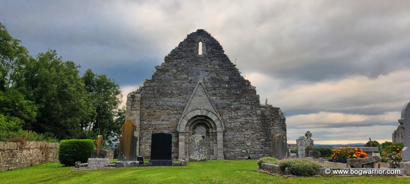
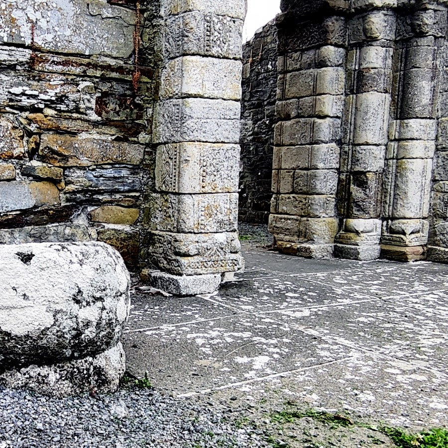
Despite this, the cemetery in Killeshin is still worth a visit if Romanesque doorways are your thing. The church ruins here are mostly from the 12th century and comprise mainly of two gable ends and plenty of fresh air in between. One of the gable ends has a window that looks out into the nice Laois countryside but it’s for the doorway that these ruins are most notable.

Part of the inscription dedicated to Diarmit MacMurrough

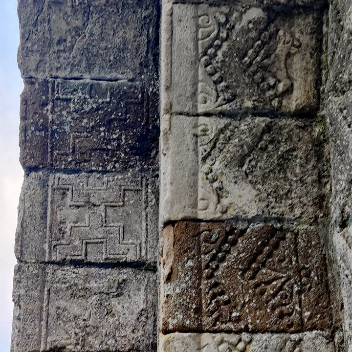
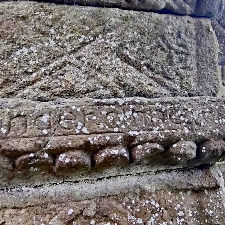
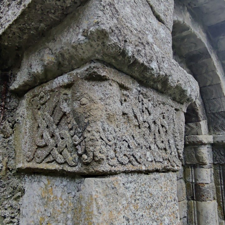
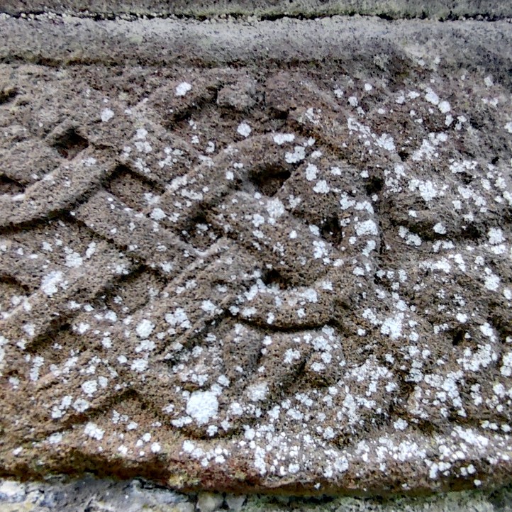
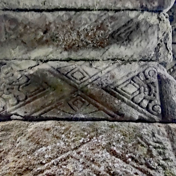
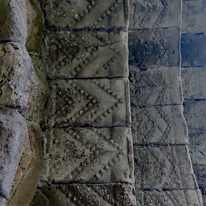
The doorway is in the unique “Hiberno-Romanesque” style and is one of the best examples to be found on the island of Ireland. To add an element of intrigue, the doorway may have been commissioned by the notorious Diarmit MacMurrough, the Irish king whose actions led to the English first coming to Ireland. There is an inscription in the doorway which reads ‘Orait do Diarmait Ri Lagen‘ or ‘a prayer for Diarmait, King of Leinster’ if your Irish is a bit rusty.

Regardless of who commissioned the doorway, it’s wonderful. It’s covered with all sorts of carvings, from written text to animal heads to all sorts of decorations. I’d go as far as to say it’s mesmerising if you have any liking for crumbly old ruins at all.

Getting There

It is an easy site to find – it is signposted and is on the side of a country road. It is a 2 minute walk from the current Killeshin Catholic church. The church’s car park is the handiest place to leave your four-wheeled means of transport. The cemetery is beautifully maintained – indeed on the evening I called in there was somebody mowing the grass.

Timahoe – the one with the fancy doorway

Timahoe is a village about 12km south of Portlaoise, Co. Laois. It’s a rather pretty place and more importantly, from this blog’s point of view, it has a round tower! A rather fine one at that.

timahoe_round_tower

Timahoe gets its name from a monastery which was founded by St. Mochua in the 7th century (Tígh Mochua = St. Mochua’s Church). Little remains of this monastery now, apart from the tower. The former church which stands alongside the tower was built much later and is now a heritage centre.

St. Mochua founded a monastery here sometime in the 7th century. He is recorded in the Annals of the Four Masters as having died in 637AD and that “His wondrous acts are mainly legendary”. Now that is what you call an obituary 😀

The tower itself is believed to date from the 12th century and is built from sandstone (bottom 3m) and limestone. It is leaning a little but it is fully intact. What’s striking about it, apart from it being in such good condition, is the doorway. It is unique – no other tower has a Romanesque style doorway. It is also quite a wide tower at its base. 5.58m. The tower itself stands 29.26m and the door sill 4.5m from the ground.

Timahoe (4)

There is little else of note to be seen in the churchyard but it is in a rather nice setting. The ruins near the tower probably stand on the spot of where the original church originally stood. Most of what is there now dates from the 17th century, with parts of an older 15th century church included in its wall. timahoe_2

Click on a thumbnail to open the gallery

Getting there

The tower is very easy to find and access. It’s visible from the roads leading into Timahoe and is in a churchyard close to the village green. Simply cross a footbridge and you’re there. There’s plenty of car parking space around too.

Vital Tower Stats

measuring

Height: 29.36m
Diameter at Base:5.58m
Height at Door-Sill: 4.3m
Suggested Date: 12th Century

Stats from The Irish Round Tower: Origins and Architecture Explored by Brian Lalor
Published by Collins Press, Cork (2005)
ISBN 10: 1903464773 ISBN 13: 9781903464779

Rock of Dunamase

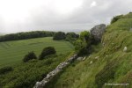
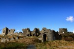
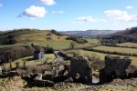
The Rock of Dunamase, or what’s left of it,
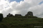
 sits on top of a hill 6km from the town of Portlaoise in the Irish midlands. The limestone outcrop on which the fortress is built dominates the surrounding plains of the Great Heath. Standing over 45m high, the Rock of Dunamase has been a site of strategic importance for over 1,000 years. It must have been a very impressive spectacle in its day. Alas, these days it something that has been savaged by a Rottweiler 😦

Ptolemy's Hibernia, showing
Ptolemy’s Hibernia, showing “Dunum” in the Midlands

Nobody is quite sure how long the Rock of Dunamase has been used as a fortress. Although the Greek geographer Ptolemy makes reference to a place called “Dunum” on his 2nd century map of Ireland, there is no evidence to suggest this site is what he meant. It’s a nice idea though. Archaeological digs and records from the time suggest that the rock was originally a 9th century fort called Dún Masc. Easy to see how its English name Dunamase came from. In the “Annals of the Four Masters” which chronicle Irish history, it is recorded that Dún Masc was raided by Vikings in 944AD. It would’ve been more unusual if the site hadn’t been raided by the Nordic invaders, such was their fondness for raiding and pillaging. No doubt the hapless abbot of Terryglass agreed – he happened to be here when they came a-knocking and was killed as a result of this raid.

Things get a bit woolly after this. Nobody seems to know or agree on when the site became a fortress it is today. It came into the ownership of the Anglo-Normans in the 12th century and was fortified. It appears to have been owned by the wonderfully named Meiler Fitzhenry at one stage and then by William Marshall. The latter is a significant Norman figure in Irish history.  It became an important centre of strategic and military importance in the region. Looking at the Office of Public Works’ recreation of the site, one can get a sense of the layout of the place.

In the 14th century, the last Anglo-Norman owner of the castle was executed by King Edward III for treason. It then came into the ownership of the Irish O’More family who didn’t handle it with care. Instead, the site was badly damaged and abandoned. Making doubly sure it wouldn’t be much use for anything, it was destroyed by Oliver Cromwell’s forces in the mid 17th century. Yet another addition to the long list of reason why he’s one of the most unpopular people in Ireland’s history.

The Barbican Gate
The Barbican Gate

In the late 18th century, an attempt was made to partially restore the fragmented remains. The great-grandfather of the legendary 19th-century politician Charles Stewart Parnell attempted to turn the Great Hall into a banqueting hall. Some doors and windows from other sites were added to the building and they remain to this day. It was a short-lived experiment though. Soon the castle returned to its current ruinous state, overlooking the surrounding countryside.

What’s there now?

The Rock of Dunamase is easily accessed, so no lengthy journeys along winding country boreens are needed here. There’s also plenty of parking along the road that runs past it, more than can be said for some of these places.

The first feature of note on the rock is the Barbican Gate which would have been the entrance to the complex. The murder hole above the entrance can still be seen and still works, should anyone have some boiling oil to hand 😉 Still to be seen along the wall attached to this gate are narrow defensive windows through which arrows could be shot at wannabe attackers.

Looking back down at the gatehouse

Beyond the Barbican Gate lie the remnants of the gatehouse, a defensive curtain wall and a deep ditch. Elements of the rock itself were used as a defensive feature. Even in its current ruinous state, it’s easy to get a sense of how tricky it would have been to attack the place. Originally there would have been wooden buildings here too but they have long since vanished.

At the top of the hill are the remains of the 12th-century keep/great hall. Even though it is ruined and is surrounded by large chunks of mangled buildings, one can still get a sense of how impressive a structure it must have been. Thanks to the failed attempt to turn it into a banqueting hall, it has been altered somewhat.

The Great Hall

The great hall
The great hall

It is a pity that this place was so badly damaged all those years ago. In recent years conservation work was carried out by the Office of Public Works so it’s about as safe as these sorts of places can be. It is still well worth visiting, not just to look at the remains of the fortress itself but to admire the views from the top. The lush greenery of The Heath is very beautiful too and apparently can be seen from outer space!

Click on an image to launch the gallery