Drumcliff – Nuffink to do with Yeats

According to the Placenames Database of Ireland, there are 3 places called Drumcliff in Ireland. Two of these are former monastic settlements and have a round tower to take a look at. The third one in Donegal needs to up its game, though I’m sure it’s very nice too. I haven’t been to the most famous of the Drumcliffs since I was a kid – this is the one where WB Yeats’s grave is to be found (note I didn’t say bones…). Instead, I’ll talk about the lesser known (but by no means inferior) Drumcliff in Co. Clare.

The round tower and ruined church

There isn’t a lot known about the monastic settlement which once stood here. It is believed to have been founded by St. Conal/Conald, possibly in the 7th century. There are no records of the monastery in any of the annals which document such things. Still, there’s a round tower here and that’s what I came for 🙂

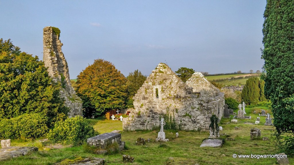
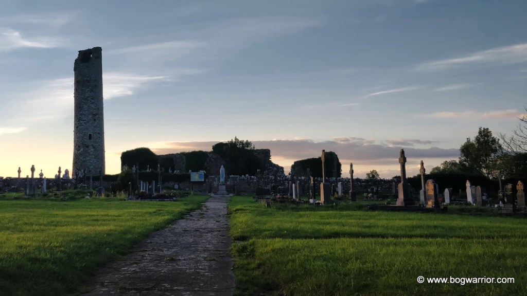
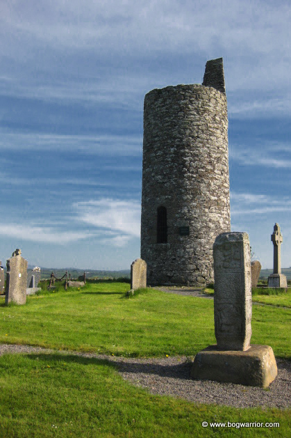
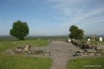
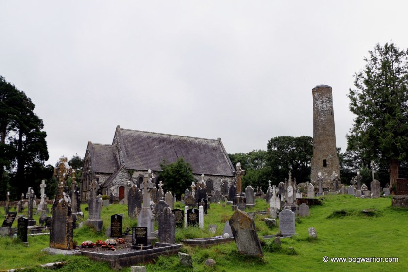
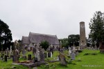
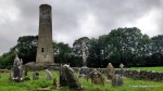
Drumcliffe is about 4km from Ennis and it’s obvious that there have been a lot of people buried in the area over a considerable period of time. There are two cemeteries on either side of the road and a reasonably large car park. As you might have guessed, the round tower is to be found in the older of the two cemeteries.

There are lots of old graves and vaults here

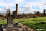
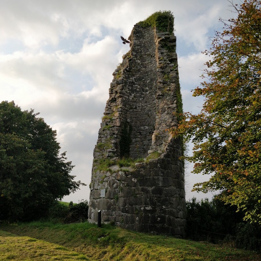
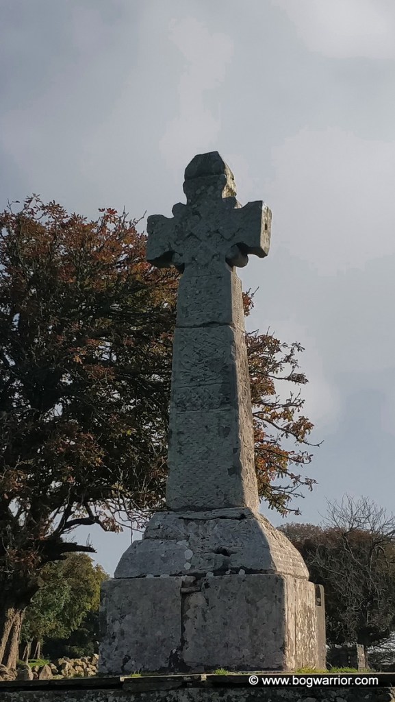
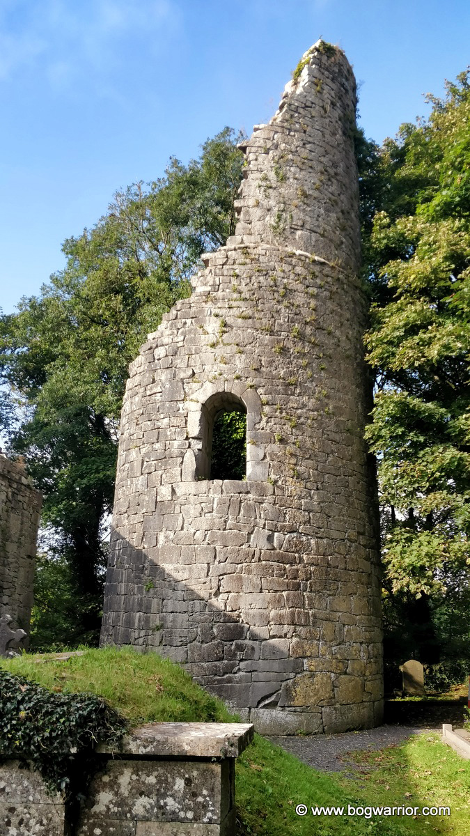
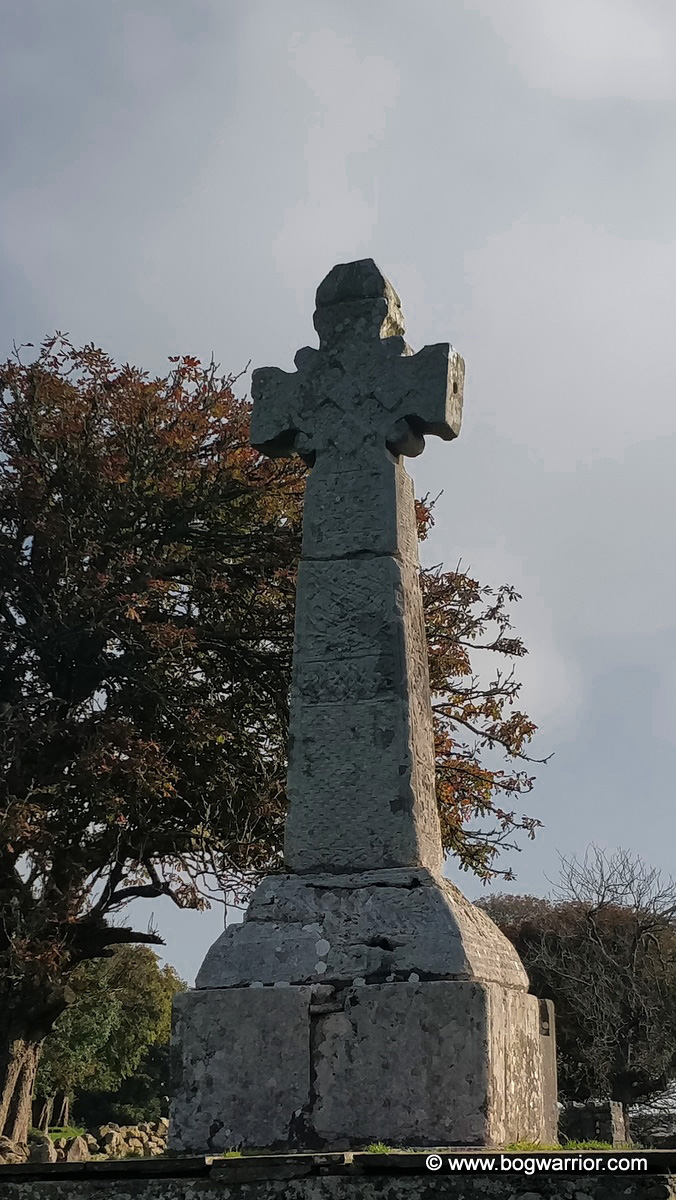
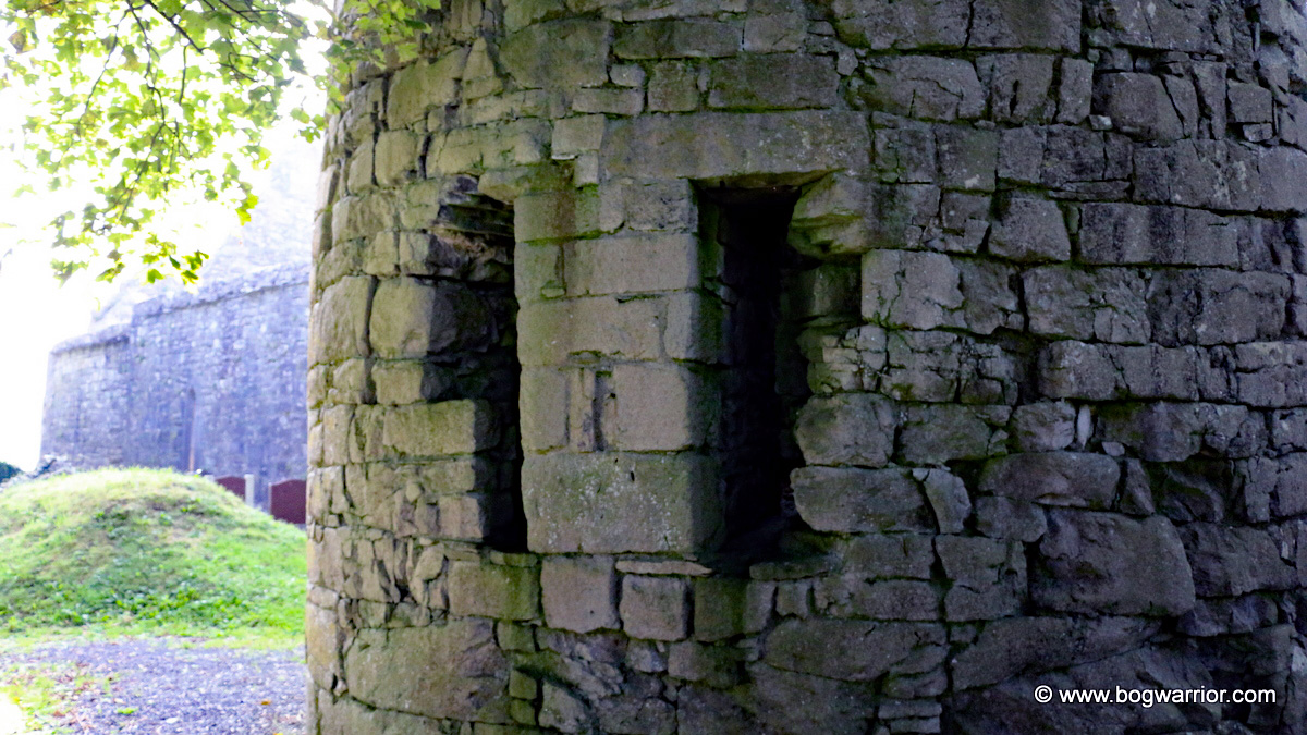
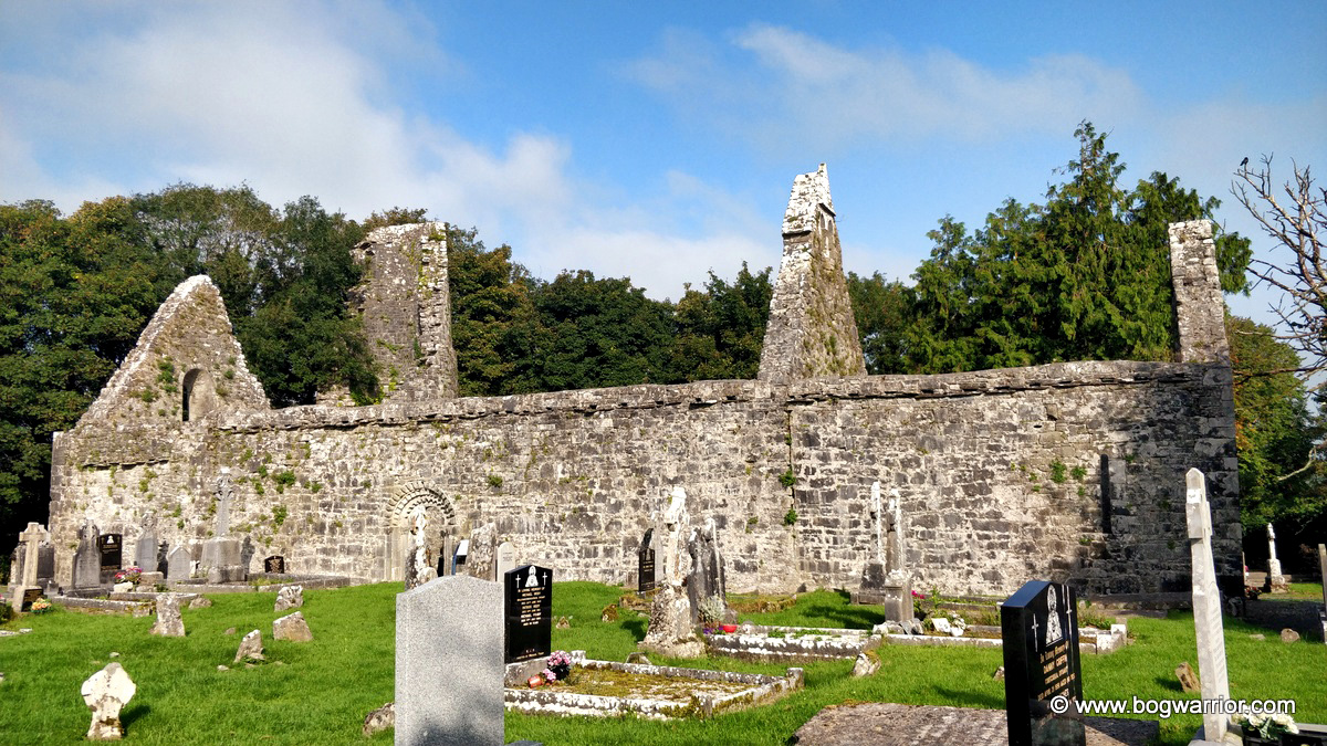
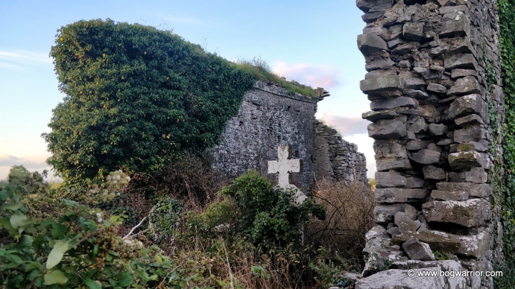
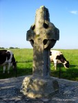
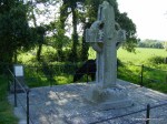
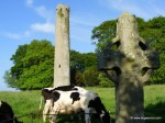
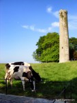
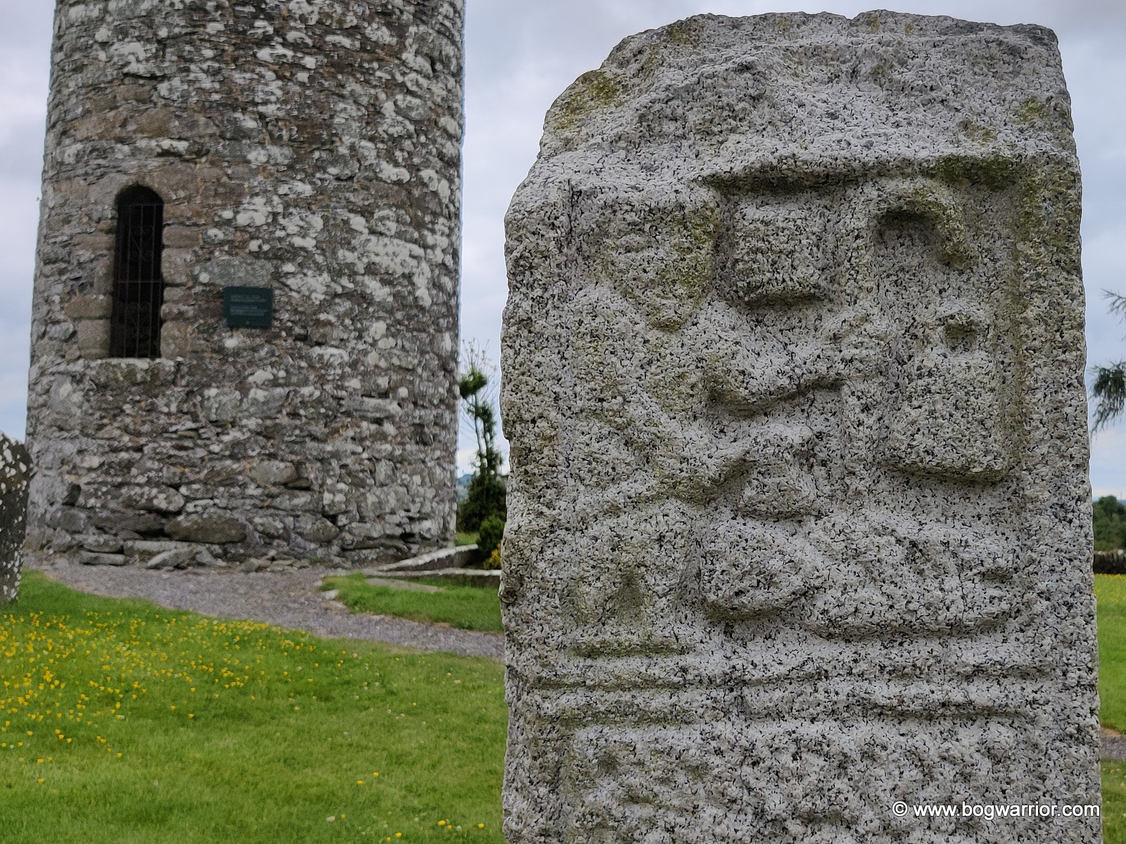
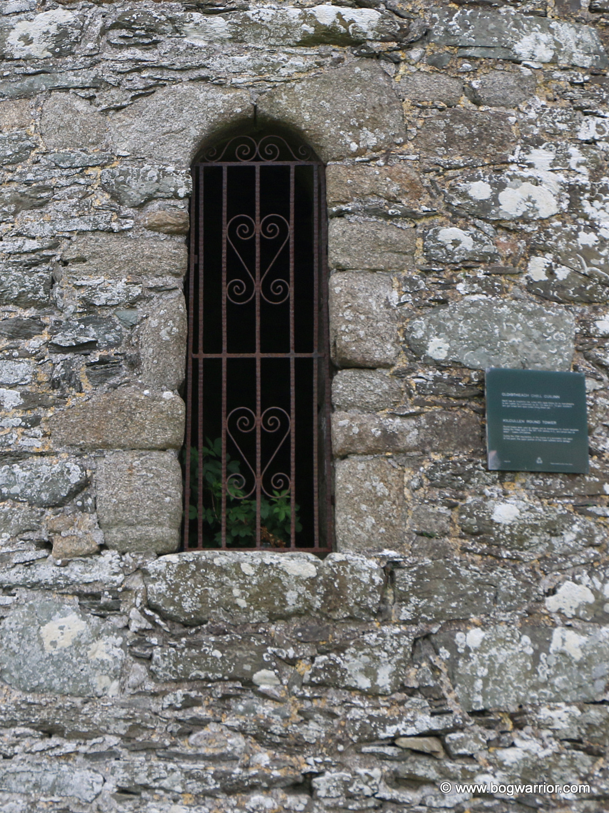
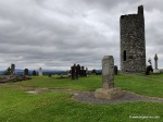
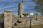
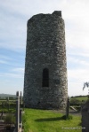
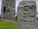
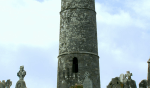
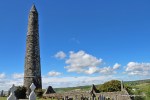
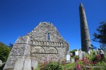
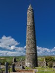
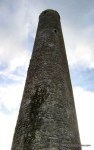
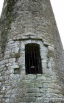
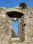
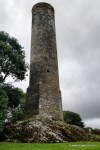
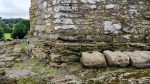
The old cemetery is dedicated to St. Senan and is on a hill which slopes up from the road. The tower is on the right hand side of the cemetery, towards the top of the hill. It stands beside a ruined 15th church which is believed to have replaced the original one for which the tower would have been a belfry. Sadly, the tower is also in ruins and stands just 11 metres in height. Still, if you’re interested in how these towers were built this one will give you an idea. You can see how thick the walls were and how they were constructed.It’s also possible to see where the internal floors would have been. At its lowest, the tower is around 3 metres from the ground.

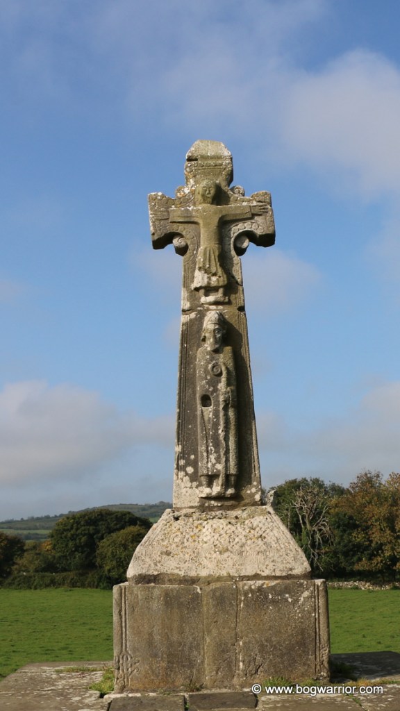
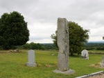
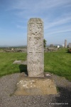
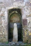
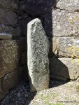
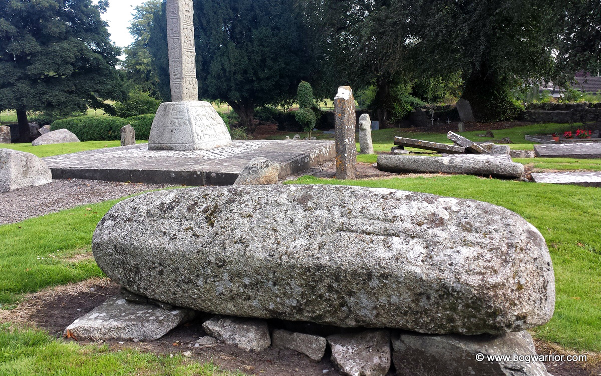
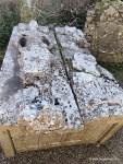
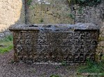
The cemetery itself is a lovely place to wander around. There are lots of interesting old graves, including many from people who obviously had plenty of money. That contrasts with other parts of the cemetery where there are mass graves. The pauper’s grave was used up until the 1950s. Many of the vicims of a cholera outbreak in the 1830s were buried here, close to a slightly later mass grave for those who perished in the Great Famine of the 1840s. It is thought that are there are around 350 cholera victims buried in the cholera plot and about 2,000 in the famine plot. They were grim times indeed.

Given how hilly and uneven this cemetery is, keeping the grass cut must be quite a challenge. Still, the cemetery is well maintained and makes it a pleasant place to visit.

Getting There

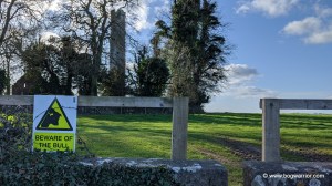
This one is nice and easy to find. Close to Ennis, there is no shortage of car parking. Then it’s just a matter of walking through the cemetery gates and climbing the hill. The tower isn’t easily seen from the road but it’s easy to find.

Date of Visit: 17th September 2020
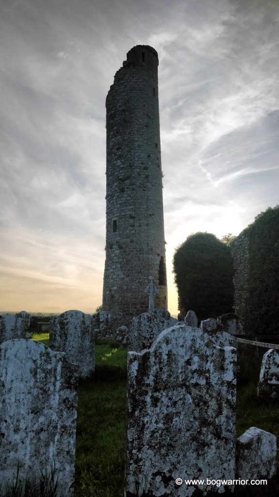
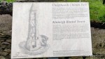
Dysert O’Dea – wet socks!

Dysert O’Dea church and round tower

For some reason, my abiding memory of my visit to Dysert O’Dea is getting my feet wet in the cemetery. I mean, why would you wear trainers into a graveyard in the middle of a spell of glorious weather in September? 😀 The things I do when struggling to come up with a heading for a blog post. Anyway, enough about my sodden feet. Let’s talk crumbly old ruins.

Dysert O’Dea was founded by St. Tola in the late 7th century or early 8th century. He is believed to be the bishop who appears below Jesus Christ on the nearby 12th century high cross. It isn’t clear when the monastery was abandoned but it is claimed that Oliver Cromwell’s troops torched the round tower and damaged it. Perhaps this is why there is a breach in the north-west wall of the tower.

These days, the round tower and church stand in a cemetery which is still in use. The tower stands just 14.6m high now, though it looks like there may have been battlements added to the top at some point. There are also the remnants of a window which was added later. Its base has the largest diameter of any of the round towers, though it’s unclear how tall the tower ever was.

Breach in the wall

On the north-west side of the tower is evidence of fire damage to the tower. There is also a breach in the wall, now supported by a column. It’s not known if this is as a result of the fire or the remnants of a doorway added later on. Either way, it’s not what one would expect to see just around the corner from the doorway. If around the corner is “a thing” on round towers…

The tower stands very close to the ruins of St. Tola’s church. The church itself dates mostly from the 12th and 13th century and is quite substantial in size. Its most striking feature is the Romanesque doorway in its south wall. I didn’t know this was here at all so what a nice surprise it was to see this.

The doorway was originally in the west wall but was moved here. It is believed to have been carved in the 12th century and has 19 heads on the top row – 12 human, 7 animal. The rest of the doorway mostly consists of geometric patterns and it’s stunning. I came here for the round tower but the doorway was my favourite feature

In the field behind the church and round tower is an unusual looking high cross. St Tola’s High Cross, known locally as the White Cross, stands in the middle of a very ordinary looking farmer’s field. According to another website I read, there can be a bull in the field. Thankfully, there were no ill-tempered bovines to be seen so I was able to admire the cross at my leisure.

It is believed that this high cross stands close to where it would’ve originally been erected. The base it now stands on looks like it originated elsewhere so we’re now looking at some historical upcycling. Still, it and the plinth underneath give the cross quite a bit of height and keep it safe from livestock. The top figure on the cross is Jesus Christ and it is thought that the bishop underneath is St. Tola, the monastery’s founder. There is a hole where his right hand should be. It is believed that a now missing piece would have been inserted into it. According to separate inscriptions on the base the cross has been repaired and re-erected twice – 1683 and 1871.

The less decorated side of the cross

Way back in 1908, a Plaster of Paris copy of this cross was made as part of an exhibition of high crosses. I was lucky enough to see this copy back in 2011 and was surprised at the time by its unusual appearance. It was really nice to finally see it in person, even if it was to be found in slightly surprising surroundings.

The church, round tower and high cross are very close to Dysert O’Dea Castle. It’s open during the summer but was closed up on the day of my visit. Weekdays in mid-September during a global pandemic probably keeps the crowds away! What was there was worth visiting, sodden socks and all.

Dysert O’Dea Castle.

Still, following the signposts for the castle was the better way to visit the site. There are two routes which will bring you to the monastic site. This route is probably more direct but if you like your car, you might not fancy parking it on the narrow country road for long. The last leg of the road to the castle is pretty rural (to say the least) but there is more room to safely park your car. The field with St. Tola’s Cross is close by and then it’s just a matter of climbing a stile into the churchyard.

Date of Visit: 18th September 2020

Tullaherin – Now Repaired

I first visited Tullaherin’s round tower in 2008. At that time, the tower was covered with scaffolding, undergoing some badly needed repairs. Brian Lalor’s book (first published in 1999) describes extensive and ominous fissures in the tower wall. The doorcase of the tower is long gone, leaving an ugly jagged hole behind. In 1892, a concrete pillar was built into this doorcase to help stabilise the tower. This made it impossible for anybody to get into the tower. The tower was struck by lightning in 1976 and it would appear that the damage from this strike led to the fissures forming. Thankfully, the scaffolding is long gone now and the tower can be seen properly again.

Tullaherin round tower

Little is known about the history of the site. Tullaherin may have been founded by St. Kieran of Saighir (also connected with Seir Kieran and Fertagh). According to the information board at the site, there used to be a pilgrimage held in his honour here. Apart from the tower, there is little left from the original monastery. It stands at the back of a cemetery which is still in use. To the north-east of the tower stands a ruined church which is a bit like Frankenstein’s monster – parts of it were built at different times. A portion dating from the 10th century is thought to be the original church for which this tower was a belfry. The rest of the church was built between the 12th and 17th centuries. Sadly, it wasn’t possible to get a closer look at the church because it’s largely fenced off and quite overgrown inside.

Now that the tower has been repaired, the concrete column in the doorcase is gone. It makes it easier to see the damage done by the removal of the tower’s doorcase though – it is sad to see a nasty looking hole there now. The tower is built from sandstone and seems to have had its top 3 metres rebuilt. There is a record of the tower being struck by lightning in 1121. A falling stone from it hit a student in the church and killed him. The repairs to the tower resulted in the bell floor having 8 rather than the usual 4 windows. This tended to happen when round towers were repaired in medieval times.

The tower doorway faces the church it once served

There are two badly worn ogham stones near the tower. The larger of the two was found locally and moved here. The second one is harder to find and while I took a photo of it, I was facing the wrong way. The writing is on the other side 😀 The other ogham stone is thought to have been removed from here. It was used as a gate pier for 30 years by a local farmer, before being returned here in 1983.

This ogham stone was used for 30 years as a gate pier

Getting There
Tullaherin is a short drive from Bennettsbridge, Co. Kilkenny. It’s close to the local church which has a car park beside it.

Date of Visit
Mostly 18th August 2020

Kilree

Kilree Round Tower is about 15km south of Kilkenny city, and not far from the Priory of Kells.  There isn’t much left of the original monastery here, apart from the tower and a high cross. Very little is known about the original monastic site. It is attributed to a St. Rhuidche but it isn’t known when he lived here. What is known is that the lands once belonged to the Dean of Ossory and were handed over to the nearby Priory of Kells in the 13th century. The tower is in the corner of an old graveyard, bisected by a wall. The nearby high cross, which would’ve been part of the original monastery, is now in the field beside the graveyard.

Although the tower is missing its cap, it is in fine condition. Since my first visit in 2008, it has undergone some repairs. It’s a proverbial curate’s egg, with some good bits and some bad bits. It has a fine doorcase and unusually, it’s not too high from the current ground level. Unlike the Kilkenny towers at Fertagh, Tullaherin and Aghaviller, it hasn’t had its doorcase removed or a new doorway added.

kilree_tower_doorway

The tower has an unusual plinth at its base, which can be better seen from the field behind. The tower at nearby Aghaviller has the same sort of plinth, suggesting that the same master mason may have worked at both sites.

The windows on the tower, on the other hand, aren’t in quite as good condition. They look like they have collapsed and aren’t as well defined as the door. The top of the tower doesn’t have a cap but has battlements instead. It also has what looks like drainage spouts at the top.

The high cross out in the field is thought to date from the 9th century. It is badly worn but there are a couple of biblical scenes on it. It has a tenon joint on the top, which makes it likely it once had a capstone.

Kilree
Kilree

When I visited, work was being carried out on the medieval church beside the tower so I wasn’t able to take a look.

And there you have it really. It’s not one of the must-visit round tower sites out there but it’s worth a trip if you happen to be visiting the nearby Kells Priory

kilree stats

Getting There

There’s some country road driving involved here but the tower is easy to find. There is a signpost across the road from the entrance to Kells Priory and it’s a short drive from there. Although the road is narrow, there is room to park a car near the entrance  Link . To access the graveyard and the tower, you will need to climb over a stile and walk a short distance through a field. There is a Beware of the Bull sign at the stile so be careful of that. On the day I visited, there were no cattle in the field at all.

Kilree Round Tower
Entrance from the road

Date of visit: 15th May 2008/Re-visit 16th March 2022

Old Kilcullen – a dwarfed dwarf?

The monastery at Old Kilcullen is said to have been founded by St. Patrick and left in the care of Mac Táil (Son of the Adze) who he ordained. It is built on top of a hill 2km outside the town of Kilcullen and overlooks some nice rolling countryside. It is also 500m south-east of the Dún Áilinne  hill fort which was a significant neolithic site. Perhaps something is to be read into an early Christian site being founded so near a pagan one?

Kilcullen

If you have been reading any of these round tower posts, it will come as little surprise to learn that the monastery was raided by Vikings in the 10th century. It was burned again in 1114.

kilcullen_outside_wall

Little remains of the monastery, apart from the tower, the ruins of a 12th-century church and the remnants of 2 high crosses. The tower now stands just 11m high but was taller until 1798. Just like the round tower at Roscrea, it was damaged during the 1798 rebellion. It lost some of its height but not to the extent that the Roscrea tower did.  It is believed that this one wasn’t all that tall to begin with. Old drawings and records suggest the tower had no cap but had 4 windows on what would have been its bell floor. This is unusual in the world of round towers but not unique. The towers at Dromiskin, Co. Louth and on Tory Island off the Co. Donegal coast are not that tall either.

Old Kilcullen Round Tower 2021 (23)

The doorway into the tower is quite low too (the door sill is just 1.8 m from the ground) but this is because the ground around it has risen over the centuries. Until the 1990s, it was possible to access the tower but there is now a metal grille in the doorway. Still, it is nice to take a closer look at a doorway that is almost at eye level.

Kilcullen doorway 2021

Apart from the tower and the partial high crosses, there isn’t a lot to see here. I’d rate this as one for round tower completists. If you want to see one round tower in Kildare, go for the one in Kildare town. Not only is it complete, it’s climbable!

kilcullen_tower_stats

Getting there. The tower is situated 2km outside Kilcullen, not too far from the motorway or the town. The site is easy to find and there is parking outside the graveyard.


Tower visits May 2009/June 2021

Ardmore – Pointy!

The round tower at Ardmore, Co. Waterford is one of my favourites. It stands in a graveyard which overlooks the seaside village of the same name and is one of the finest round towers in Ireland. The site also has some other interesting features, as you’ll find out if you keep reading 😉

Ready for lift off….5….4….3….

The monastery in Ardmore was founded by St. Declan in the 5th century. Perhaps the most notable thing about St. Declan is that he was already busy converting Irish people to Christianity before St. Patrick came along. It is believed that he met the great snake banisher in Rome while he was being ordained as a bishop. There’s more information about him on Wikipedia if you’re interested – he was considered important enough to have had his life documented.

The round tower is believed to be the last one to be built in Ireland. It is thought to have been built in the mid to late 12th century. This is quite late in the life of the monastery that had been here for hundreds of years by then. Perhaps it isn’t all that surprising that when the base of the tower was excavated in the 19th century, skeletons were found underneath it.

The tower, as featured in a 2005 postage stamp
2005 postage stamp

This sandstone tower is quite distinctive in few ways. While all round towers are narrower at the top than at the bottom, the batter on this one is more pronounced than usual. At its base, the tower is 5 metres. At the top it is just over 3 metres. It also has 3 string courses around its outside. These don’t coincide with what is thought to be its interior floors and are merely decorative. The tower had 6 floors over its basement. Its doorway faces towards the cathedral, which presumably was the site of the original church. According to Brian Lalor’s book, there some decorative non-structural corbels in the tower. Of course, nobody can see these because there is no access to the tower these days.

The 19th century was a busy time for the tower. In the mid-century, some internal floors were installed in the tower but were removed about 50 years later. Repairs were also carried out to the top of the tower. The capstone was repaired and a cross placed on the top. More can be read about the repairs here.

Tower repairs in the 19th century. No, I didn’t take this photo…

Even if the tower wasn’t here, Ardmore would be worth a visit for the other features to be found in the graveyard. As you can see from the above photo, there are some rather striking sculptures set into the gable end of the ruined cathedral. It is though that the sculptures were moved to here when the cathedral was extended. They denote scenes from the Bible, such as Adam and Eve and the Judgement of Solomon.

One of the panels in the gable end

The cathedral itself was built in the 11th/12th century. It is thought that some of it incorporates an earlier church. Although the cathedral is now ruined, there is still plenty to see inside. 3 ogham stones were excavated on the site and 2 of them are still to be found here (the 3rd is housed in the National Museum of Ireland). Ogham is an old form of written Irish and it dates back to the 4th to 7th century. Amazingly, it can be read.

This one reads LUGUDECCAS MAQI[  ̣  ̣ ?   ̣  ̣MU]/COI NETA SEGAMONAS/ DOLATI BIGAISGOB… which translates as ‘of Luguid son of …? descendant of Nad-Segamon’.

Close to the cathedral is St. Declan’s Oratory. It is believed to be built over the grave of St. Declan. If there was ever anything of value in here, it is long gone. All that remains inside is an open stone-lined pit which has been empty for many a year. Still, it is an interesting little building and it is in better condition than similar shrines in Clonmacnoise and Glendalough. The oratory was renovated and re-roofed in 1716.

St Declan’s Oratory
An aerial view of the site, as stolen from the BBC series “Coast”

In 1947, the cargo ship SS Ary capsized off the Waterford coast, killing 15 of its 16 crew. The dead sailors are now buried in the cemetery.

So in conclusion, Ardmore is well worth a visit. The area around it is rather nice too if you’re in the mood for some pretty seaside scenery. And if you fancy long walks, you could always try St. Declan’s Way

Getting There: This is pretty easy to find. The tower overlooks the village of Ardmore and is well signposted.

Click on a thumbnail to view the gallery

Castledermot – battlements!

The town of Castledermot in Co. Kildare gets its name from a hermitage founded by St. Dermot. The date when it was founded isn’t entirely clear but it seems to have been some time after 810AD. The monastery was raided twice during that century and burned in 1106. The tower is now the only intact remnant of the monastery.

Castledermot round tower

The tower which stands beside St. James’s Church of Ireland is rather unusual looking. Unlike most round towers, it is built from field stones and looks a bit like it has been coated with crinkled bubble wrap. Instead of being topped with the usual conical-shaped roof, it has castle-like battlements. It isn’t known when the battlements were added to the tower or when it lost its original roof. Another unique feature of this tower is that it doesn’t have a raised doorway. It is just 53 centimetres from the ground. The doorway can’t be seen from outside because it is at the end of a short passageway running between the church and the tower. The photo above is the nearest anybody can get to the tower’s doorway, unless they can gain access to the church. It is believed the doorway is original to the tower and not something that was added later.

The tower was used as a belfry in more recent times. According to Brian Lalor’s book, the bell is still up there, as are the internal floors and ladders. The tower is locked up though so it isn’t accessible. The tower seems to have been altered in other ways too, starting with a little window at floor level. It may also be missing a floor at this stage. It is not known for sure where the original monastery church stood at this point.

castledermot_round_tower

Apart from the tower, this churchyard also has two high crosses plus the base of a third one. It is also home to the only known Scandinavian style “hogsback” grave slab in Ireland. There is also a reconstructed Romanesque archway close to the church and tower. It is all that is left of a now-vanished medieval church.

castledermot_stats

Getting There

The tower is right beside St. James’s Church of Ireland, a short detour from Castledermot’s Main Street. There is plenty of parking nearby.

Date of visit:  21st August 2013

Click on a thumbnail to open the gallery

Fertagh – the tall, thin one

Fertagh or Grangefertagh, is about 4km from the village of Johnstown, Co. Kilkenny. It’s easy to spot from a distance because it is rather tall. It is a shame that only a small fragment of its cap remains because if it was rebuilt, it would become the tallest round tower in Ireland. Maybe somebody needs to sort that out! 😀

Fertagh (7)

According to the OPW information here, the monastery was probably founded in the 5th or 6th century by St. Kieran of Saighir. This is the same saint who founded the monatery at Seir Kieran. Like just about every other monastery in Ireland, it found itself under attack at various times. It is recorded that the Vikings tried to raid it in 861 but were repelled by Cerbhall of Ossory, who was a powerful King at that time. Indeed, it is suggested that no Vikings raided monasteries in Kilkenny at that time because they did not relish the thoughts of tangling with him. Cerbhall was long gone when the monastery was well and truly raided and burned in 1156. It is said that the tower was burned by the High King of Ireland, Muirchertach MacLochlainn, with the monastery’s lector inside it…

Fertagh (3)

The original doorway into the tower was badly damaged around 1800 when a local farmer decided that the stones from it would protect his property from fire. The doorway was repaired at a later date but it is still easy to see the damage that was done by this local.

Also in the cemetery are the ruined remains of a 13th century church. It remained in use until the 1780s. In the 19th century, its west doorway and east window were removed and are now to be found in Johnstown Church of Ireland. The Catholic Church got its baptismal font and a representation of the Crucifixion. Later still, part of the church was converted into a handball alley. Still, after all of that there still is something left to look at. Inside the church’s side chapel is a tomb, believed to be the final resting place of a king called Seán Mac Giolla Phádraig. Alongside the effigy of the late king is one of a woman. This is believed to be his wife Nóirín Ní Mórdha.

Fertagh 2021 (36)

Fertagh 2021 (40)

Getting there

The tower is easy to find – it is in a small cemetery on a narrow country lane. There aren’t many places to park a car though, as you can see from Google Streetview.

Tower Height 31 metres. Diameter at Base 4.77 metres Height at Door Sill 3.3 metres. Date 11th Century

Date of Visit: 16th March 2008

Click on a thumbnail to view the gallery

Kinneigh – The one with the hexagonal base

The monastery at Kinneigh was founded in the 6th century by the wonderfully named St. Mocholmóg. Little is known about the monastery or its founder. All that remains is the unusual round tower which stands on a rocky outcrop to the rear of a cemetery.

The lower 6 metres of the tower are hexagonal in shape. This section houses the basement and entry floors. The skill with which the tower transitions from being hexagonal to round suggests that this was the work of a particularly talented master mason. The work bears some resemblance to cathedral towers in Europe, suggesting that this could have been built around the 12th century. The tower itself is built from slate, a material local to the area. The base of the tower cracked quite severely in the past, possibly because of its hexagonal shape. It would appear that the classic cylindrical shape is the best design for these structures.

These days there is no access into the tower. Brian Lalor, whose book on round towers is well worth a read, climbed the tower in the 1980s. He has some useful observations about it, starting with a reference to the rickety metal internal ladders. At least one of these ladders is now gone, saving or denying visitors a hair-raising climb to the top. It’s up to you which description you prefer…

The entrance floor is thought to be original and made from large slate slabs. It has a rectangular hole in its centre, which gives access to the basement. The upper floors in the tower are made from rough poured concrete. It is unknown when the tower had a cap on it.

kinneigh_tower2

Just to the west of the tower is St. Bartholomew’s Church of Ireland. It was built around 1857. During this time, the tower was again put to use as a belfry. This might explain the concrete upper floors. The top 1.5m of the tower may be work done to help fit the bell. According to the Irish Round Towers website, the bell was removed and is now on display in the museum at Charles Fort, Kinsale.

There isn’t a lot else to see here. St Bartholomew’s church is still in use but closed up most of the time. Inside the grave yard is a slab commemorating the people buried there during the Great Famine of the 1840s, plus victims of a different sort. As to whether it’s worth visiting especially, the jury is out. The tower is an interesting curio but there isn’t much else to see here.

Click on a thumbnail to open the gallery

Getting There

Kinneigh is out in the countryside so be prepared for some nice, winding country roads. Unless there happens to be hordes of round tower enthusiasts visiting at the same time, you shouldn’t have any trouble finding somewhere safe to park your car.

Vital Tower Stats

measuringHeight: 21.5m
Diameter at Base: 6m
Height at Door-Sill: 3.24m
Suggested Date: 12th Century

Stats from The Irish Round Tower: Origins and Architecture Explored by Brian Lalor
Published by Collins Press, Cork (2005)
ISBN 10: 1903464773 ISBN 13: 9781903464779

Visit date: 22nd August 2019


Ferns – the one with the unusual round tower

Ferns, Co. Wexford is a fascinating place in its own right and I plan to write a little bit more about it soon. For now, I’ll concentrate on the round tower which is is part of the site.

Ferns is closely associated with Dermot MacMurrough (Diarmaid MacMurchada), the King of Leinster who was deposed from his throne in 1166. In an effort to regain his title and his lands, he travelled abroad in either 1167 or 1168 to seek help from King Henry II of England. This led to some Anglo-Norman Lords from south Wales invading Ireland in 1169/1170 and the beginnings of English involvement in Ireland.

Dermot MacMurrough's Grave
The final resting place(?) of Dermot MacMurrough. The grave is marked with the broken shaft of a high cross.

MacMurrough is also associated with the Augustinian Abbey which is where the round tower comes into the picture. The Abbey was founded by him in 1158 but was burned around 1160. MacMurrough had it rebuilt. Presumably the tower/belfry was built at this time. The Abbey was plundered in the 14th century during the wars triggered by Robert the Bruce’s brother Edward invading Ireland. It was still in existence in the 16th century when King Henry VIII was suppressing the monasteries. It was recorded at the time as consisting of a church and belfry, a dormitory, a chapter house and a hall. The Abbey had 600 acres of land at the time.

Ruins of Abbey and Round Tower in Ferns. St. Edan's Cathedral is in the background
Ruins of Abbey and Round Tower in Ferns. St. Edan’s Cathedral is in the background

These days, all that remains is the belfry (round tower) and the ruins of its attached church. Because the tower isn’t free-standing like most round towers and is only round for its upper half, there are some who don’t consider it to be a proper round tower. On the other hand, there are some examples of towers with unusual shaped bases and which are attached to churches. Or as Brian Lalor puts it in his book “If it isn’t an early medieval Round Tower, than what is it?”. It has similarities with the free-standing round tower at Kinneigh, Co. Cork. All of which are good enough for me.

The tower has a doorway and a brick spiral staircase can be seen through the locked gate. It is believed that the internal staircase dates from the 17th century

Click on a thumbnail below to open the gallery

Getting There

The tower is in the middle of a field behind St. Edan’s Cathedral. There is plenty of street parking nearby.

Is it worth visiting? Absolutely. Aside from the ruins here, there is lots to see in Ferns. Seeing as I’m confined to the house because of Covid-19, I might just write about it next.

Vital Tower Stats

measuringHeight: 18.24
Square Base: 2.9m x 2.9m
Diameter of base at circular section: 2.9m
Suggested Date: 12th Century

Stats from The Irish Round Tower: Origins and Architecture Explored by Brian Lalor
Published by Collins Press, Cork (2005)
ISBN 10: 1903464773 ISBN 13: 9781903464779