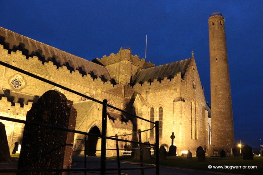
I nearly got locked into the cathedral grounds overnight when taking this photo (oops!)
The round tower in Kilkenny stands beside the rather wonderful and historic St. Canice’s Cathedral. It is a complete tower, although it lacks the usual capped roof. Instead, the top of the tower is a low stone wall with a modern day cage around it. This is to stop people who’ve climbed to the top of it (yes!) from falling off. The ground is a long way down – just over 30 metres in fact. And yes, it does lean a bit but let’s not think about that. The cathedral and the tower are built on top of a hill, which gives it a fine view over Kilkenny. It is thought that this led to the tower doubling up as a watchtower and why the roof was either removed or not added in the first place.
The original monastery here was founded by St. Canice in the 6th century. The original church for which the tower was a belfry has vanished without a trace. The doorway of the tower faces away from the cathedral, suggesting that the church stood elsewhere.
Weather permitting, the tower can be climbed. As you can see from this photo, the weather was not permitting on this particular day.
The original ladders and floors in the tower are long gone but happily, it can still be climbed. There are a number of wooden floors and connecting ladders which will bring you right up to the top. It’s probably not a climb for the faint-hearted or anyone who suffers from claustrophobia. The interior of of the tower is quite small and the climb to the top involves ascending a series of steps which are glorified wooden ladders. Still, if you make it to the top, the view is worth the effort. There are so few of these towers which can be ascended, it’d be a shame to pass up the opportunity.
A more youthful me atop the tower
Getting There
The cathedral and tower are best visited on foot. Parking is limited in the area and a quick glance at Google Streetview might dissuade you from driving the lane-way that goes past the front gate 😉 There is ample parking in the city’s car parks (Market Yard and Market Cross Shopping Centre are 5 minutes walk away). Besides, nobody visits Kilkenny just for the tower…
Vital Tower Stats
Height: 31m
Diameter of Base: 4.77m
Height of Door Sill: 3.3m
Suggested Date: 11th century
Stats from The Irish Round Tower: Origins and Architecture Explored by Brian Lalor
Published by Collins Press, Cork (2005)
ISBN 10: 1903464773 ISBN 13: 9781903464779
To Irish people of a certain age, the mention of the name Seir Kieran will most likely conjure up memories of the 1980s and 1990s. The days when Offaly could field competitive hurling teams, always featuring handy players from the Seir Kieran GAA club in their. Ah, those were the days…
The Seir Kieran club is located in the small village of Clareen and gets its name from the nearby monastery which has all but vanished. Just like its round tower really
Seir Kieran Round Tower ^
The monastery, known as Saighir, was founded by St. Ciarán the Elder. (Seir Kieran is simply an Anglicisation of the monastery name and its founder). He was given this name to differentiate him from St. Ciarán who founded Clonmacnoise. There is quite a bit of confusion about St. Ciarán’s life and plenty of rabbit holes to go down if you want to figure it all out! The basic facts seem to be that Ciarán was born in the 5th century, possibly in Cape Clear, Co. Cork. He was a Christian before St. Patrick’s arrival into Ireland and may have been studying abroad by then. He seems to have been ordained a Bishop in Rome prior to his return to Ireland. His plan was to be a hermit and he settled in Saighir. However, instead of being left in peace to do hermitty things, people started to flock to him and the place turned into a thriving monastery. In time, Ciarán’s monastery became the burial place for the Kings of Osraige (Ossory), something that would have had quite some status at the time. Ciarán met St. Patrick and became one of his helpers. He became the first Bishop of Ossory – that title continues to this day though the seat is elsewhere.
Over time, Saighir fell into decline. It wasn’t helped by being raided by the Vikings but being superseded by Aghaboe Abbey 30km away was the death knell really. It was finally dissolved in 1568, as part of King Henry VIII’s dissolution of the monasteries.
Little remains of St Ciarán’s monastery or the round tower. There is now a 19th century Church of Ireland church built on the site. It is possible that it is standing in much the same place as the original monastery church would have stood. The church (which I haven’t been inside) contains a number of early medieval memorial slabs which probably were here prior to it being built. The round tower is close by but there isn’t a lot to see now.
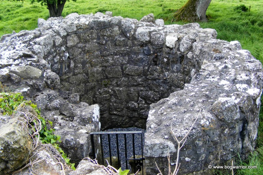
There are just 6 courses of stones remaining of the tower overground and it is sitting in a field at a lower level to the rest of the adjoining grave yard. The basement can still be seen and taking that into account, it brings its height to 2.9m high. Its diameter at the base is 5.14m. Still, it is possible to see just how thick the walls of these towers were.
The entrance gate to the tower was added later. There is a bullaun stone embedded in the wall of the tower under the gate. Nobody knows what these were for but they are often found in old ecclesiastical sites.
Elsewhere, there is the base of a 10th century high cross. And that more or less sums up what’s to be found here.
Date of Visit: 22nd May 2009
Getting there
The site is just outside the village of Clareen. It is signposted from the road and is easy to get to (link).
Whether it’s worth it or not is debatable. There is quite a bit of history attached to this monastery and to St. Ciarán but not a lot to see if you’re a tower spotter.
Vital Tower Stats
Height: 2.9m
Diameter at Base: 5.14m
Height at Door-Sill: Unknown
Suggested Date: Unknown
Stats from The Irish Round Tower: Origins and Architecture Explored by Brian Lalor
Published by Collins Press, Cork (2005)
ISBN 10: 1903464773 ISBN 13: 9781903464779
Recently, I posted about round towers so I thought I’d write something about the ones I have visited so far. Some of my memories might be a bit shaky but when did that ever stop me? 😀 I shall begin with the first round tower I ever clapped eyes on. O’Rourke’s Tower in Clonmacnoise, Co. Offaly.
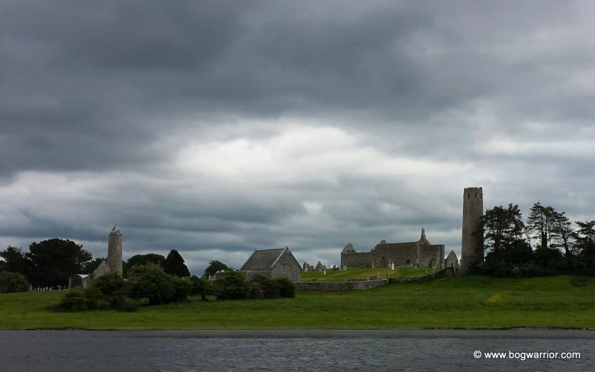
The remains of the monastic settlement of Clonmacnoise are located about 11km south of Athlone. It sits on the banks of the River Shannon, in an area that was of great strategic importance at the time. It was originally founded in the mid 6th century by St. Ciarán and went on to become a significant monastery. Some manuscripts, including the Annals of Tighernach (11th century) and Book of the Dun Cow (12th century), were written here. It wasn’t just literature which was a feature of life here. The Clonmacnoise Crozier was unearthed when Temple Ciarán (reputed to be St. Ciarán’s final resting place) was being excavated. It can now be seen in the National Museum in Dublin. Or on a postage stamp (remember those?). There are numerous early Christian carved stone slabs on display too.
Clonmacnoise was a settlement of some importance, growing to include a cathedral, seven churches, three high crosses and two round towers. The monastery was raided numerous times by the native Irish, the Vikings and the Normans. It began to fall into decline around the 12th century, partly because Athlone was starting to rise in prominence by this stage. It was finally destroyed and closed in 1552. Just about all of the monastery remains in ruin, apart from Temple Connor which was restored by the Church of Ireland and continues to be used occasionally. These days, Clonmacnoise is a popular tourist attraction. If navigating the winding roads of west Offaly aren’t for you, you can explore the place without getting out of your chair. Google Streetview has paid a visit.
Photo taken on a boat out on the river
O’Rourke’s Tower
O’Rourke’s Tower with some humans for scale
O’Rourke’s Tower was built in the 12th century. It is recorded as having being completed in 1124AD. It is built from ashlar limestone masonry (in other words, the limestone has been cut into square blocks) and it is thought that the master mason had knowledge about European tower building techniques. Sadly, the tower is no longer as tall as it originally was. It is estimated that ⅓ of its original height is now missing. A lightning strike is the most likely reason for this. The stonework on the last 3 metres of the tower is thought to have been added at a later date – if you look you can see for yourself where this newer masonry is. The 8 windows at the top are unusual and it is unlikely the original tower had as many on the bell floor.
The doorway of the tower faces towards the cathedral which is to the south-west. The cathedral is the oldest dated stone church in Ireland and is recorded as having been completed in 909AD. If you’re still reading this and are taking a note of the dates, you might have noticed that cathedral is quite a bit older than the tower. In Brian Lalor’s excellent The Irish Round Tower book, he wonders was there a timber predecessor to the tower? These towers were belfries after all…
Vital Tower Stats
Height: 19.3m
Diameter at Base: 5.62m
Height at Door-Sill: 3.5m
Date: 12th Century (Annals references for 1124 and 1135)
Stats from The Irish Round Tower: Origins and Architecture Explored by Brian Lalor
Published by Collins Press, Cork (2005)
ISBN 10: 1903464773 ISBN 13: 9781903464779
McCarthy’s Tower
McCarthy’s Tower and Temple Finghin
Clonmacnoise is a little unusual in that there is a second round tower on-site. This tower is shorter than O’Rourke’s Tower and is attached to the remains of Temple Finghin. It stands 16.76m high with a diameter at the base of 3.97m. It is believed to have been built in the mid to late 12th century. Because this is an engaged tower, it doesn’t have the usual features found on free-standing towers. Its doorway is at ground level and would have been accessed from the interior of the church. It has some small windows in the drum but none on the top bell floor.
Entrance into the tower
In 1864, the church attached to the tower was vandalised by “by a person from Birr on a ‘pleasure party’ to the Seven Churches (Clonmacnoise)”. They were prosecuted and the proceeds from this were used to repair the roof of the tower. Unusually, the tower’s roof has a herringbone design, though this is difficult to see in any photos I have. Which is yet another reason for me to pay a visit – it has been a while 🙂
Vital Tower Stats
Height: 16.76m
Diameter at Base: 3.97m
Height at Door-Sill: N/A
Suggested Date: Mid to late 12th Century
Stats from The Irish Round Tower: Origins and Architecture Explored by Brian Lalor
Published by Collins Press, Cork (2005)
ISBN 10: 1903464773 ISBN 13: 9781903464779
Is there anything else worth looking at while you’re there?
Absolutely. Because Clonmacnoise was such a significant site, there was a lot going on here. The three high crosses are well worth a look. Even the North Cross which is mostly missing. The original crosses were taken indoors to preserve them and are now on display in the visitor centre. There are exact replicas of them standing in their original locations outside. There are also plenty of ruins and old Christian burial slabs dotted around the place. The Nun’s church, as seen in the collage below this, is 1km away but worth the short walk/drive.
Beside the monastery are the rather precarious looking remains of Clonmacnoise Castle. It is now fenced off but it’s still worth taking a look at. If only to try and figure out what is holding it up. The interior of it can be seen in the 1971 film Flight of the Doves. But unless you really really like Oirish films, I recommend you steer clear.
Getting there
Clonmacnoise is easy to find. It is well signposted and there is a car park outside the visitor centre. It is run by the Office of Public Works (OPW). More info here
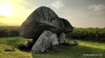
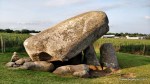
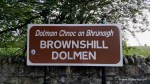
The Brownshill Dolmen can be found not too far outside Carlow town. What’s nice about this one is that it’s easy to get to. There’s a car park outside and a fenced-off walkway that leads from there to the dolmen itself. So although you still feel like you’re almost in someone’s field, you’re safe from marauding bulls, crops that behave like Triffids and erm…I’ll stop now.
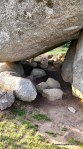
Anyway, if you’re in search of a good dolmen, you can’t do much better than the Brownshill Dolmen. There are approximately 190 of them in Ireland, though they can also be found in other European countries and in Asia. This one has never been excavated, possibly because its capstone is estimated to weigh 150 tons. How the people who built it roughly 5,000 years ago managed it is sadly lost in the mist of times. It is believed that this one is the largest in Europe.
Dolmens usually consist of 2-3 stones, topped by a large capstone. It is believed that they would have originally been topped by mounds of stones. These have long since vanished, leaving behind a “skeleton”. Although they’re generally described as being tombs, there isn’t any concrete evidence one way or the other to say for sure that they were.
I’ve been in or around the seaside town of Duncannon many times but until this year had never got around to visiting its star-shaped fort. I’ve seen it from a distance, I’ve looked up at it from the beach that lies underneath it and I’ve even walked past the entrance gates. The fort, which has long since ceased to be an active facility, is open to the public during the summer months. And as I discovered when I finally did get around to visiting and took the excellent guided tour, it’s a fascinating work in progress.
The layout of the fort as it is today
A Brief History
The fort is built at the tip of a peninsula, overlooking the entrance into Waterford Harbour. As strategic locations go, it’s one of the better ones. The width of the bay and the layout/depth of the channel means that one fort is enough for keeping an eye on anything coming and going by sea. More bang for your buck when it comes to forts. Perhaps unsurprisingly, the fort which stands here now isn’t the first one to have been built on the site. The present fort dates from the 16th century but it was had previously been home to a Norman fort of some sort in the 12th century. There is also evidence that suggests there was a wooden fort here going further back into history. Old maps from the 16th/17th century show a ruined church, a castle and some defensive structures on the site. These are long gone but the stone from them has no doubt been reincorporated into what’s here now.
Fearing an invasion by the Spanish Armada, the present fort was built by Queen Elizabeth I in 1587-88. They never arrived but that didn’t mean that it didn’t get to see some action. In 1645 it was captured by Irish Catholic Confederation forces and remained under their control until 1650. Oliver Cromwell, arguably the least popular Englishman to ever tread on Irish soil, tried but failed to recapture it a year earlier. His son-in-law Henry Ireton got his hands on it a year later. It is believed that both monarchs who fought in the Battle of the Boyne in 1690 stayed in Duncannon Fort before leaving the country. King James II left for France on 3rd July 1690 whilst the victorious William of Orange stayed there in September of the same year.
During the 1798 Rebellion, the fort remained under British control. Indeed, it became a prison for captured Irish rebels and a place where some of them were executed. Depending on which version of the Irish rebel song “The Croppy Boy” you listen to, the title character meets his end in Duncannon. Or Dungannon which is at the other end of the country..
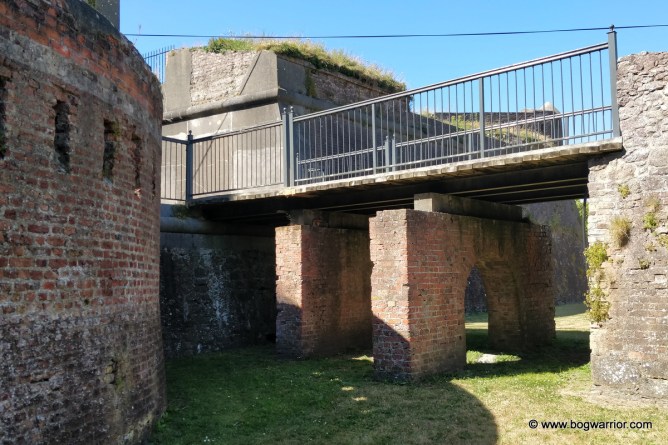
The entrance into the fort, as viewed from the dry moat
In Samuel Lewis’s Topographical Dictionary of Ireland (1837) the fort is described as “..adapted for mounting 42 pieces of cannon, and, including ” the bombproof” erected in 1815, contains barracks for 10 officers and 160 men, residences for the chaplain, fort-major, storekeeper, and other officers, and a chapel for the garrison; the whole is surrounded by a dry moat crossed by a drawbridge, and the only entrance is defended by a portcullis.”
The buildings in the fort were built at different times but look more uniform these days because of changes made to the site in the run-up to World War I. They were covered with roughcast and Tarmacadam was poured on the ground. This covered over the cobblestones which had been there. At least one archway was knocked so that tanks could be driven into the fort. Despite the alterations, there are still many older features remaining intact. The dry moat and sloping walls, circular lunette fortifications, tunnels and gun batteries being some of these.
The fort was handed over to the Irish Army in 1922 when British rule ended here. It was largely burnt down during the civil war the following year. With the onset of World War II (a.k.a. “The Emergency” because we didn’t do wars here) the fort was partially rebuilt and a military presence reinstated. The old Governor’s house now has 1943 (the year it was rebuilt) and the logo of the Irish army on the front of it.
Burke’s House
A caretaker’s house (locally known as Burke’s house, after the family who lived in it) was built in 1939 as part of the refortification. Unlike the other buildings here, its front door isn’t level with the ground but has steps up to its front door. This is because when they began to excavate the foundations, they found some human remains. It’s thought this is where a graveyard had been. It’s known that at one stage there was a church close by.
The fort was used as a camp for the Reserve Defence Forces for many years, before finally being handed over to Wexford County Council in 1993. As of 2018, there are still parts of the fort which are too dangerous for members of the public to access. Happily, there are still many places which are safe and will give the visitor a good overall view of what life was like in a place like this.
The fort is also visible from the beach below. As the tour guide remarked, the window which overlooks the beach now has iron bars on it to ward off a newer type of invader.
Visitor Information
Duncannon Fort is only open during the summer months. Tickets can be bought in advance or on the day. The official website for opening dates/times is https://duncannonfort.ie/ Admission is by guided tour only but it’s well worth it.
– Click on a thumbnail to launch the gallery –
Duncannon Fort Lighthouse
A ship bound for Waterford passes close by
The entrance into the fort, as viewed from the dry moat
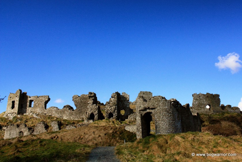
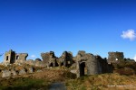
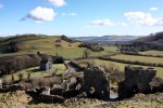
The Rock of Dunamase, or what’s left of it, sits on top of a hill 6km from the town of Portlaoise in the Irish midlands. The limestone outcrop on which the fortress is built dominates the surrounding plains of the Great Heath. Standing over 45m high, the Rock of Dunamase has been a site of strategic importance for over 1,000 years. It must have been a very impressive spectacle in its day. Alas, these days it something that has been savaged by a Rottweiler 😦
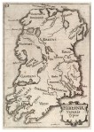
Ptolemy’s Hibernia, showing “Dunum” in the Midlands
Nobody is quite sure how long the Rock of Dunamase has been used as a fortress. Although the Greek geographer Ptolemy makes reference to a place called “Dunum” on his 2nd century map of Ireland, there is no evidence to suggest this site is what he meant. It’s a nice idea though. Archaeological digs and records from the time suggest that the rock was originally a 9th century fort called Dún Masc. Easy to see how its English name Dunamase came from. In the “Annals of the Four Masters” which chronicle Irish history, it is recorded that Dún Masc was raided by Vikings in 944AD. It would’ve been more unusual if the site hadn’t been raided by the Nordic invaders, such was their fondness for raiding and pillaging. No doubt the hapless abbot of Terryglass agreed – he happened to be here when they came a-knocking and was killed as a result of this raid.
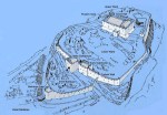
Things get a bit woolly after this. Nobody seems to know or agree on when the site became a fortress it is today. It came into the ownership of the Anglo-Normans in the 12th century and was fortified. It appears to have been owned by the wonderfully named Meiler Fitzhenry at one stage and then by William Marshall. The latter is a significant Norman figure in Irish history. It became an important centre of strategic and military importance in the region. Looking at the Office of Public Works’ recreation of the site, one can get a sense of the layout of the place.
In the 14th century, the last Anglo-Norman owner of the castle was executed by King Edward III for treason. It then came into the ownership of the Irish O’More family who didn’t handle it with care. Instead, the site was badly damaged and abandoned. Making doubly sure it wouldn’t be much use for anything, it was destroyed by Oliver Cromwell’s forces in the mid 17th century. Yet another addition to the long list of reason why he’s one of the most unpopular people in Ireland’s history.
The Barbican Gate
In the late 18th century, an attempt was made to partially restore the fragmented remains. The great-grandfather of the legendary 19th-century politician Charles Stewart Parnell attempted to turn the Great Hall into a banqueting hall. Some doors and windows from other sites were added to the building and they remain to this day. It was a short-lived experiment though. Soon the castle returned to its current ruinous state, overlooking the surrounding countryside.
What’s there now?
The Rock of Dunamase is easily accessed, so no lengthy journeys along winding country boreens are needed here. There’s also plenty of parking along the road that runs past it, more than can be said for some of these places.
The first feature of note on the rock is the Barbican Gate which would have been the entrance to the complex. The murder hole above the entrance can still be seen and still works, should anyone have some boiling oil to hand 😉 Still to be seen along the wall attached to this gate are narrow defensive windows through which arrows could be shot at wannabe attackers.
Looking back down at the gatehouse
Beyond the Barbican Gate lie the remnants of the gatehouse, a defensive curtain wall and a deep ditch. Elements of the rock itself were used as a defensive feature. Even in its current ruinous state, it’s easy to get a sense of how tricky it would have been to attack the place. Originally there would have been wooden buildings here too but they have long since vanished.
At the top of the hill are the remains of the 12th-century keep/great hall. Even though it is ruined and is surrounded by large chunks of mangled buildings, one can still get a sense of how impressive a structure it must have been. Thanks to the failed attempt to turn it into a banqueting hall, it has been altered somewhat.
The Great Hall
The great hall
It is a pity that this place was so badly damaged all those years ago. In recent years conservation work was carried out by the Office of Public Works so it’s about as safe as these sorts of places can be. It is still well worth visiting, not just to look at the remains of the fortress itself but to admire the views from the top. The lush greenery of The Heath is very beautiful too and apparently can be seen from outer space!
Click on an image to launch the gallery
Defensive wall
The curtain wall and deep ditch
Up the hill to the great hall
Barbican gate
Arrow slit in the wall behind the barbican gate
The Gatehouse
The original fort, as re-imagined by the OPW
Murder hole in top of the barbican gate
Interior of the Great Hall
The Rock of Dunamase, as seen from the road
The great hall
The Barbican Gate
Looking back down at the gatehouse
Ptolemy’s Hibernia, showing “Dunum” in the midlands
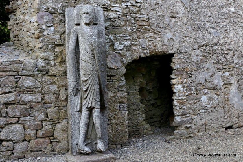
The Long Man has been leaning against a wall in this church for rather a long time
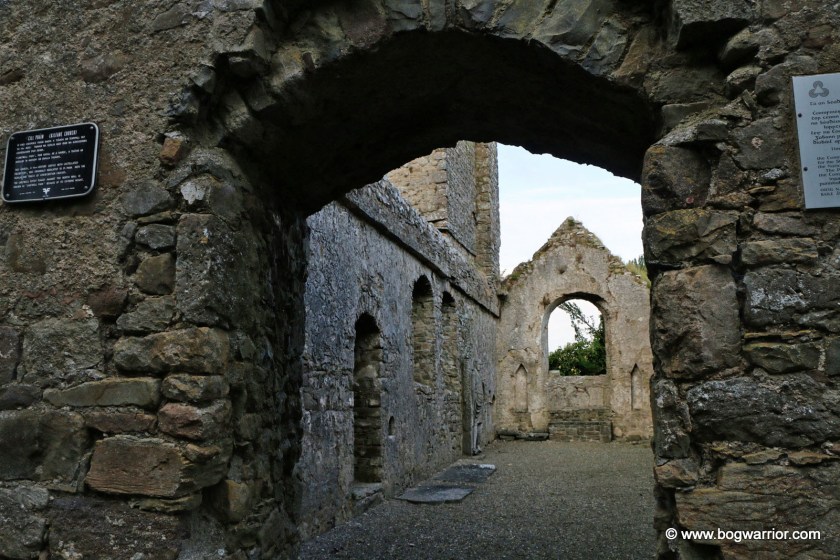
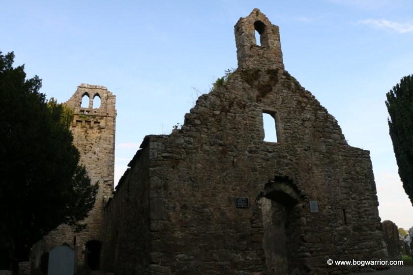
Hidden at the end of a peaceful country lane in south Co. Kilkenny is a ruined 14th-century church. The church itself is quite interesting in its own right but standing inside its walls is something quite unusual. Carved out of limestone and standing against one of its walls is a 13th century effigy of a Norman knight. The Long Man of Kifane or Long Cantwell. It’s thought that this effigy was once the lid of a sarcophagus but it has been propped against the wall of Kilfane Church for as long as anyone can remember. Just over 2m in height, it’s the tallest effigy of its type in the British Isles. What exactly effigy “of its type” means I’m not sure. He cuts a fine dash though.
One look at the knight and you can see he is armed to the teeth and ready for battle. A surprising number of clues can be picked up about him, just by looking at what he’s wearing and carrying. The main one is the coat of arms on his shield. It’s the coat of arms of the Cantwell family who were lords in the area at the time. It is believed this is Thomas de Cantwell who died in 1319, though chances are he was nowhere nearly as tall as his limestone likeness. He’s also wearing combat gear – a skullcap, chainmail and spurs on his feet. The spurs mean he fought on horseback. His legs are crossed in a similar fashion to effigies elsewhere, meaning that he probably fought in The Crusades. Usefully for a knight about to head into battle, he’s also carrying a sword.
As for the church itself, it dates back to the 14th century. It has a priest’s seat which is thought to belong to an older church. According to the internet which is always right, there is medieval paint to be seen. I didn’t notice any but maybe it was just too subtle for my eyes. There is also a tower attached to the church which is where the incumbent priest would’ve lived. Although the church is ruined and in the middle of nowhere, it’s a really lovely site to visit. I visited it one summer’s evening and even though the crows were making a racket overhead, it wasn’t creepy but beautiful and restful. It would appear that the graveyard is still occasionally used, judging by the modern headstones on the site.
Click on a thumbnail to open the gallery
Altar and sedilia (fancy word for seating) to the right
All 2 metres of Norman Knight
The bell tower which may also have been the presbytery
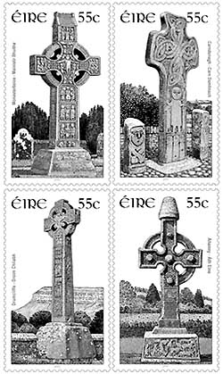
The high cross is an early medieval form of Christian sculpture, unique to the British Isles. From around the 6th century onwards, monastic settlements developed all around Ireland. It is thought that high crosses were a way of marking out the sacred areas in the larger monasteries. The first high crosses are believed to have been made of wood and metal. Of course, none of these have survived to the present day. From around the 9th century onwards, the crosses began to be carved from stone. Interestingly, the earliest crosses appear to be replicas of the original wood and metal crosses, though in time their style evolved. There are almost 300 high crosses in Ireland, in various states of repair. They have become one of the iconic symbols of Ireland, appearing on everything from jewelry to postage stamps.
Postage Stamps from 2010, featuring line drawings by Michael Craig. The price of stamps has certainly gone up since then.
Let’s get plastered
In the late 19th century/early 20th century, a greater interest and awareness of national identity and archaeology took hold around Europe. Seeing as trying to transport rather ancient, rather heavy stone crosses around was out of the question, they went for the next best option. Faithful copies.
At what turned out to be prohibitively expensive in the end, plaster casts of some of the better known high crosses were painstakingly created. From 1898 to 1910 these casts were made and shipped abroad to the UK, the USA and Australia.
Interestingly, in 2005 the replicas were exhibited in Aichi, Japan where they were seen by over 2 million people.
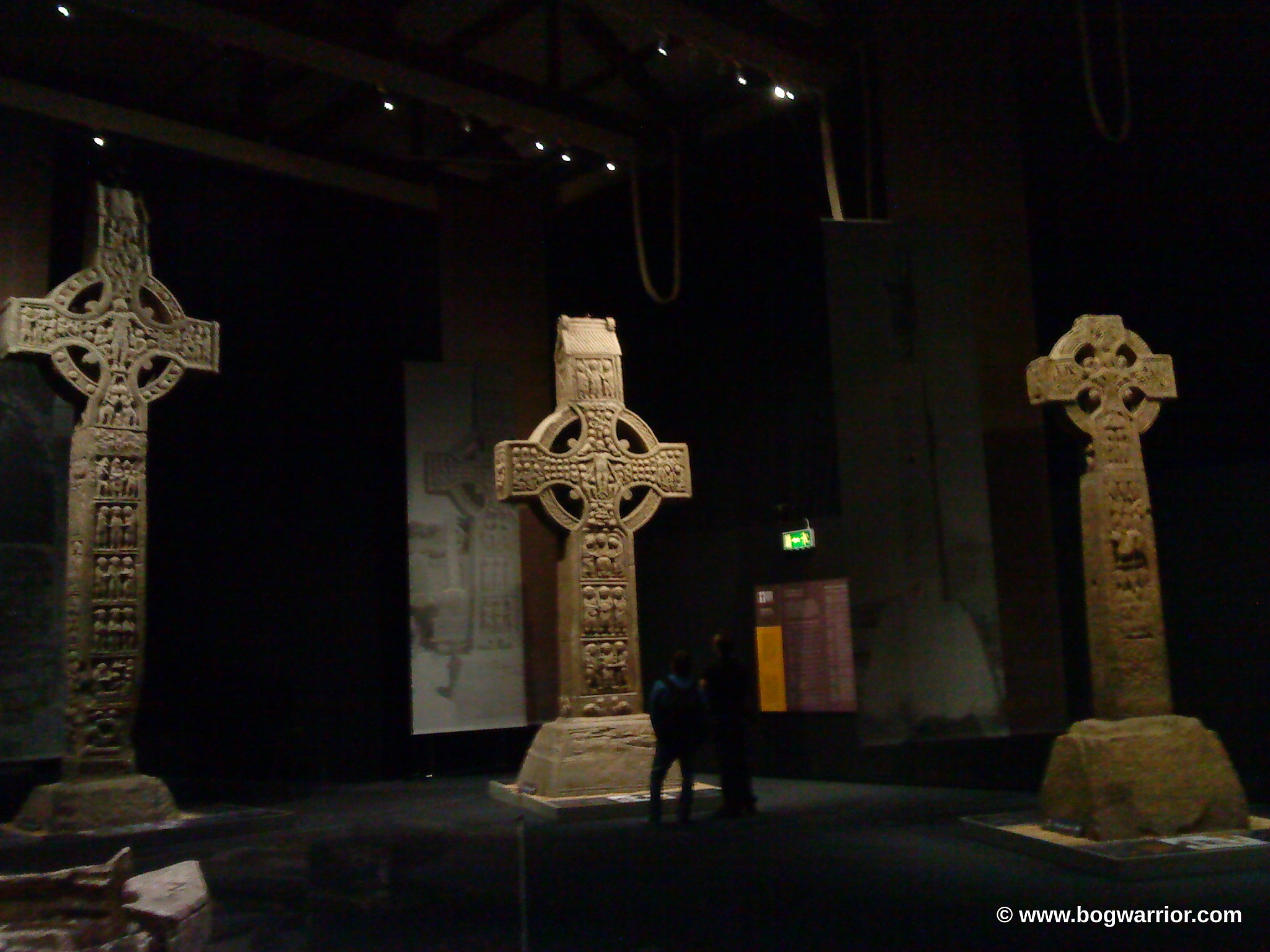
L-R the Tall Cross and Muiredeach’s Cross (Monasterboice, Co. Louth), Drumcliffe (Co. Sligo)
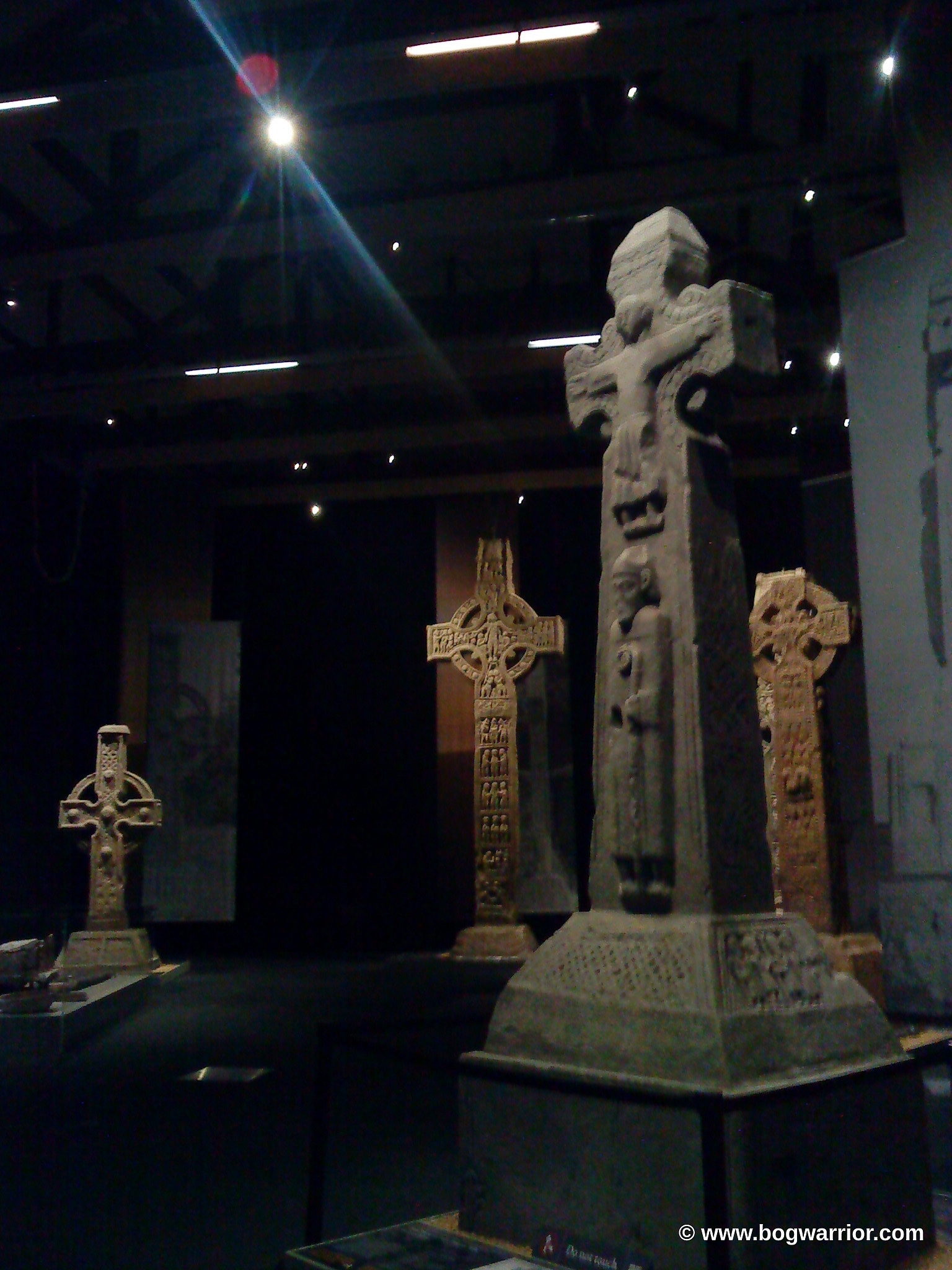
Completely by accident, in May 2011 I came across an exhibition of these replicas in the Museum of Decorative Arts & History in Dublin. And so, all I have to show for my visit are a couple of dodgy pre-smartphone mobile phone snaps and a nice booklet 🙂 It turned out to be a surprisingly compelling exhibition. I’ve seen loads of these high crosses over the years – it’s hard not to miss them- but I had never noticed how tall and imposing they were. In their normal setting, they’re out in the open air and somehow seem smaller. There’s nothing like standing in a darkened room with these crosses looming over you to concentrate the mind!
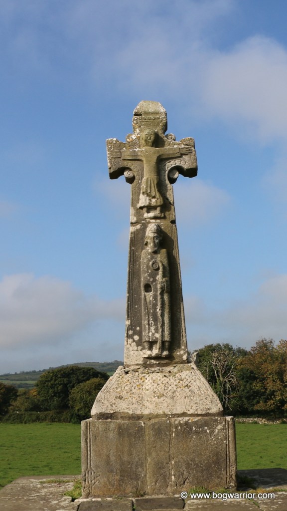
It was also a unique opportunity to see how these crosses evolved over time. The South Cross from Ahenny is a very basic cross which replicates its original wood and metal ancestors. The later Muireadach’s Cross is awash with scenes from scripture. Dysert O’Dea has a bishop on it and looks quite different to the others.
Interestingly, the Office of Public Works has gradually been making high-quality replicas of the better known high crosses around Ireland and moving the originals indoors. Following on, after a fashion, in the footsteps of the original plaster casters.
L-R South Cross(Ahenny) Tall Cross (Monasterboice, St Tola’s (Dysart O’Dea) and Drumcliffe
The crosses exhibited in this exhibition were:
The North & South Crosses, Ahenny, Co. Tipperary
The two high crosses in Ahenny
These two 9th century crosses I’ve seen “in the wild”. These days, Ahenny is off the beaten track and I had to drive along some alarmingly narrow and twisty country roads to get to it. The two crosses are situated in a quiet cemetery that’s situated in a field close to the village of Ahenny. They’re all that remains of the monastery at Kilclispeen. The interesting thing about these two high crosses is that they appear to replicate the earlier wood/metal crosses and mostly have abstract art on them. There are some figures from scripture on the base of the North cross but they’re not so obvious on my photo. Both crosses are considered to be very fine examples of Hiberno-Saxon art and are just two of a number of high crosses in this style in the area.
Their plaster casts were made in 1906 by an Italian modeller named Sig. Orlandi. The cost of making the moulds for these two crosses ran to £151. The two casts were produced at a cost of £35.
Muireadoch’s Cross and the Tall Cross, both in Monasterboice
These are two crosses I saw on a geography field trip when I was a student. So not only do I not have photos of them (I am rather ancient, after all) but I barely remember them. I mostly remember our lecturer helpfully pointing out how the ground level in the cemetery was rising because of all the dead people buried there and that even when we died, we’d still have a contribution to make. Anyway, enough of that. What about the crosses?
Muireadach’s Cross is considered to be the finest of the high crosses in Ireland. Perhaps it’s unsurprising that it was the first cross to be moulded, back in 1896. It dates to the 9th century and depicts many scenes from scripture. In recent years, concern has been expressed over the damage the weather is doing to the cross. The Tall Cross lives up to its name, being almost 7 metres in height. The process of making moulds of this cross proved to be tricky because of the condition of the base.
Drumcliffe High Cross, Drumcliffe, Co. Sligo
Drumcliffe High cross
Now this cross, I have no idea if I’ve ever seen. When I was 14 my family took a holiday in the north-west of Ireland and we visited Drumcliffe. These days it’s mostly known for being the alleged final resting place of W.B. Yeats (there are serious question marks over who’s in that grave) . In olden times, there was a monastery here. There is still a partial round tower remaining. There’s also this cross which I may have seen but not taken any particular notice of. It was cast in 1907 and is from the 11th or 12th century. Along with biblical scenes, it also has animals which is unusual.
St Tola’s Cross, Dysert O’Dea, Co. Clare
This cross is unusual in that it has no ring. It also doesn’t look like most Irish high crosses. It is from the later Romanesque series of crosses and instead of having biblical scenes, has a bishop on the shaft. It was one of the last crosses to be copied, work taking place in 1908. It is thought that this cross may have had wooden additions but of course, these did not survive. In September 2020 I finally got to see this one in person.
Fore is a sleepy village in north Co. Westmeath, nestled in the hills near Lough Lene. It’s off the beaten track and not the sort of place you’ll visit by chance. At first glance, the monastic ruins beside the village don’t seem to be anything out of the ordinary. That is until you take a closer look…
A brief history of Fore
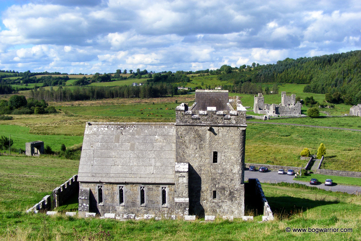
Fore gets its name from the old Irish word Fobhair which is pronounced in the same way as Fore. It means “water springs” which makes sense because there’s plenty of that around here. The monastic settlement at Fore is actually made up of two separate monasteries, split by a road. The older part of the monastery, on the left-hand side of the road, was founded by St. Féchin in the 7th century. Very little remains from that era apart from a little church that’s named after St. Féchin (more on that later). There may have been two more churches on the site but they have vanished without a trace. It is thought that in the heyday of this early monastery, 300 monks and 2,000 students lived here. Where exactly they crammed them all is another question. Further up the hill from the church is a mausoleum which is a relatively modern addition.
The layout of the Fore Monastic Site
In 665, St. Féchin and some other high ranking clergy were approached by two kings who had an interesting request for them. They asked them to pray to God for a plague to come and wipe out the lower classes of society, reducing their number. God answered their prayers after a fashion – St. Féchin and his comrades died of yellow plague.
Across the road from are the remnants of a much more substantial monastery. These buildings were built by the Anglo-Normans and it became a Benedictine monastery with strong links to France. Indeed, this monastery is dedicated both to St. Féchin and to the French St. Taurin. The first Benedictine monks in Fore were French – what they thought of rural Westmeath has been lost in the mists of time. Because this was the era when England and France were at war, Fore frequently was seized by the English because of the French connection. It also suffered many attacks during its existence. It’s known that Fore was burned at least 12 times between the 8th and 12th centuries. Often these attacks were led by the Vikings. It’s believed that there were a staggering 3,000 monks housed in and around the abbey in Fore’s heyday. The abbey’s time finally came to an end in 1539 as part of King Henry VIII’s campaign of monastery closures in the British Isles. Luckily for the abbot in charge of Fore, he walked away with his head still attached to his shoulders and a pension from the king. All he had to do was agree to the closure of the abbey. Once this happened, it was ransacked and anything of value taken away.
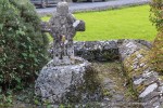
A less obvious feature of the area is what has become known as the Fore Crosses. There are 18 of these little crosses, carved hundreds of years ago and placed along the road to Fore and in nearby fields. There is one in the centre of the village and others on the outskirts of the village.
The Fore Cross located in the centre of the village
It may be mostly crumbly old ruins these days but Fore still is known for its mysterious 7 Wonders. These are
The Monastery in a bog
The Mill without a race
The water that flows uphill
The tree that has three branches or the tree that won’t burn
The water that won’t boil
The anchorite (hermit) in a cell
The stone raised by St. Féichin’s prayers
Are these wonders still as wondrous as they were? You decide 🙂
The Monastery in a Bog
The Monastery in the Bog
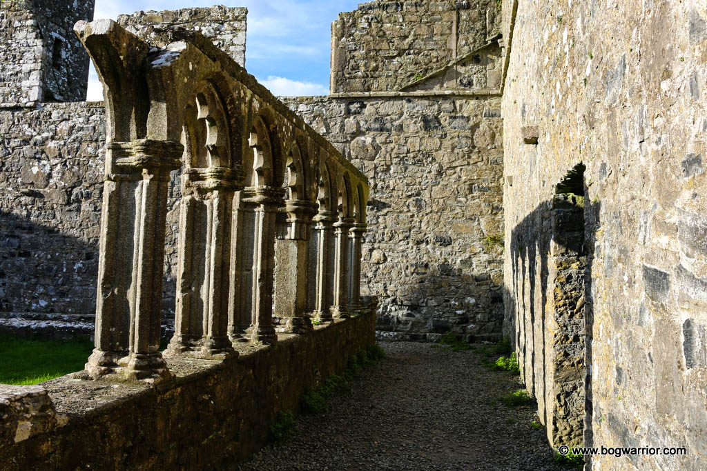
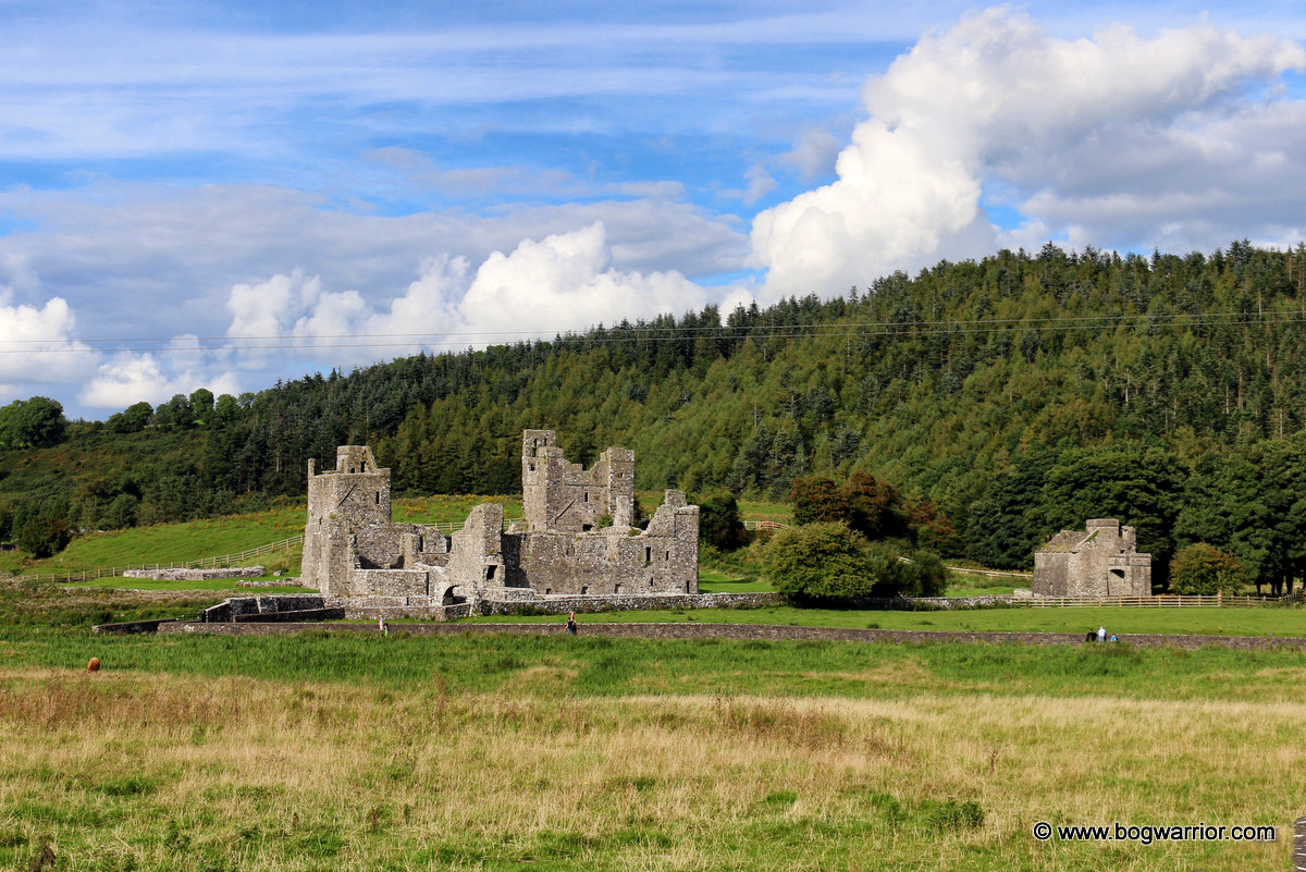
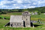
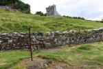
This 13th century Benedictine Abbey is now in ruins but there’s still lots to see. It was built around a cloister and courtyard. The partial remains of the cloister can still be seen. Two large towers were built in the Abbey, partly as accommodation, partly as defensive structures. Arrow slits can be seen on the towers and the entrance gate has a murder hole incorporated into it. These days, the ground surrounding the abbey is less marshy/boggy than it was. Perhaps a modern day miracle is that despite all the attacks and being open to the elements for centuries, there’s so much remaining.
The Mill Without A Race
The mill
Legend has it that a mill was built but it had no race. Luckily St. Fechin was on hand with his trusty crozier. He struck the ground with it and water gushed forward. Spectacular but perhaps a slight embellishment of the truth. The mill was supplied by a number of springs which flow underground from nearby Lough Lene. There are still some remnants of the old mill pond, although it’s mostly silted up these days. The existing mill (or what’s left of it) are built on the site of the original mill from St. Féchin’s time. It remained in use until around 1875 and is marked on the original Ordnance Survey 6″ map.
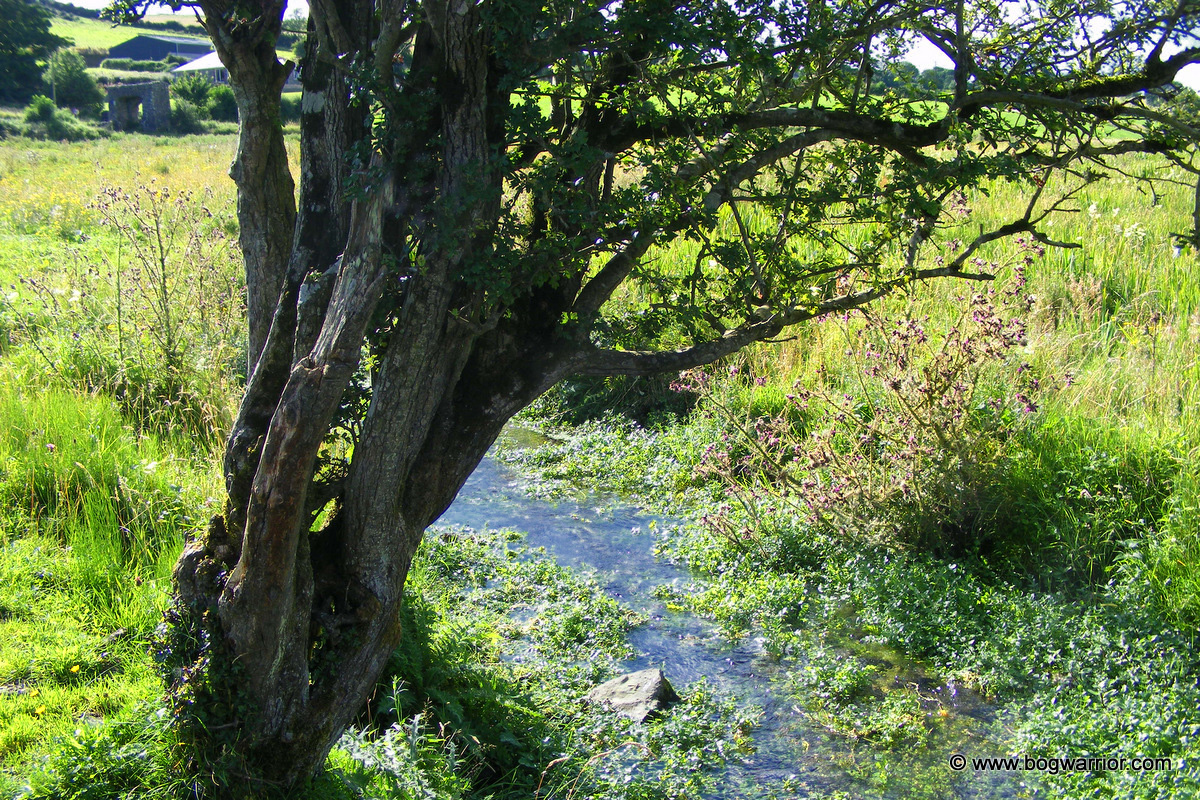
The water that flows uphill
This is flowing uphill..
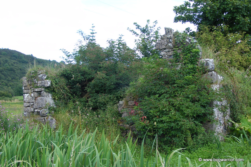
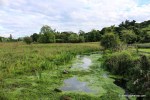
Unfortunately, the subtlety of this one passed me by. It seems that if you look carefully, the stream that flows ever so slightly downhill in the field leading to the ruined abbey turns back on itself and flows uphill. Maybe.
The tree that has three branches or the tree that won’t burn/the water that will not boil
Tobernacogany
Now this one is even more bewildering than the uphill water. Especially if you’re on the lookout for a tree with three branches. The original unburnable, three-branched tree stood over a holy well known as Tobernacogny. A plaque on the wall behind it explains it all
“There was an ash tree with three branches growing over the well and it was – and still is – the custom for visitors to drive a coin edgeways into the bark. This may have been injurious to the tree which is now dead but the single surviving branch still exhibits a good selection of coinage. It is said that the wood from the tree will not burn and the water from the well will never boil. The water was taken as a cure for headache and toothache. ”
The tree that stands today is known as a rag tree or a raggedy bush. As the name might suggest, it is covered in rags and pieces of clothing. There is still a belief amongst certain people that if a piece of clothing belonging to someone who’s ill or has a problem is hung on the tree, that it will disappear as the cloth rots. There was no sign of any water in the well so perhaps it has given up on curing people’s aches and pains.
The Anchorite (or hermit) in a cell
Anchorite’s Chapel
There is a hermit’s cell in the tower of this little chapel. When a hermit entered the cell, he vowed never to go outdoors again for the rest of his life. It is believed that the last hermit in Ireland was Patrick Beglan, who was here in 1616. The tower was built in the 15th century and the rest of the chapel added on in the 18th. Unfortunately, this church is usually locked up so few people ever get to see the cell looks like.
The stone raised by St. Féichin’s prayers
Lintel raised by a few prayers
St. Féichin’s church is the oldest building on the site. It was built in the 7th century as a much smaller church but was extended in the centuries after that. Its most notable feature is the lintel over the doorway. It is very heavy (it’s estimated it weighs at least 2 tons) and not something that could be lifted easily by anyone. The story goes that when the workmen building the church were having their breakfast, St. Féichin said some prayers, then lifted up the stone and put it in position.
St. Feichin’s church
Overlooking Fore is a hill with a rocky outcrop on top. It’s known as Carrick Balor. For anyone unfamiliar with Irish placenames, Carrick is an Anglicisation of the word Carraig which means rock. Balor was an evil-eyed monster or god from Irish mythology.
Along the gravelled walkway that leads from the car park to the ruins of the Abbey is a second holy wall known as Doaghfeighin, or St. Féichin’s Well. It’s described elsewhere as being a well surrounded by box-like stones. Alas, it’s not possible to take a closer look these days because not only is it mostly hidden by trees but it’s fenced off with a barrier. It is possible that this may have been an earlier megalithic tomb or cist.
Doaghfeighin
The village of Fore developed alongside the monastery. Today it’s a quiet village with a population of fewer than 400 people. A sign of its previous importance are the two medieval town gates on its outskirts and the remnants of a jail in the village itself.
In the 19th century, an ancient bell was found in nearby Lough Lene. This was a popular haunt of Turgesius the Viking, a man who was partial to raiding Fore. The website Voices from the Dawn has put forward the intriguing theory that this bell may once have been St. Féchin’s ceremonial bell. The bell is now in the possession of the National Museum of Ireland. A smaller replica of it is used in the Irish Parliament (The Dáil) by the speaker of the house to try and maintain order.
The miraculous 2 ton lintel, as viewed from inside St. Fechin’s Church
The cloister
The north-west gateway into the ancient village
The view from Fore Abbey
This is flowing uphill..
Part of the mysterious mill without a race
Tobernacogany
Remnants of Doaghfeghin
Carving in St Feichin’s church
The Dovecote.
Some more of the mill race that was
Anchorite’s Chapel
St. Fechin’s church
The Fore Cross located in the centre of the village
Lintel raised by a few prayers
Anchorite’s chapel, as viewed from the grave yard behind St. Feichin’s churhc


 Height: 31m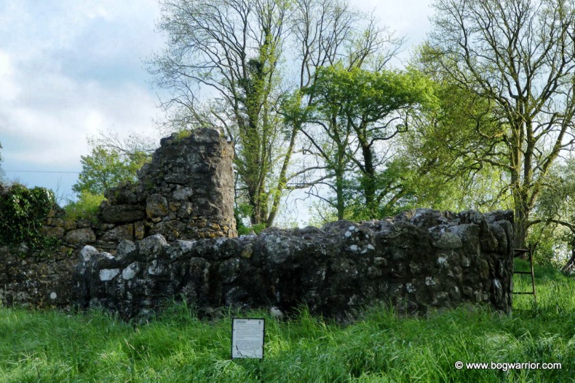












 The buildings in the fort were built at different times but look more uniform these days because of changes made to the site in the run-up to World War I. They were covered with roughcast and Tarmacadam was poured on the ground. This covered over the cobblestones which had been there. At least one archway was knocked so that tanks could be driven into the fort. Despite the alterations, there are still many older features remaining intact. The dry moat and sloping walls, circular lunette fortifications, tunnels and gun batteries being some of these.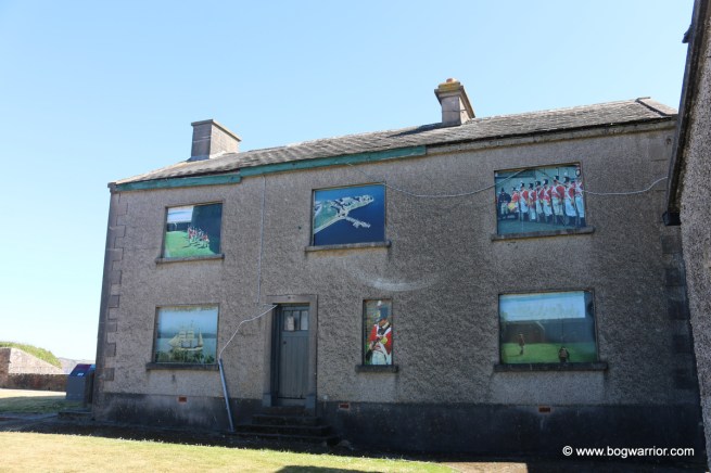
 A caretaker’s house (locally known as Burke’s house, after the family who lived in it) was built in 1939 as part of the refortification. Unlike the other buildings here, its front door isn’t level with the ground but has steps up to its front door. This is because when they began to excavate the foundations, they found some human remains. It’s thought this is where a graveyard had been. It’s known that at one stage there was a church close by.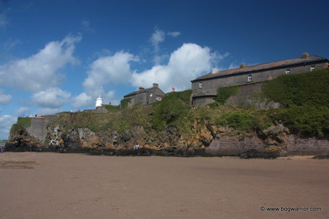
 Visitor Information


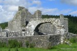
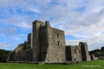
 The Rock of Dunamase, or what’s left of it,